Toyota and Kumamoto Prefecture Join Forces for Disaster Response Initiative


Toyota and Kumamoto Prefecture Collaborate on Disaster Response
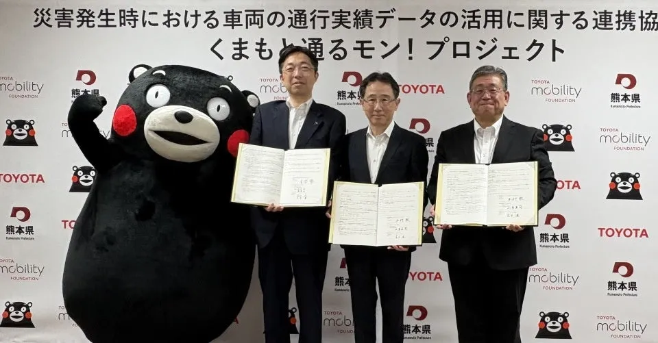
In a significant move towards enhancing disaster response capabilities in Japan, Toyota Motor Corporation and the Kumamoto Prefecture have announced their collaboration through the 'Kumamoto Tour Mon!' project. This initiative aims to utilize vehicular traffic data and geographic information to facilitate effective disaster relief efforts during critical times. The agreement was formalized in a ceremony attended by Kumamoto's Governor Takashi Kimura and other dignitaries.
Background of the Initiative
Natural disasters, such as the Kumamoto Earthquake of 2016 and the torrential rains of 2020, have highlighted the dire need for accurate information regarding accessible roadways in emergency situations. When major roads are damaged, timely rescue operations and the delivery of supplies are severely hindered. This is particularly apparent from the devastating impacts these events have had on local infrastructure. The recent record-breaking rainfall in August has further reinforced this priority by emphasizing the necessity for rapid information on road statuses. To address this, the initiative plans to leverage vehicle probe information to ascertain in real-time which routes are operational right after a disaster strikes.
Key Components of the Collaboration
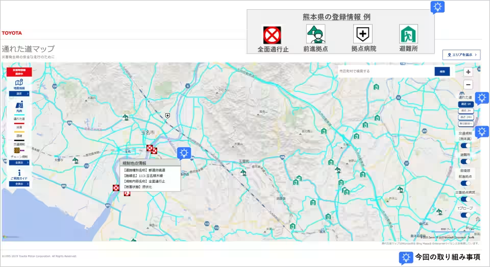
Through the 'Accessible Road Map', a system developed by Toyota, data from vehicle probes will visualize the traffic history from the last three hours during disaster situations. However, to improve responsiveness, the project will also include information from the past hour. Kumamoto Prefecture will contribute essential data regarding flooded, damaged, or obstructed roadways, as well as details about crucial facilities like hospitals and evacuation centers. By integrating this information into a comprehensive map, both parties will engage in practical exercises during disaster drills organized by the prefecture to test and refine these rapid-response strategies.
Project Duration
This collaborative effort is set to run from September 1, 2025, to March 31, 2026.
Roles and Responsibilities
Kumamoto Prefecture
- - Provide information on road damage
- - Explore methods for utilizing this information during emergency response actions
- - Facilitate opportunities for validation through disaster drills
Toyota Motor Corporation
- - Integrate the prefecture's data into the 'Accessible Road Map'
- - Assess effective ways to utilize the comprehensive map
Toyota Mobility Foundation (TMF)
- - Support the overall initiative
Collaborating Organizations
- - ITS Japan (Non-Profit Organization): Offers advice to ensure broader regional applicability.
- - Toyota Map Master Co., Ltd: Provides guidance to assist in the recovery and rebuilding phases after disasters.
Moving Forward
The insights gained from this collaboration will not only identify potential uses for vehicular traffic data but also explore ways to apply geographical information in recovery efforts. Working together with ITS Japan and Toyota Map Master will allow the teams to incorporate a wider range of knowledge and solutions into their strategies. The ultimate goal of this agreement is to create a data utilization model that ensures nobody is left behind during a disaster, merging the resources of both public and private sectors for the greater good.
In conclusion, with community-centric efforts driven by Toyota and Kumamoto Prefecture, the 'Kumamoto Tour Mon!' initiative exemplifies a pioneering approach to disaster management that hopes to set a standard for future collaborative projects within Japan and beyond. By prioritizing the well-being of all stakeholders, this initiative seeks to pave the way for resilience and preparedness in the wake of unforeseen calamities.
Topics Policy & Public Interest)
【About Using Articles】
You can freely use the title and article content by linking to the page where the article is posted.
※ Images cannot be used.
【About Links】
Links are free to use.