Japan Achieves First Nighttime Drone Flight for CO2 Observation in Tokyo's Skies


A Historic Achievement in Environmental Monitoring
In March 2025, SoraVision, a drone consultancy based in Kyoto, achieved a groundbreaking milestone in environmental monitoring. In collaboration with Tokyo University's Atmosphere and Ocean Research Institute, it undertook Japan’s first nighttime drone flight over Tokyo, operating at heights exceeding 700 meters to successfully observe the vertical distribution of carbon dioxide (CO2) concentrations in the atmosphere. This monumental event not only showcases the capabilities of drone technology but also enhances our understanding of atmospheric changes.
Key Details of the Project
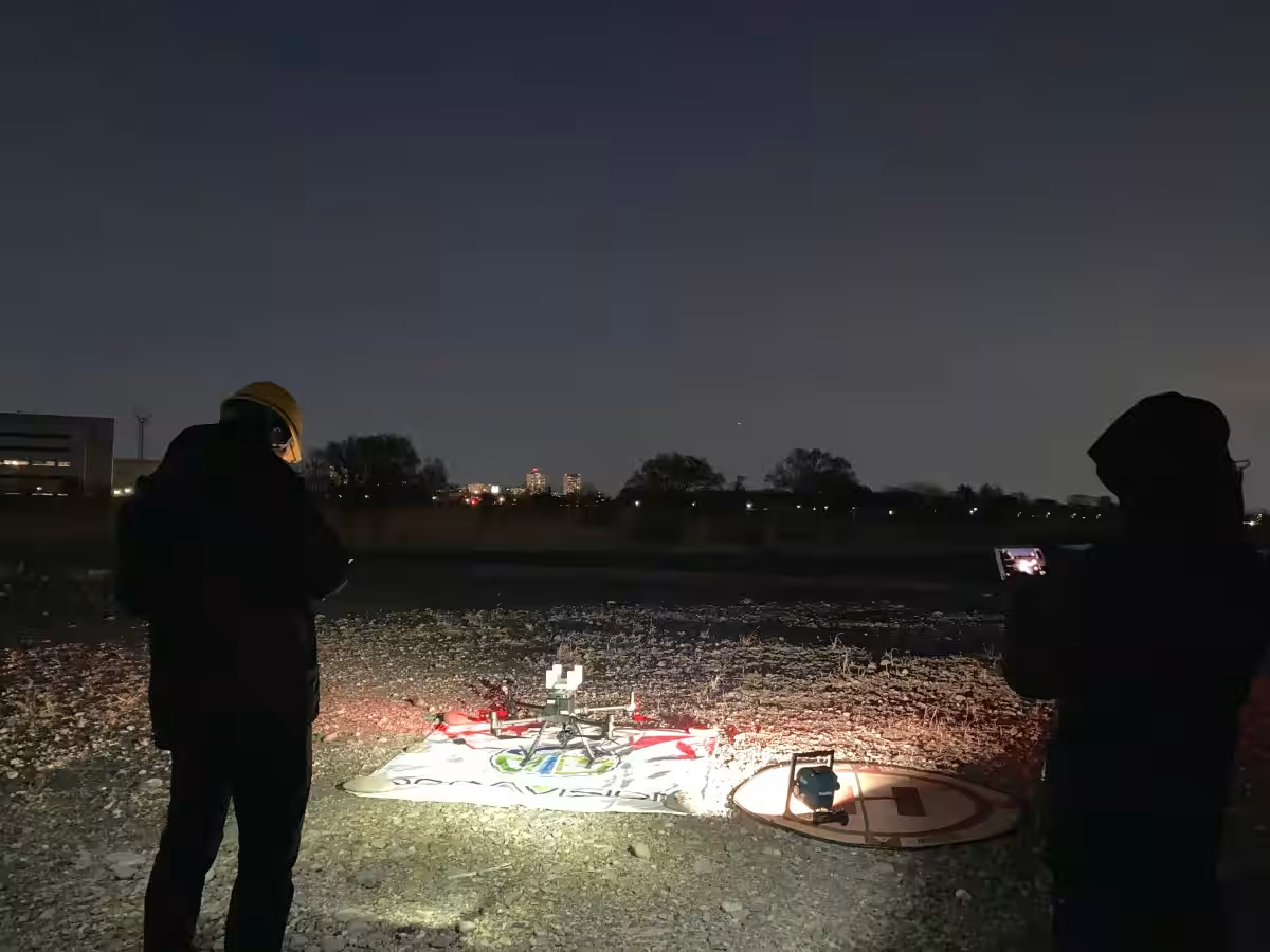
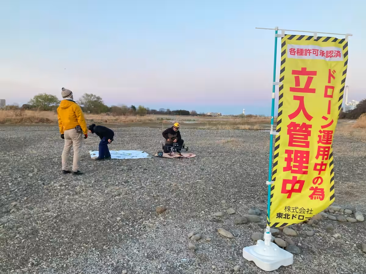
The project was conducted as part of the initiative led by Professor Ryoichi Imasu at the University of Tokyo, aimed at developing estimation models for CO2 emissions derived from large emission sources, using satellite observation data and quantitative accuracy evaluation. The operation took place over two nights, from March 17 to 18, 2025, in a designated area along a riverbank in Tokyo.
Collaboration and Challenges
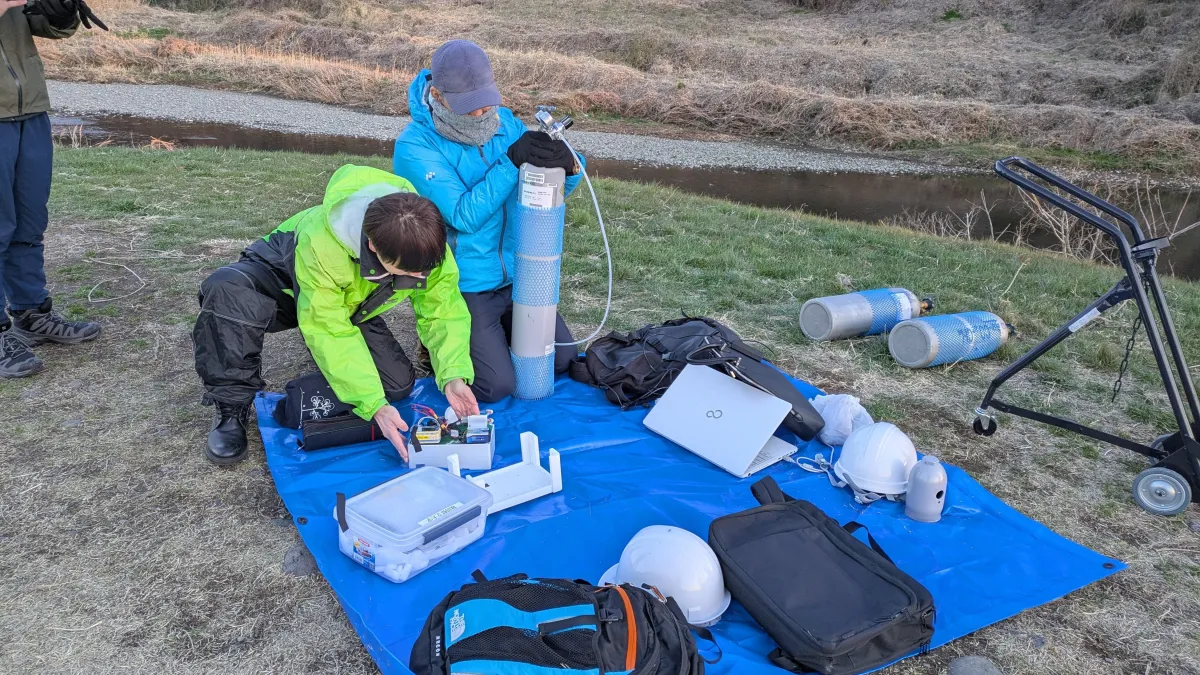
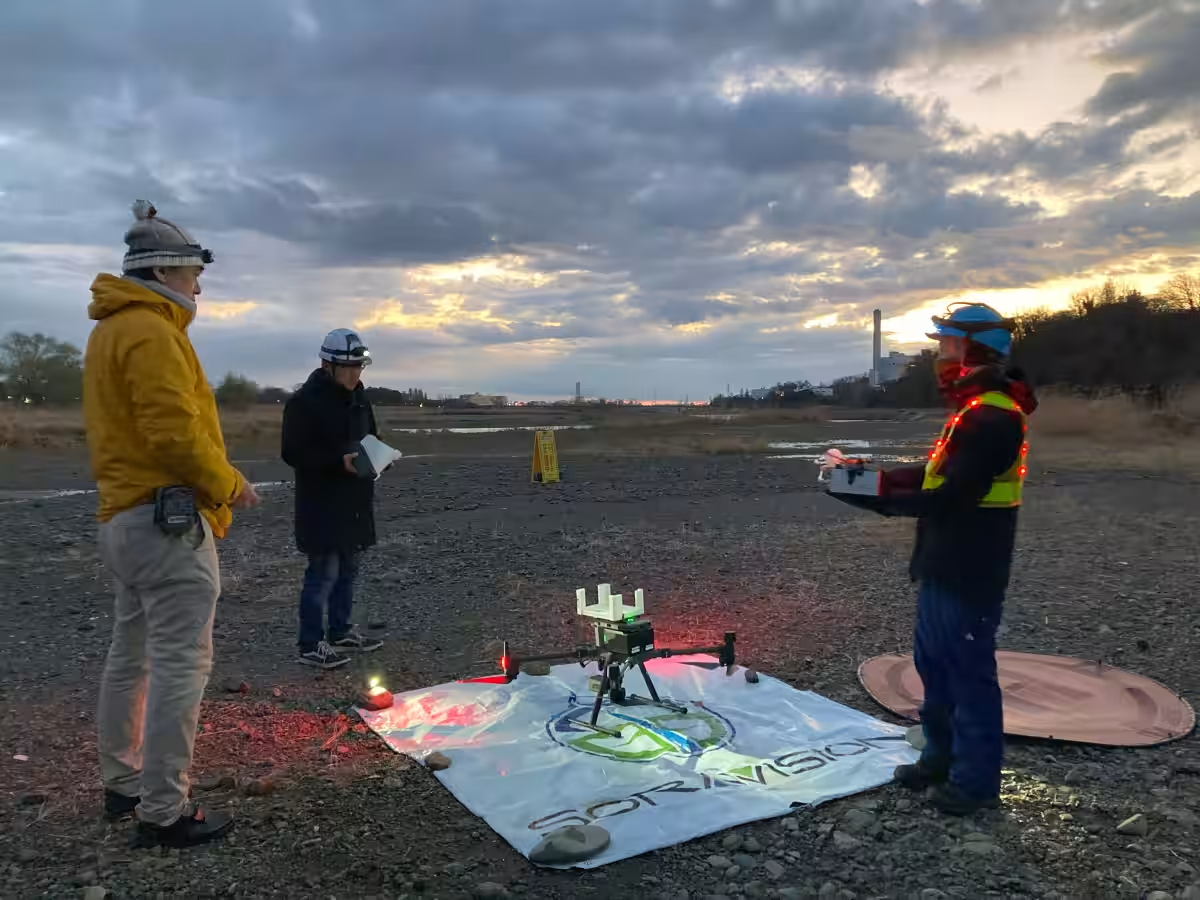
SoraVision took charge of this ambitious project alongside Tohoku Drone Co., which provided skilled drone pilots, and Yano Law Office, which facilitated the complex legal permissions often required for flights in such sensitive environments. Observing atmospheric changes at high altitudes in a densely populated area posed significant challenges, especially given the proximity to US and Japanese military bases.
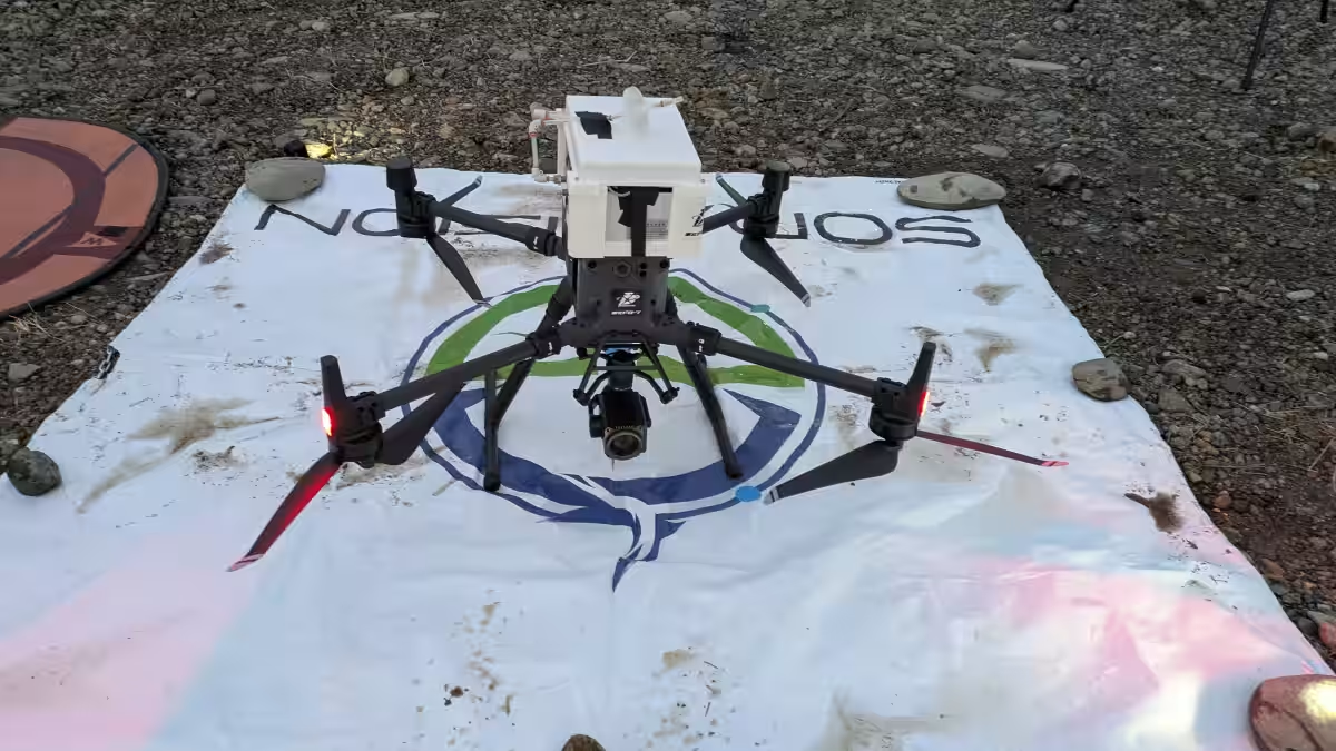
To navigate these hurdles, the team conducted detailed discussions with Professor Imasu to clarify research goals and optimal flying locations using GIS data. The drone, a DJI Matrice 300 RTK, was equipped with a Leica LI-840 sensor, allowing for precise measurements of CO2 concentrations at 100-meter intervals, with 30-second hovering periods.
The Execution
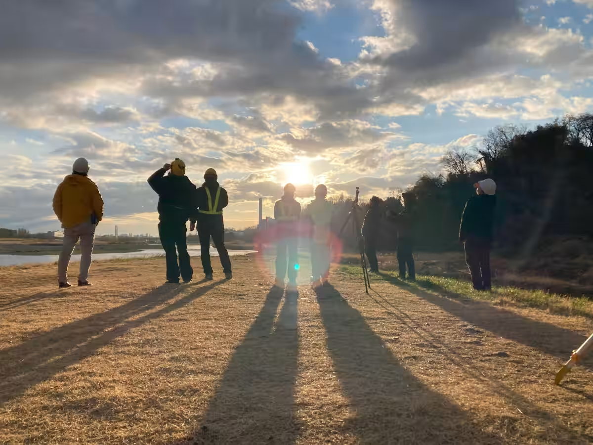
While strong winds initially halted night operations, the team successfully completed several observation sessions during the early morning hours of March 18. These measurements were pivotal in demonstrating the dynamic changes in CO2 levels as human activity ramped up with the dawn. Such findings aim to contribute to the understanding of urban emissions and their effects on the atmosphere. The data collected during this historic flight will be subject to further scrutiny and detailed analysis, with the expectation that results will be published through academic papers and presentations.
Significance of the Findings
The accomplishment indicates a new frontier for drone-assisted environmental monitoring in Japan. SoraVision, with a network of over 1,000 professionals, meticulously assembled a team capable of meeting the project's high demands for expertise and experience.
Professor Imasu remarked on how the project provides a robust method to validate future satellite observation data, highlighting the importance of the results for initiatives like the upcoming Japanese greenhouse gas observation satellite, GOSAT-GW. Furthermore, the observations have illuminated the pronounced effects of urbanization on CO2 variations, shedding light on how emissions increase as city activities intensify.
Insights from Experts
Various stakeholders involved in this project shared their insights:
- - Professor Makoto Inoue from Akita Prefectural University's Faculty of Bioresources noted the challenges in developing a lightweight, precise CO2 monitoring system that could be easily installed on drones.
- - Shunsuke Kiryu, representative of Tohoku Drone, discussed the complexities involved in the preparation of UAVs for such high-altitude flights, emphasizing the innovative design solutions achieved by their technical team.
- - Kota Yano, from Yano Law Office, managed the flight applications, highlighting the legal intricacies that come with operating drones in restricted airspace.
Future Directions
The success of this project lays the groundwork for further advancements in drone-based atmospheric research. SoraVision plans to extend its observational range beyond 700 meters while exploring other urban areas and forests to compare CO2 concentrations and better understand environmental dynamics.
With such initiatives, valuable data can be extracted to assist in combating climate change, disaster prevention, and urban infrastructure management, ultimately addressing significant societal challenges. The team’s commitment to expanding drone observation technology presents exciting prospects for future environmental studies, promising a dual force of scientific inquiry and practical application in tackling our planet's critical issues.

Topics Environment)


【About Using Articles】
You can freely use the title and article content by linking to the page where the article is posted.
※ Images cannot be used.
【About Links】
Links are free to use.