Unveiling the Yokohama Chinatown Barrier-Free Map 2026: A Collaborative Effort


Launch of the Yokohama Chinatown Barrier-Free Map 2026
On March 8, 2026, the certified NPO WheeLog, led by President Yurika Oda, unveiled the latest version of the Yokohama Chinatown Barrier-Free Map. This project, driven by citizens and supporters, reflects the collective effort of 60 participants engaged in a mapping event in Yokohama's Chinatown. The new area map is now accessible within the WheeLog! app, enhancing the usability of barrier-free information in one of Japan's most iconic districts.
A Leap from Paper to Digital
The initial edition of the Yokohama Chinatown Barrier-Free Map was created during the COVID-19 pandemic in 2021, aiming for a future where everyone can safely venture outside. Since then, city landscapes and establishments have evolved significantly, necessitating an update. This revamped version goes beyond a traditional PDF format, shifting to a digital application that allows users to navigate using real-time location data.
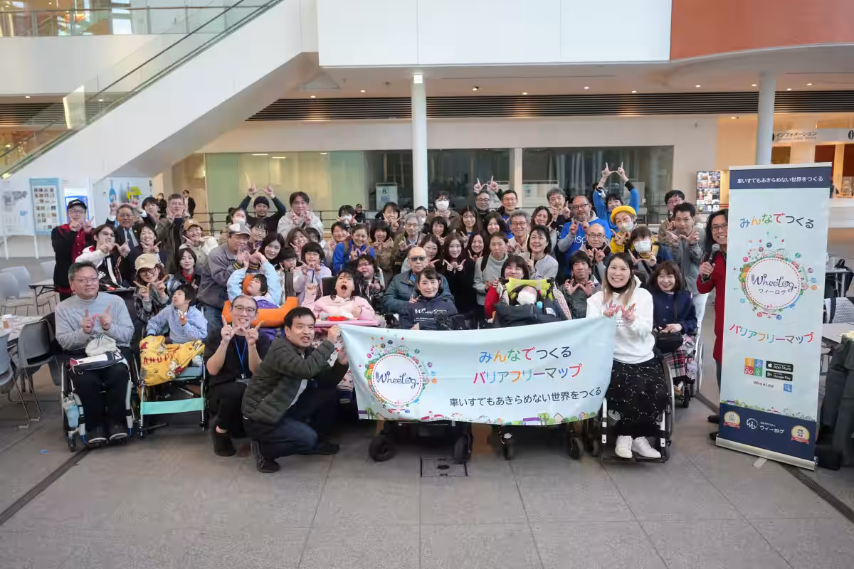
A Collaborative Gathering of 60 Participants
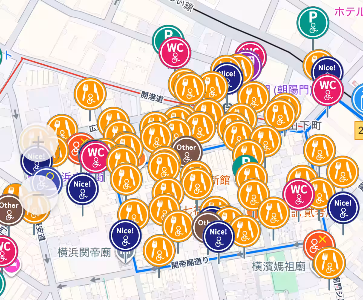
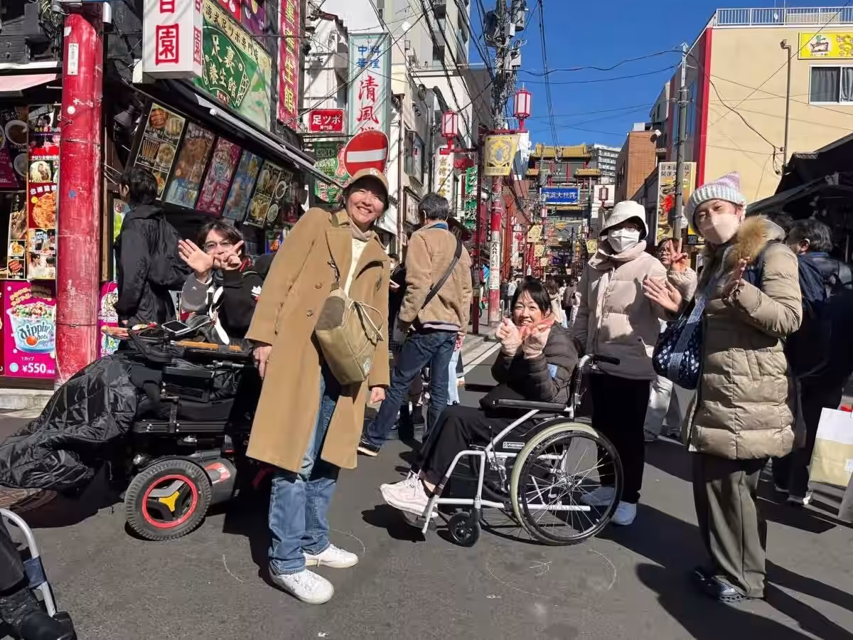
To realize this upgrade, WheeLog organized a mapping event at the Yokohama City Hall Atrium, gathering 60 individuals, including wheelchair users, students, and volunteers. These teams explored Chinatown, meticulously assessing the accessibility of restaurants, the presence of ramps, and the condition of barrier-free restrooms. They gathered information on newly opened stores and updated facilities that had emerged in the five years since the last version, ensuring that the app reflects the most current data.
Visibility in Tourism Through Collaboration
The project was made possible through funding from the 'Crowdfunding 2025' initiative, alongside generous donations from Kao Corporation and the Kao Heart Pocket Club, as well as the support from the Yokohama City Health and Welfare Bureau and the Yokohama Chinatown Development Association. This cooperative effort among citizens, businesses, and government entities marks a significant step toward creating a more accessible society where everyone can enjoy the cultural richness of Yokohama Chinatown.
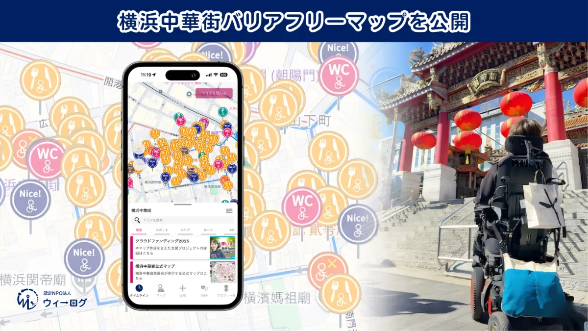
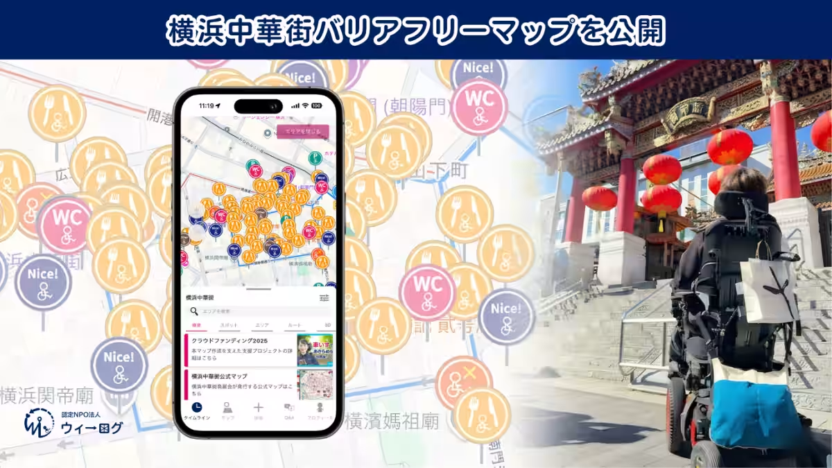
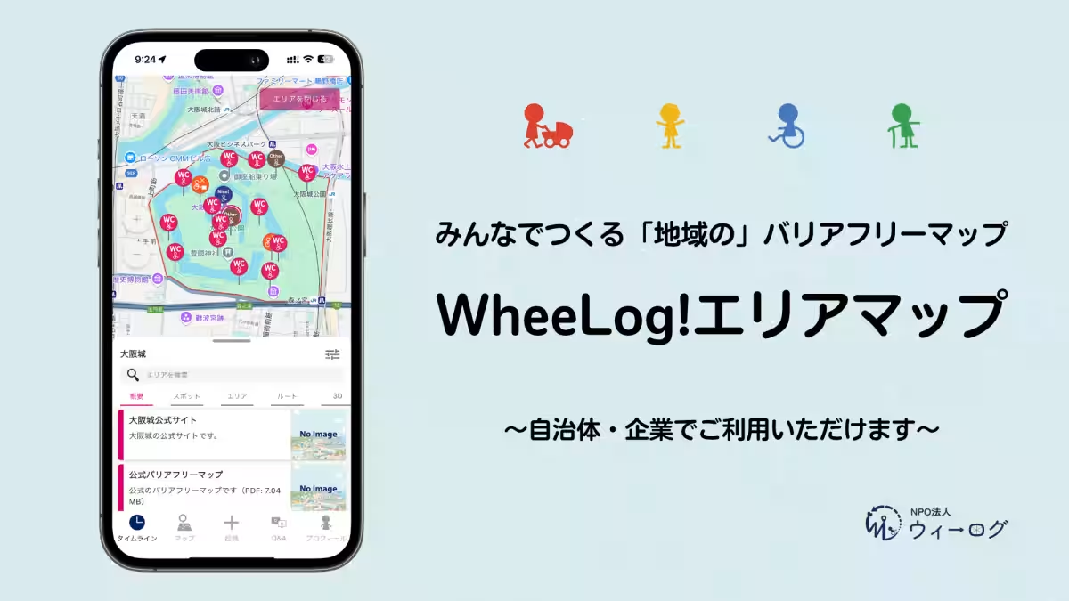
Features of the WheeLog! App’s Area Map
The enhanced area map function provides specific barrier-free information intuitively displayed on a map. Visitors can easily find accessible establishments, even in the quaint alleys of Chinatown, supporting wheelchair users, stroller-dependent visitors, and the elderly in their pursuit of a fulfilling travel experience.
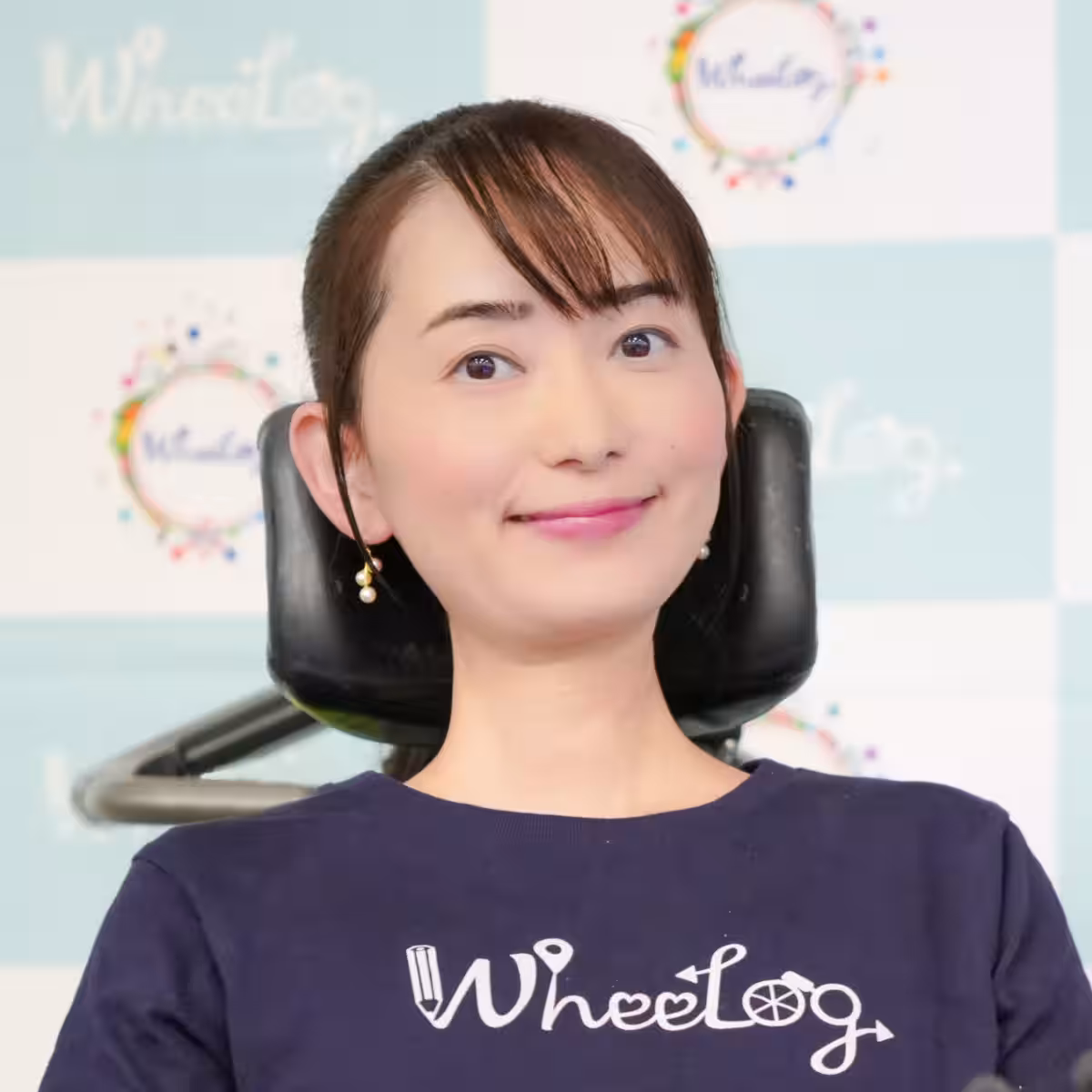
Remarks from President Yurika Oda
"Five years ago, we embarked on an exciting journey together with the initial paper and PDF maps as a foundational step for our activities. With the encouragement received from crowdfunding this time, I am thrilled to see the map updated in this new digital format after five years. My hope is that this map serves as a reliable guide for everyone visiting Yokohama Chinatown, encouraging them to take that first step," stated Yurika Oda, the president of WheeLog.
About WheeLog
- - Organization Name: Certified NPO WheeLog
- - Representative Director: Yurika Oda
- - Location: 4th Floor, Kudansaka Park Building, 1-15-2 Kudankita, Chiyoda, Tokyo
- - Website: WheeLog
Contact Information
For further inquiries, please contact the WheeLog Secretariat (Attn: Matsushita)
- - Email: [email protected]
- - Phone: 050-6867-4769
Topics People & Culture)

【About Using Articles】
You can freely use the title and article content by linking to the page where the article is posted.
※ Images cannot be used.
【About Links】
Links are free to use.