Degas Selected for GENIAC Project to Enhance Domestic Generative AI Capabilities


Degas Selected for the GENIAC Project
Degas Co., Ltd., headquartered in Shibuya, Tokyo, is proud to announce its selection for the third phase of the GENIAC project, a collaborative initiative of the Ministry of Economy, Trade and Industry (METI) and the New Energy and Industrial Technology Development Organization (NEDO) aimed at strengthening generative AI development in Japan. This endorsement allows Degas to receive support in building a large dataset composed of over 11 million satellite images paired with text, alongside GPU computing resources.
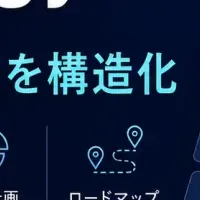
The focus of this project is the development of the Geospatial Language Model (GeoVLM), which integrates Degas' geospatial foundational model with a large language model (LLM). This AI-driven model will process satellite images and enable real-time analysis through a text-based interface. Instead of relying on experts to interpret satellite data, anyone will be able to inquire about disaster-related questions, such as “Which roads are impassable due to yesterday’s flood?” The GeoVLM will instantly analyze satellite imagery to identify and report affected areas, enhancing decision-making for organizations like the United Nations, governments, and insurance companies.
Background and Societal Issues
Degas has previously utilized satellite data to solve societal issues in emerging markets, especially in African countries, focusing on agricultural production support and disaster management. With a machine learning team comprising scientists and engineers from GAFAM companies, Degas has developed and commercialized geospatial foundational models. In its quest for global expansion, the company entered into a capital and business alliance with Sojitz Corporation last year.
Satellite imagery serves as a vital source of information for addressing large-scale issues, such as disasters and environmental degradation; however, traditional analysis methods face significant limitations:
- - Expert Dependence: Specialized personnel and expertise in GIS and remote sensing are required, making disaster reporting time-consuming—often taking several hours to half a day.
- - Lack of Real-time and Scalability: The need for timely, broad-scale monitoring of simultaneous disasters and changes in land use remains constrained by human resources and costs.
- - Limitations of RGB Imagery: Many tasks, such as assessing forest health or detecting ground shifts, necessitate multispectral data which RGB images alone cannot provide.
Through this initiative, Degas is determined to overcome these operational and technical barriers by developing an AI-powered satellite image analysis tool (VLM) accessible to non-experts.
Project Details
This undertaking focuses on creating a multispectral image-capable Geospatial Language Model (GeoVLM). By merging Degas' geospatial model with an LLM, and utilizing the vast dataset of over 11 million satellite images and text pairs (nearly 450 billion tokens) for preliminary training, an innovative AI foundation will enable natural language inquiries regarding satellite data.
The anticipated impact of the satellite observation VLM includes:
- - Enhanced Disaster Response: AI will automatically analyze emergency situations, identifying disaster areas and generating reports previously completed in hours within mere minutes. This significantly accelerates the initial response and decision-making processes during crises, thereby mitigating the risk of prolonged damage.
- - Automation of Wide-Scale Environmental Monitoring: AI will autonomously detect changes like deforestation and diseases over time. Queries such as “How many hectares of forest were lost yesterday?” or “What were the traces and extent of recent fires in the area?” can be answered almost instantly, fostering prompt responses to environmental risks.
- - Democratization and Industrialization of Satellite Imagery: With accessible satellite data analysis, various stakeholders—such as local governments, agricultural organizations, disaster management agencies, insurance firms, real estate, trading companies, and defense sectors—can leverage this tool, ultimately paving new market opportunities and broadening data-driven decision-making.
This initiative is expected to elevate Japan’s international standing in the field of generative AI, establish a de facto standard in satellite image analysis, and strengthen the competitive edge of the domestic AI industry.
Comments from Degas Leadership
Yohei Nakayama, CTO of Degas, expressed, “We are thrilled and honored to have our project selected for GENIAC. At Degas, we have consistently aimed to resolve challenges in agriculture and finance across Africa, utilizing the power of AI and satellite observation. With our geospatial foundational model, we are excited to develop the GeoVLM seamlessly integrating natural language capabilities.”
Meanwhile, Doga Makiura, CEO of Degas, stated, “With a mission of ‘Changing people’s lives, dramatically,’ we manage approximately 3,100 Tokyo Dome-sized agricultural fields in Africa. We fully comprehend the impact of creating a world where anyone can promptly understand disaster and agricultural conditions, and we are grateful for the opportunity to shape this vision through the GeoVLM project.”
Join Degas
Degas is actively seeking members to join our mission to change the world. Opportunities for job openings can be found here: Degas Careers
About Degas
- - Company Name: Degas Co., Ltd.
- - Representative: Doga Makiura
- - Website: Degas
- - Capital: 100 million yen
- - Number of Employees: 155
- - Business: Providing services and developing technologies that dramatically change people’s lives.
Contact Information
For inquiries about this release:
Degas Co., Ltd.
Contact: [email protected]
Additional Resource
GENIAC selection results can be found here: GENIAC Announcement
- ---
Notes
1. GENIAC (Generative AI Accelerator Challenge): This project mainly focuses on providing computational resources for foundational model development—the core technology of generative AI—and supporting demonstrations for data and AI utilization.
2. Reference: SatSwinMAE: Efficient Autoencoding for Multiscale Time-series Satellite Imagery. Research Paper.
3. Degas has entered into a capital business alliance with Sojitz Corporation to accelerate AI development.

Topics Business Technology)
【About Using Articles】
You can freely use the title and article content by linking to the page where the article is posted.
※ Images cannot be used.
【About Links】
Links are free to use.