


Clairatura Doubles Accuracy of Surface Water Detection Using Satellite Data and AI
Introduction
Clairatura Inc., a climate tech firm based in Chuo, Tokyo, has made significant strides in the field of satellite data and its integration with artificial intelligence (AI). Recently, they shared groundbreaking research results in the peer-reviewed journal, IEEE Journal of Selected Topics in Applied Earth Observations and Remote Sensing (JSTARS). The study unveils a new AI framework that substantially boosts the detection accuracy of surface water in rice paddies, particularly under challenging conditions such as dense crop cover.
Key Achievements
According to the research, the new framework has proven to enhance surface water detection performance by more than double when compared to traditional methods. This is a remarkable feat considering the usual difficulties in detecting surface water presence beneath thick vegetation. Alexis Declaro, the head of Data Science and GIS at Clairatura, stated, "The key is not which satellite data is the best on its own, but how combining various elements can accurately represent what’s happening on site. We expect this research to prompt a re-evaluation of the dependency on SAR technology in rice paddy water management monitoring and encourage the optimal use of context-specific optical data."
Framework Overview
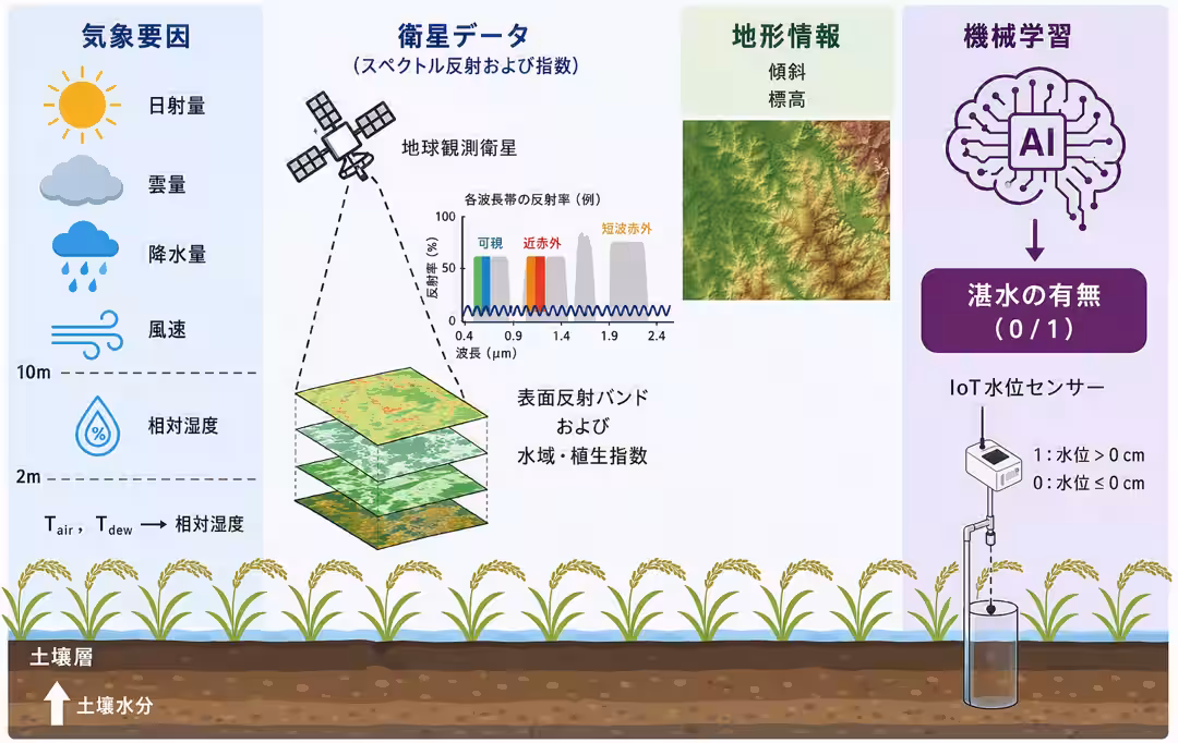
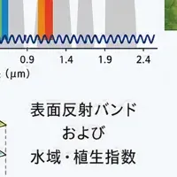
As illustrated in the research framework (Figure 1), traditional satellite analysis struggles to determine the presence of water when rice is sufficiently grown, often forcing reliance on estimates. However, Clairatura's research demonstrates that by integrating satellite imagery with meteorological and topographical data, they can accurately detect inundation events that were previously elusive to conventional detection methods.
The framework’s uniqueness lies not just in data integration, but in the clear handling of how each input data reflects the physical conditions on the ground. It builds upon observable interactions between vegetation and surface water, along with the moisture conditions of the atmosphere and soil, as well as the impact of terrain on water flow. This leads to highly transparent and explainable predictions, providing a significant advancement in surface water monitoring.
SWAP Model
The research also lays the scientific groundwork for Clairatura's operational system, known as SWAP (Surface Water Absence and Presence) model. SWAP is an innovative platform that integrates multiple satellite data sources to achieve nearly daily water management monitoring at the paddy level. Additionally, it supports the large-scale implementation of water-saving and emissions reduction techniques such as Alternate Wetting and Drying (AWD). This capability is poised to contribute significantly to sustainable agricultural practices in the future.
Conclusion
For those interested in the detailed findings, the full paper titled "Data-Driven Assessment of Climate and Topographic Integration With Satellite Imagery for Improved Surface Water Detection Under Agricultural Vegetation" can be accessed through the DOI link provided. By leveraging combined satellite imagery and AI, Clairatura is setting a benchmark in the agricultural technology realm, paving the way for improved water management strategies that are both efficient and sustainable.
Reference
- - Authors: Alexis Declaro, Jin Xiao, Robert Galla, Shinjiro Kanae (Tokyo University of Science / Yamanashi University)
- - Journal: IEEE Journal of Selected Topics in Applied Earth Observations and Remote Sensing (JSTARS)
- - DOI: https://doi.org/10.1109/JSTARS.2026.3699594
Topics Consumer Technology)


【About Using Articles】
You can freely use the title and article content by linking to the page where the article is posted.
※ Images cannot be used.
【About Links】
Links are free to use.