


MAPiNAVi: A Multi-Language Navigation App for Construction Sites
Introduction
In a groundbreaking collaboration, Kohki Group, based in Osaka, and NCS Corporation, headquartered in Tokyo, have jointly developed a state-of-the-art navigation application called MAPiNAVi. This app is designed specifically for smartphones and supports ten languages, aiming to assist in navigating areas that conventional car navigation systems find challenging.
Purpose and Development Context
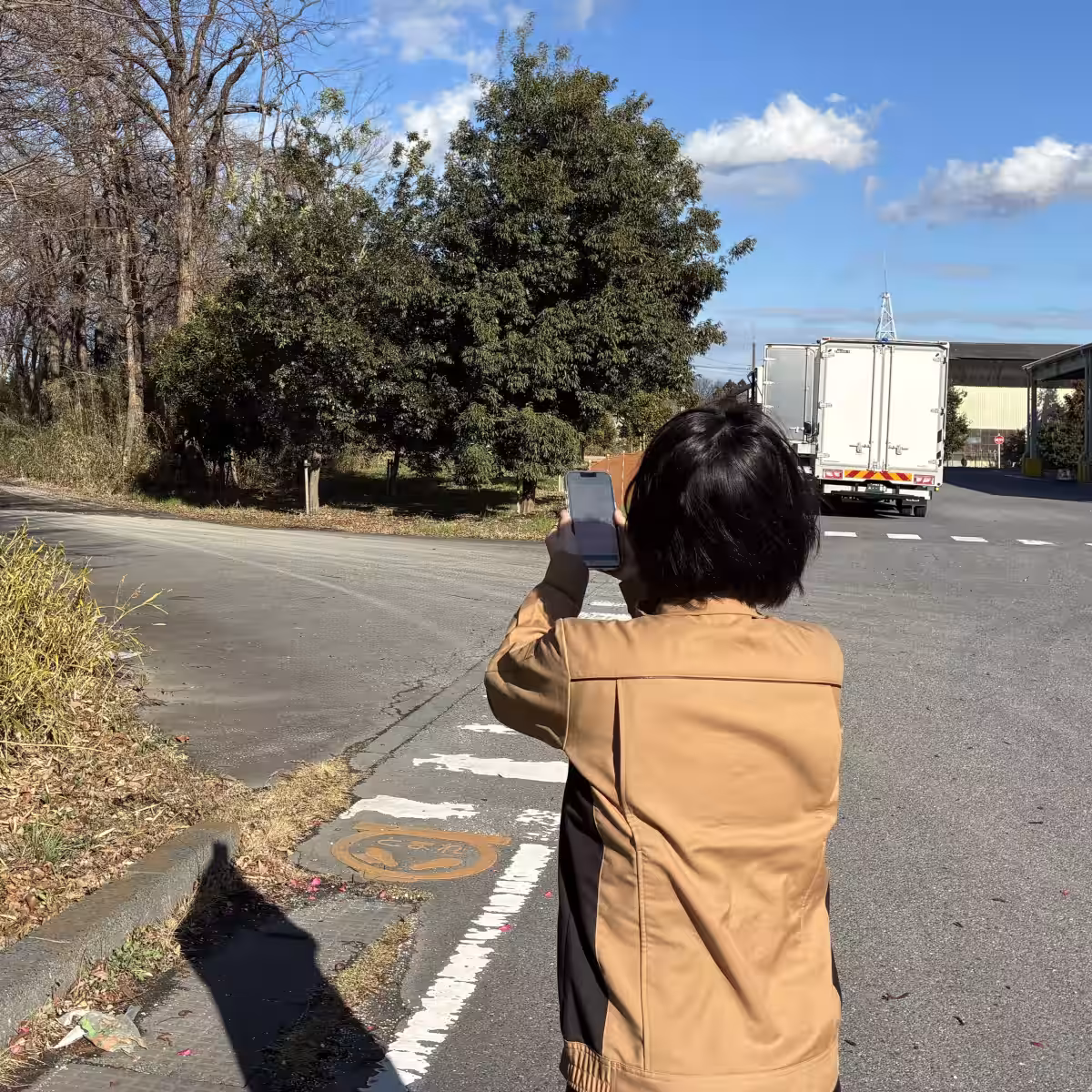
The genesis of MAPiNAVi arose from feedback gathered from construction workers entering new sites. Many reported feeling lost on site, mistakenly entering hazardous areas, or struggling to comprehend unique safety regulations specific to each environment. The increase in foreign workers has further highlighted the pressing need for effective communication across language barriers. Keeping these concerns in mind, Kohki Group and NCS focused the app's development on enhancing smooth navigation, securing safety for on-site personnel, and ensuring awareness of site-specific safety regulations.
Key Features of MAPiNAVi
1. Navigation Support in Challenging Areas
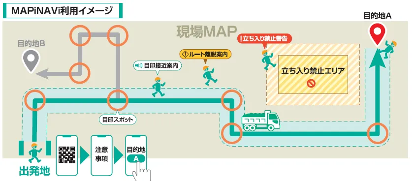
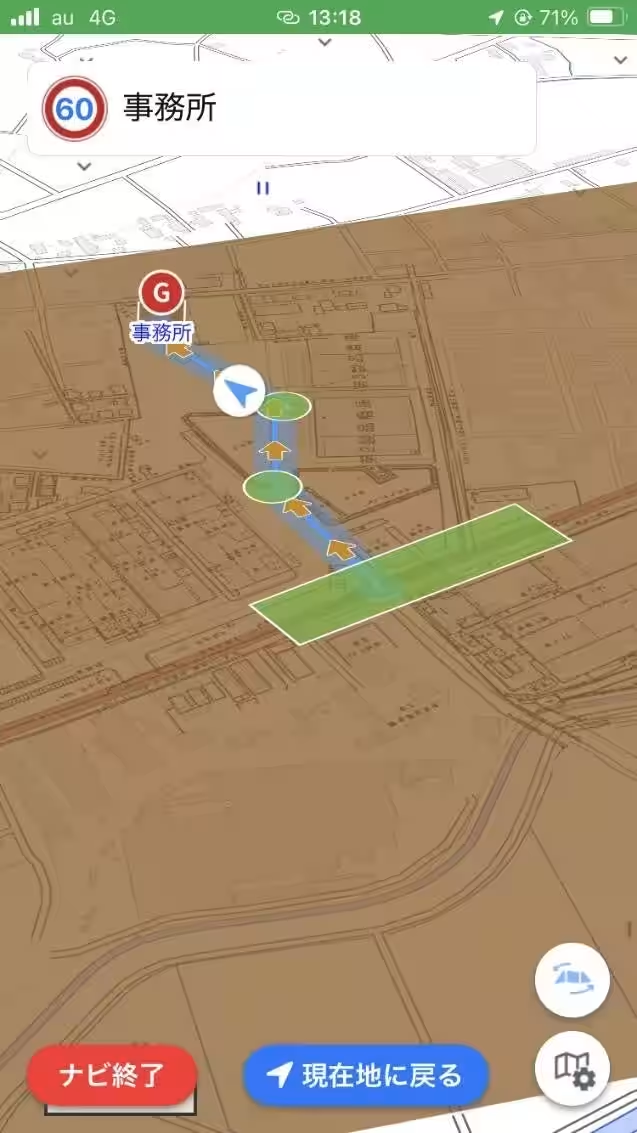
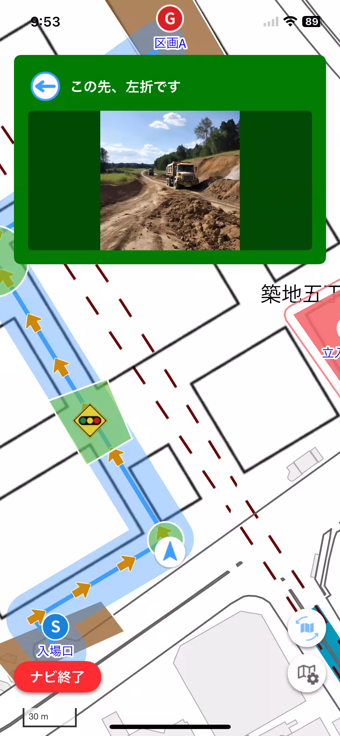
MAPiNAVi utilizes original maps that overlay construction site layouts and temporary circuit plans onto official geographic maps provided by the Geospatial Information Authority of Japan. This allows for effective route setting in areas where traditional navigation systems fail, including ongoing construction sites, temporary roads, mountainous regions, and expansive factory premises. As a result, even new entrants can reach their destinations without disorientation.
2. Divergence Warning Functionality
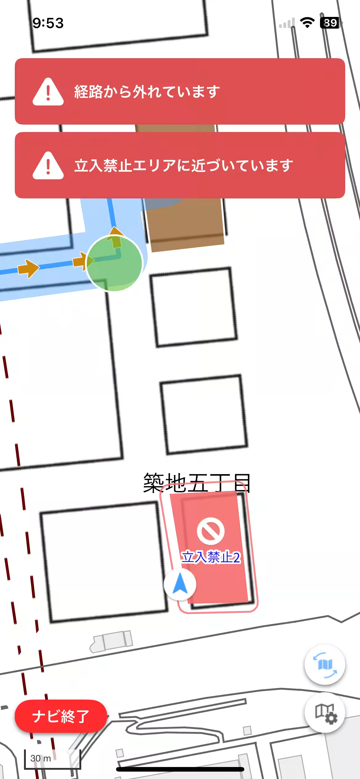
To enhance safety, the app instantly alerts users if they stray from the designated route during navigation. This feature is crucial in preventing accidental entry into hazardous zones while ensuring overall traffic safety within the construction site. Additionally, the site staff can monitor user locations, relieving them of the burden of guiding new entrants manually.
3. Mandatory Confirmation of Safety Guidelines
A distinctive feature of MAPiNAVi is its requirement that users acknowledge the specific safety instructions pertinent to each site before commencing navigation. This includes becoming familiar with no-entry zones, heavy machinery operation areas, and one-way traffic rules unique to each construction site, significantly reducing misunderstandings related to safety information.
4. Multi-Language Support
In response to the diverse makeup of the construction workforce, MAPiNAVi provides support in ten languages. This feature guarantees that users receive navigation prompts, safety tips, and warning alerts in their native languages, minimizing the potential for miscommunication arising from language barriers.
5. Accessibility through Smartphones
MAPiNAVi does not require specialized equipment, making it accessible via standard smartphones. Users simply need to install the app and input the ID and password received from the site to seamlessly navigate from arrival to their designated locations.
Expected Benefits
By implementing this app, the safety of construction workers from partner companies is expected to improve significantly. Moreover, MAPiNAVi enhances the efficiency of educating new entrants and supports the smooth integration of a multinational workforce, ultimately reducing risks of accidents and disasters on construction sites.
Future Prospects
Both Kohki Group and NCS are committed to continuous testing and refinement of MAPiNAVi within their sites, with consideration for external commercialization in the future. Through the promotion of ICT and DX initiatives, the companies aim to foster a working environment where diverse personnel can operate safely and efficiently across all construction sites.
*Note: The app's foundation is built upon NCS's construction management support service called
Topics Other)


【About Using Articles】
You can freely use the title and article content by linking to the page where the article is posted.
※ Images cannot be used.
【About Links】
Links are free to use.