


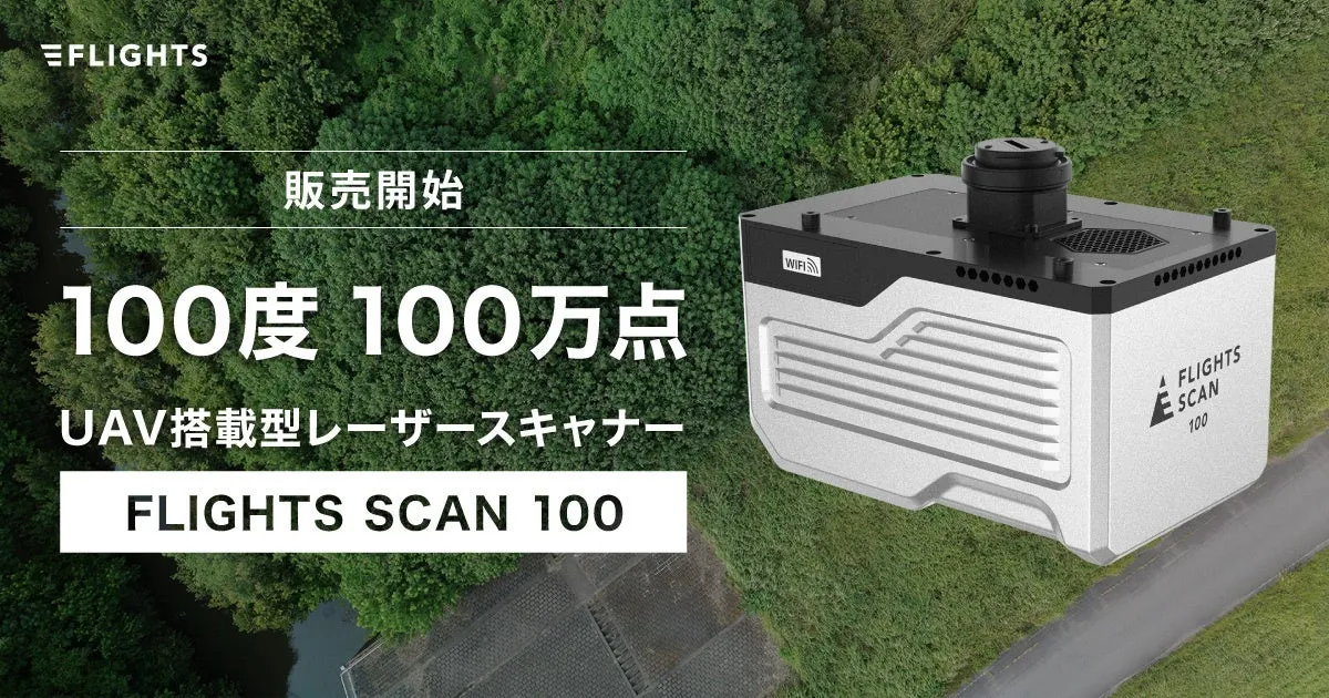
Launch of the High-End Drone Laser Model FLIGHTS SCAN 100 with Online Webinar
Introducing the FLIGHTS SCAN 100
On September 2, 2025, FLIGHTS Inc., headquartered in Shibuya, Tokyo, proudly announced the launch of their high-end drone-mounted LiDAR model, the FLIGHTS SCAN 100. With the increasing demand for accurate surveying and mapping solutions, this advanced model promises to set new industry standards.
Key Features of FLIGHTS SCAN 100
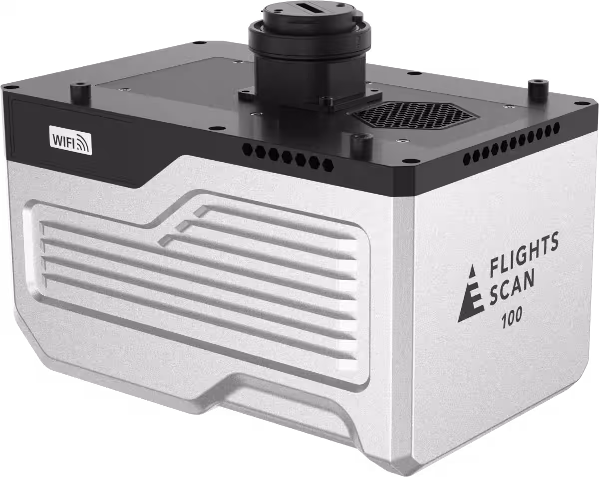
The FLIGHTS SCAN 100 stands out with its superior specifications compared to similar products on the market.
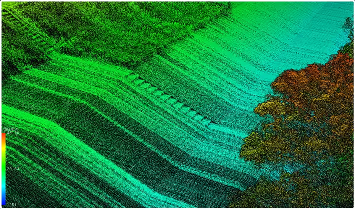
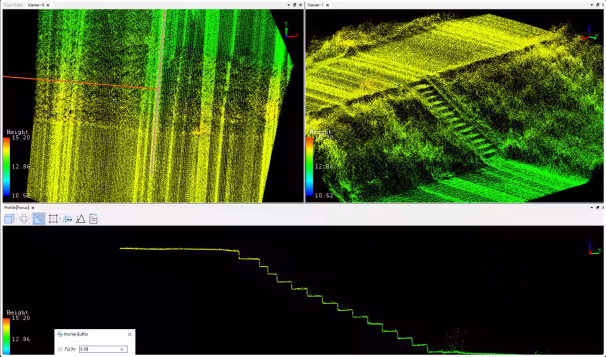
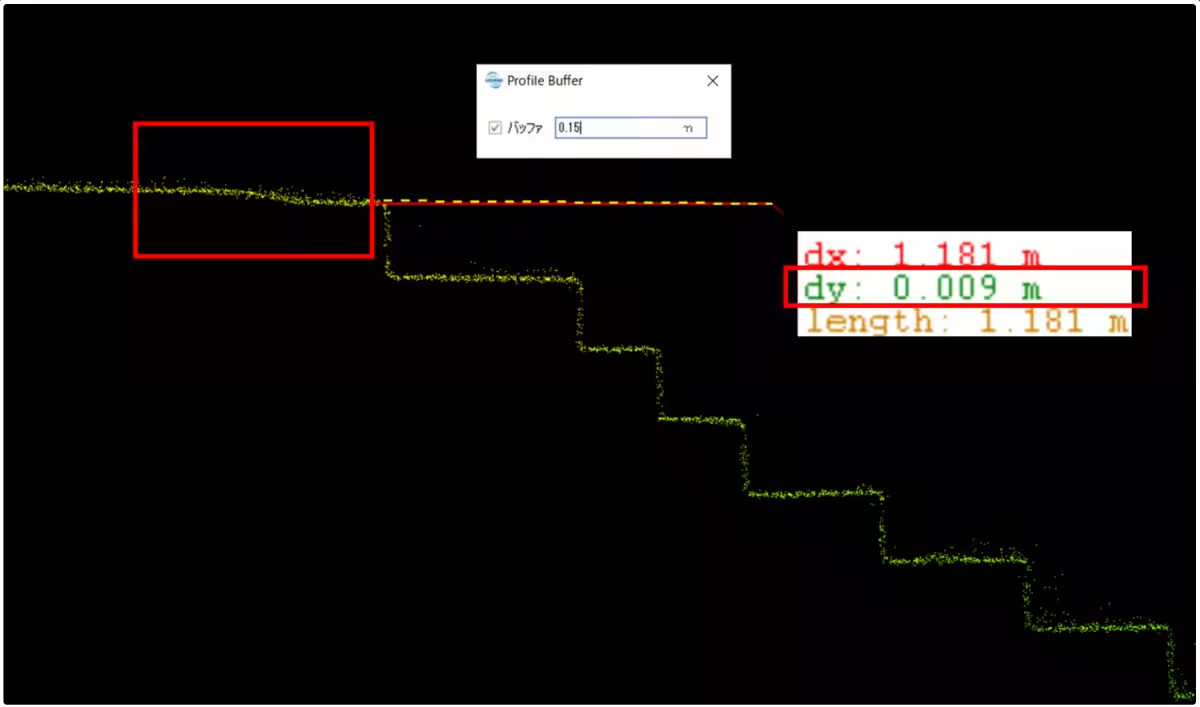
- - Field of View: A 100-degree field of view allows for efficient and wide-ranging measurements, minimizing blind spots during scans.
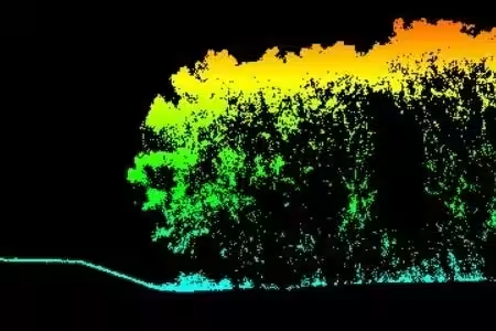
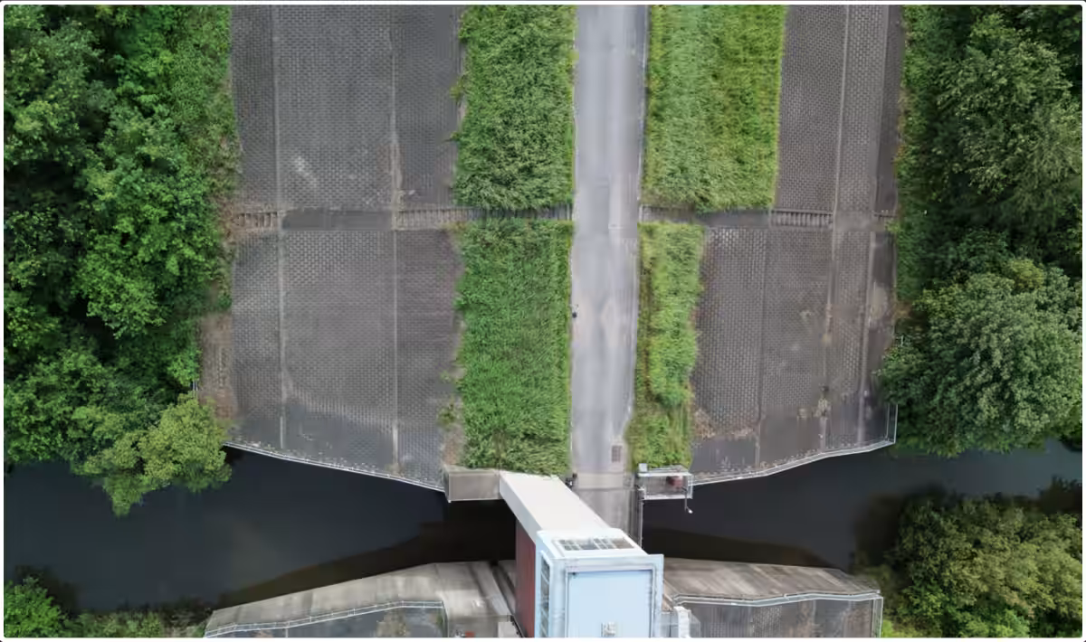
- - Scanning Performance: It can scan up to 1 million points per second at altitudes of up to 80 meters, ensuring high point density for detailed analysis.
- - Beam Diameter: With a beam diameter of 0.5 mrad and a maximum return count of 7, this model can capture more accurate data from structures and terrains, even in densely vegetated areas.
In tandem with the FLIGHTS SCAN 100 launch, a new software application called FLIGHTS CLOUD will also be released, facilitating intuitive point cloud data generation for users without specialized knowledge. This innovative solution streamlines workflows considerably, contributing to efficiency and productivity in data processing.
Upcoming Online Webinar
To commemorate the launch, FLIGHTS will host a free online webinar on September 9, 2025, at 15:00 JST. During this 30-minute event, attendees will receive detailed insights into the features and applications of the FLIGHTS SCAN 100 model.
Webinar Details:
- - Date: September 9, 2025
- - Time: 15:00 - 15:30 JST
- - Speaker: Dr. Koshio, Executive Officer at FLIGHTS Inc.
- - Target Audience: Businesses and organizations interested in drone laser surveying technology, as well as relevant media representatives.
- - Registration: Sign up here
Why You Should Attend
If you are looking to efficiently measure large areas, utilize drone laser technologies in public surveys, or upgrade to a high-spec product from an existing LiDAR solution, this webinar is the perfect opportunity. Learn firsthand about the FLIGHTS SCAN 100's capabilities and hear from experts in the field.
Applicability in Various Industries
FLIGHTS SCAN 100 aims to address key challenges in industries such as surveying, construction, and urban planning, where precise and efficient measurement techniques are critical. FLIGHTS Inc. is committed to delivering high-performance drone-mounted LiDAR systems at accessible prices, ensuring more companies can leverage this cutting-edge technology.
Conclusion
As FLIGHTS Inc. continues to innovate, the introduction of the FLIGHTS SCAN 100 represents a significant step toward transforming the landscape of surveying and measurement technology in Japan. With plans for ongoing demonstrations and further advancements to streamline workflows, industries can expect major productivity gains.
For more information about the FLIGHTS SCAN 100 and to explore its specifications and capabilities, feel free to visit their official website.


Topics Consumer Products & Retail)


【About Using Articles】
You can freely use the title and article content by linking to the page where the article is posted.
※ Images cannot be used.
【About Links】
Links are free to use.