


Expanding Snow Removal Support System in Japan's Snowy Regions
Dynamic Map Platform's Snow Removal Support System Expansion
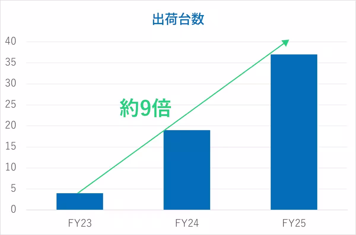
In a remarkable development, Dynamic Map Platform Inc., headquartered in Shibuya, Tokyo, is significantly expanding the deployment of its snow removal support system, known as SRSS (Snow Removal Support System), particularly in the snowy regions of Hokkaido and Tohoku. Over the past two years, the number of units shipped has increased nearly ninefold, showcasing a growing reliance on digital transformation in this crucial sector.
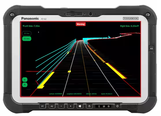
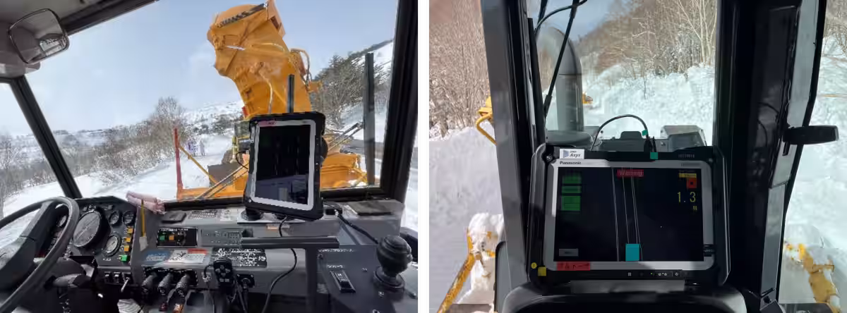
The SRSS leverages high-precision 3D map data, which is also utilized in the autonomous driving field, to provide visibility on features like road edges, manholes, and structural elements buried beneath the snow. The system displays this crucial information on tablet devices, assisting operators in making informed decisions and executing snow removal tasks more efficiently.
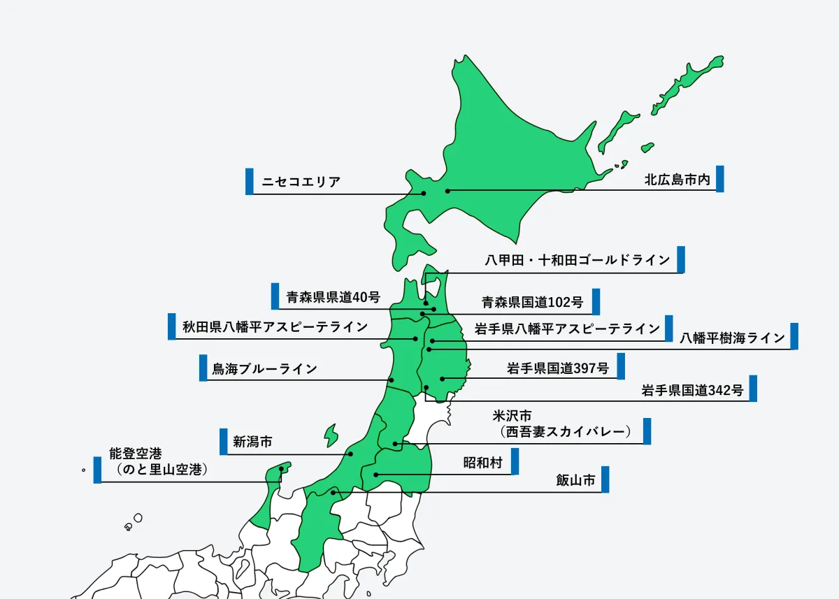
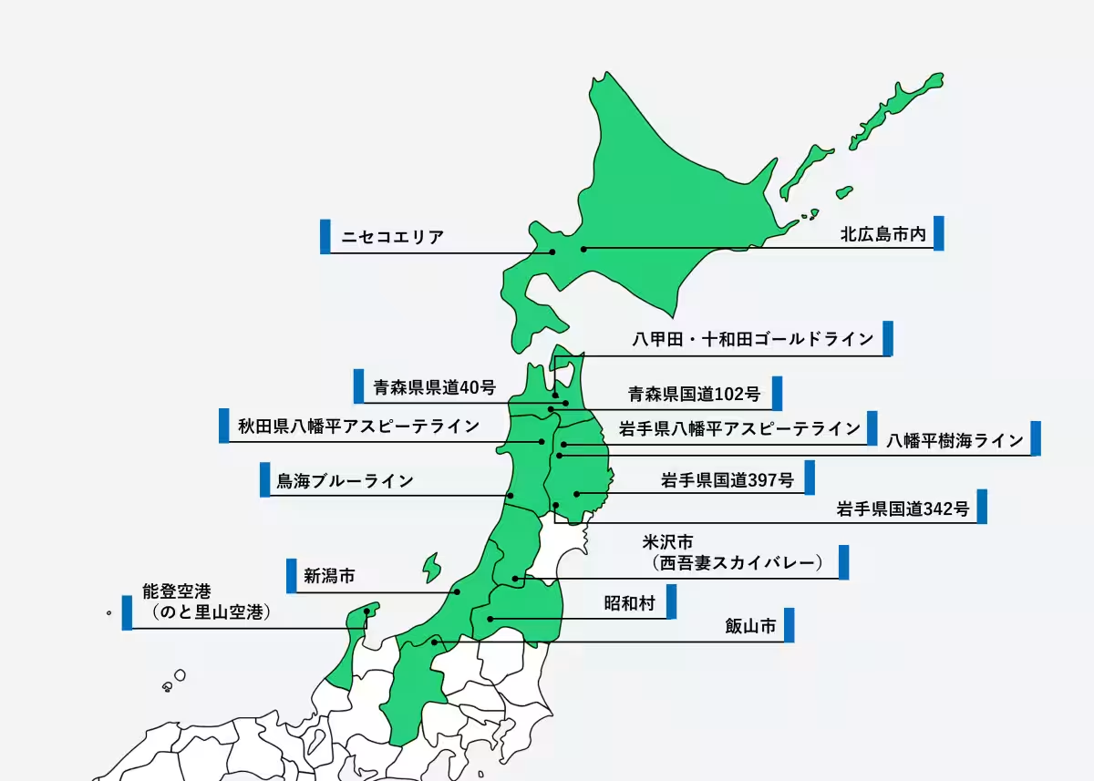
In recent years, the growing shortage of personnel and an aging workforce have posed challenges for snow removal operations. Municipalities are in urgent need of creating a safe and efficient snow removal framework that does not depend on individuals' experience and instincts. This is where SRSS comes into play, making its mark across various critical locations known for heavy snowfall and tourism, such as Yamagata Prefecture's Yonezawa City and Noto Airport in Ishikawa Prefecture. Additionally, new implementations have begun in areas like Kutchan Town in Hokkaido's Niseko region and on key routes in Aomori and Iwate Prefectures, with a total of 15 operational sites already equipped with SRSS.
The significance of SRSS extends beyond just operational efficiency; it is integral to the safety and productivity of snow removal activities. As one representative from the Iwate Prefectural Government highlighted, areas like the mountain routes, such as the Hachimantai Aspite Line, previously relied heavily on experienced operators. However, with SRSS's deployment, awareness of road shape and hazardous spots beneath the snow has greatly improved, enhancing both safety and efficiency in real-world operations.
Furthermore, feedback from local officials has indicated the system's positive impact on training younger operators. Traditionally, knowledge transfer relied on the memories of experienced personnel, but SRSS allows for specific instruction based on precise location data, ensuring safety protocols and hazards are clearly communicated.
The government supports SRSS as a product aligned with public procurement initiatives aimed at fostering startup innovations. In addition to enhancing operational quality and safety, SRSS contributes to workforce development and improved working environments within the snow removal sector.
Going forward, Dynamic Map Platform plans to increase the deployment of SRSS units in areas already utilizing the system while also targeting other snowy locales, airports, and arterial roads to further promote snow removal digital transformation (DX). These efforts align with the company's commitment to building a sustainable societal infrastructure in heavy snowfall regions through innovative solutions.
About SRSS
SRSS integrates high-precision 3D mapping data with advanced positioning capabilities, employing RTK positioning enabled by the CLAS satellite system. This integration allows for accurate visibility of hidden road features, promoting safer snow removal operations.
More information about SRSS can be found on the official site: Dynamic Map Platform SRSS.
Company Background
Dynamic Map Platform Axyz Inc., established in October 2022, specializes in utilizing high-precision 3D data for innovative business creation. The parent company, Dynamic Map Platform Inc., was founded in June 2016 and operates under the vision of 'Modeling the Earth,' providing high-precision 3D mapping solutions across various industries, including autonomous driving and infrastructure management. The company continues to innovate, contributing significantly to advancements in public safety and operational efficiency in the face of changing climatic conditions.
Topics Consumer Products & Retail)


【About Using Articles】
You can freely use the title and article content by linking to the page where the article is posted.
※ Images cannot be used.
【About Links】
Links are free to use.