


Experience Cutting-Edge Surveying Technology in Free Seminars in Yokohama and Niigata
Unleashing the Future of Surveying with Drones in Japan
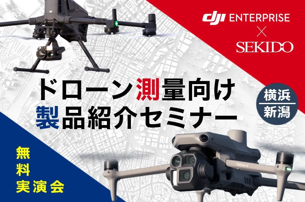
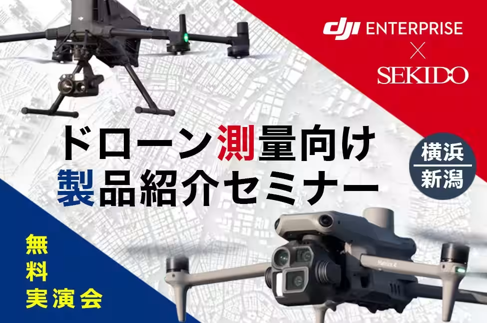
On July 18, 2025, Sekido Co., Ltd., a leading provider of drone solutions and the official distributor for DJI in Japan, will host a free seminar titled the "DJI Industrial Drone Surveying Product Introduction Seminar" in both Yokohama and Niigata. This event aims to educate participants on the latest advancements in drone technology focused on surveying operations, highlighting the efficiency and precision that drones can bring to the industry.
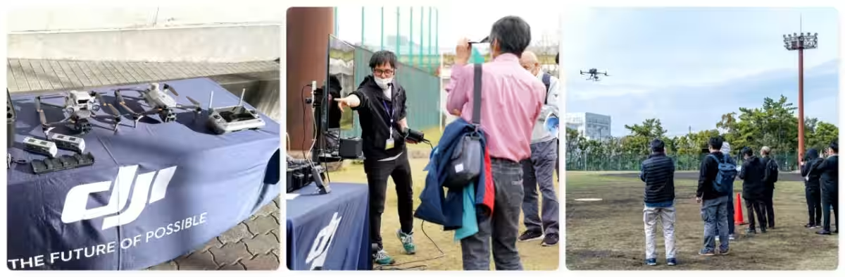
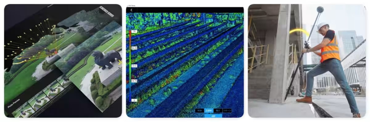
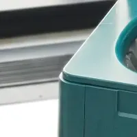
The seminar will showcase the newest industrial drones that leverage AI for enhanced data collection and operational efficiency. Attendees will get a chance to see live demonstrations of various drone capabilities, including the innovative LiDAR modules and high-performance cameras designed for precision measurements. In addition, participants will learn about the portable 3D scanner and GNSS rover that compliment drone surveying.
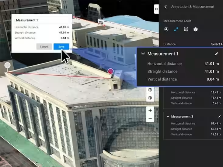
During the event, we will simulate a surveying site, allowing participants to view actual footage captured during the demonstration flights. This interactive experience is not only informative but also addresses concerns about drone implementation in surveying tasks, including how to access public subsidies and grants to assist in the adoption of these advanced tools.
With a solid track record and numerous successful implementations, Sekido aims to alleviate any apprehensions regarding the adoption of modern surveying technologies. Drones have become indispensable tools in photo surveying and laser measurements, significantly improving efficiency across various surveying operations. Together with our authorized dealers, we organize these free seminars to facilitate safer, more accurate, and efficient surveying practices in Japan.
Among the highlighted products at the seminar are:
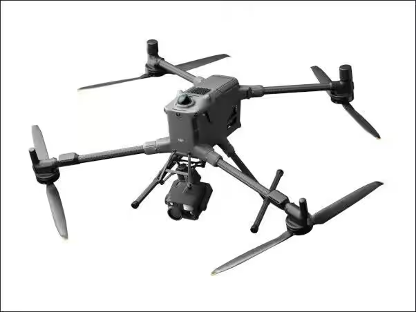
- - DJI MATRICE 400: A flagship industrial drone designed for high-accuracy measurements and infrastructure inspections with a flight time of up to 59 minutes.
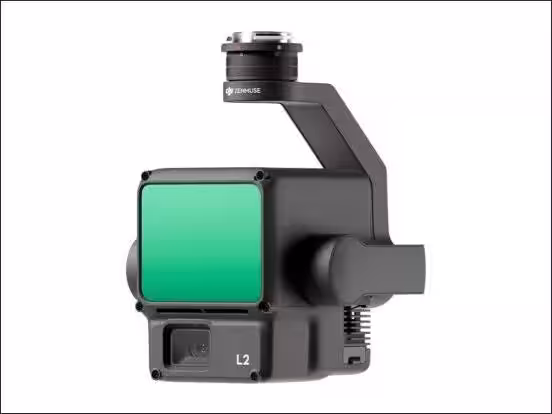
- - DJI ZENMUSE L2: A cutting-edge LiDAR module offering reliable terrain data acquisition with high precision.
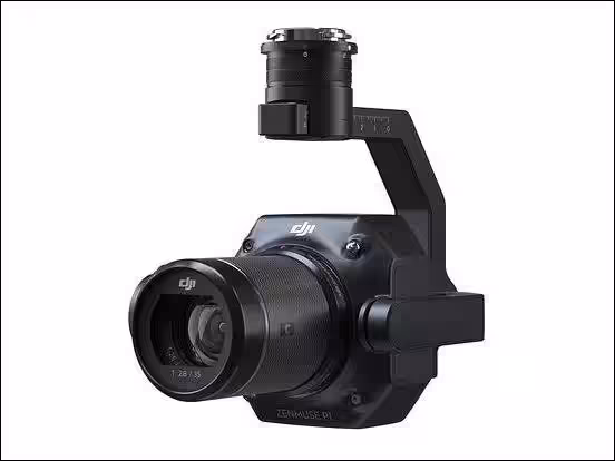
- - DJI ZENMUSE P1: A full-frame sensor camera designed for aerial photogrammetry, providing superior accuracy and efficiency.
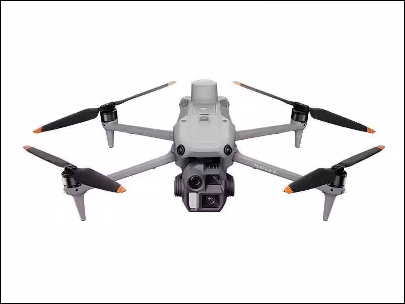
- - DJI MATRICE 4E: A compact drone optimal for surveying and mapping in diverse environmental conditions.
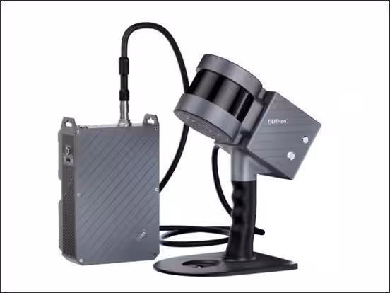
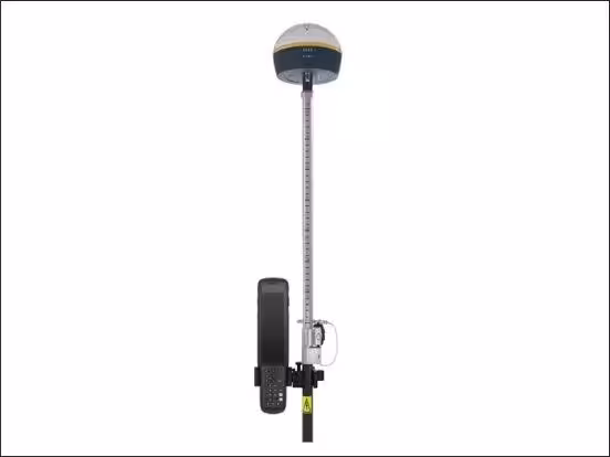
Participants will also learn about the handheld 3D scanner FJD Trion S1 and the GNSS rover, FJD Trion V1/V1t. Our experienced staff will guide attendees through the operational benefits of these tools, ensuring that even those new to drone surveying leave with a solid understanding of how they can implement these technologies in their work.
This popular seminar is geared toward individuals looking to improve efficiency in surveying and civil engineering tasks but also caters to those who are new to drone surveying. Whether you are currently using the Phantom 4 RTK and considering upgrading, or whether you are completely new and unsure about which model to choose, our expert staff will be available to address any questions or concerns you may have.
Free Seminars at a Glance:
[Yokohama]
- - Date: July 18, 2025 (Friday)
- - Time: 2:00 PM - 4:00 PM (Registration starts at 1:50 PM)
- - Venue: Sekido DJI Yokohama Drone Training Center, Kanazawa Industrial Promotion Center, 1-5-2 Fukuura, Kanazawa Ward, Yokohama 236-0004
- - Capacity: First 20 attendees
[Niigata, Sanjo]
- - Date: July 18, 2025 (Friday)
- - Time: 1:00 PM - 3:00 PM (Registration starts at 12:50 PM)
- - Venue: Sanjo Monozukuri School Multipurpose Hall, 12-38 Sakuragi-cho, Sanjo, Niigata 955-0844
- - Capacity: First 20 attendees
Common Details:
- - Participation Fee: Free
- - Target Audience:
- Individuals who are newcomers to drone surveying and feel uncertain about adoption;
- Companies contemplating the use of the latest LiDAR, GNSS rovers, and 3D scanners;
- Any stakeholders interested in improving efficiency in their surveying operations.
This is a unique opportunity to experience firsthand how drone technology can transform business operations and enhance efficiency across industries. We encourage everyone interested to not miss out on this valuable seminar.
For Press and Media Inquiries:
Media representatives are welcome to attend to observe the live drone demonstrations and viewer-generated data showcases. Interviews and on-site reporting options are available upon request.
You can register here (Free of charge, first-come basis):
Sekido's Commitment to the Future
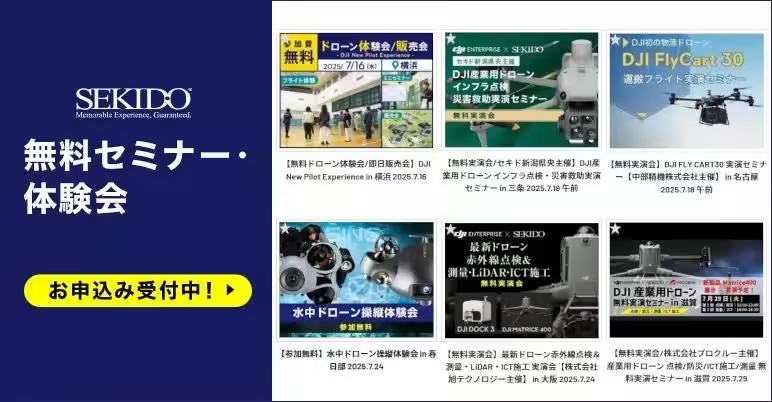
Sekido has established its presence as a leading company in drone sales and support in Japan, forming partnerships with over 45,000 companies and government agencies. As the first distributor of DJI in Japan, Sekido operates comprehensive drone facilities in Tokyo, Yokohama, and Fukuoka. Our commitment to knowledge sharing through seminars has seen over 21,000 attendees since the inception, paving the way for greater adoption of drone technologies in various industries. We look forward to helping the surveying community understand, adapt, and thrive in an increasingly technological landscape.
Topics Consumer Products & Retail)


【About Using Articles】
You can freely use the title and article content by linking to the page where the article is posted.
※ Images cannot be used.
【About Links】
Links are free to use.