Noto Airport Adopts Innovative Snow Removal Support System for Winter Operations


Noto Airport Implements Advanced Snow Removal System
In a significant milestone for winter airport operations, Noto Airport has adopted the snow removal support system known as SRSS (Snow Removal Support System). The system, provided by Axyz Inc., a subsidiary of Dynamic Map Platform Co., Ltd., leverages high-precision 3D map data to enhance the efficiency and safety of snow removal operations during the upcoming 2025 winter season.
Challenges Faced at Noto Airport
The decision to adopt the SRSS system comes in the wake of difficulties posed by the Noto Peninsula earthquake in January 2024, which strained the airport's ability to mobilize snow removal personnel. The workforce now includes individuals with limited snow removal experience. Moreover, essential lighting and airport markings have been removed due to ongoing disaster recovery efforts, creating a challenging environment where visibility of important markers is greatly reduced. This has complicated accurate snow removal processes, making it essential to utilize innovative solutions.
The SRSS Advantage
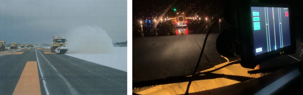
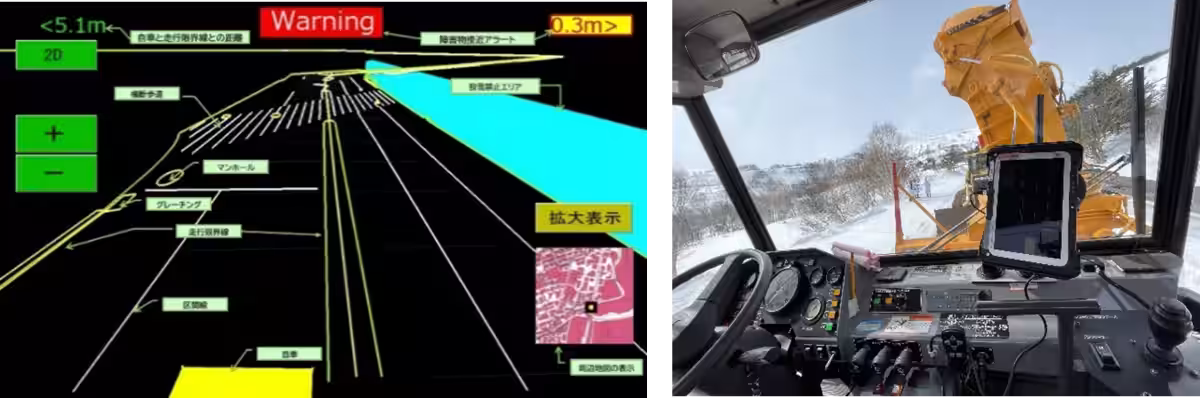
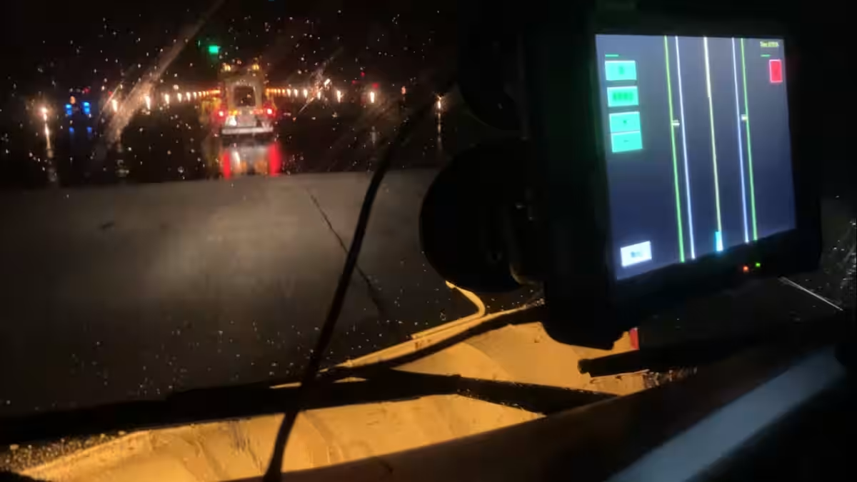
The SRSS system is rooted in high-precision 3D data utilized in autonomous vehicles and is designed to specifically assist in snow removal tasks. It enhances operational visibility by making the locations of critical markers—such as edges of the runway and manholes—visible on tablet devices. By visualizing these locations, the system facilitates smoother operations, even under low visibility conditions or when less experienced workers are on the job. This technological application helps to ensure effective responses to snowfall while enhancing the safety of the personnel engaged in these operations.
Joheki Matsuda, an operator who utilized the SRSS during snow removal, shared positive feedback on the system's benefits:
- - "The locations of structures and boundaries became much easier to understand, reducing near-miss situations and providing psychological comfort during operations."
- - "Even in low-visibility situations like snowfall or at night, I was able to determine the appropriate path to follow."
- - "There were fewer instances of stopping to check my position, allowing for a smoother overall snow removal process."
Commitment to Innovation and Safety
Dynamic Map Platform Co., Ltd. is dedicated to being a leader in high-precision 3D data applications across various industries. As a platform provider, the company aims to create innovative solutions that address societal challenges. The integration of SRSS at Noto Airport exemplifies the potential for tech-driven advancements in the transportation sector, setting a new standard for winter operational preparedness across airports.
About the SRSS System
The SRSS system integrates GNSS receiver data and relies on high-precision positioning through technologies like CLAS (Quasi-Zenith Satellite System) and RTK positioning. This combination allows for centimeter-level accuracy in determining vehicle locations and visualizing concealed markers. By making otherwise hidden features accessible on digital screens, the system supports safe and effective snow removal operations.
For more details on the SRSS service, you can visit Dynamic Map Platform's official site.
About Dynamic Map Platform Axyz, Inc.
- - Founded: October 2022
- - Headquarters: Shibuya, Tokyo
- - CEO: Hiromichi Amatani
- - Business Focus: Creating new business opportunities utilizing high-precision 3D data.
About Dynamic Map Platform Co., Ltd.
Dynamic Map Platform Co., Ltd. was established with support from the Japanese government and investments from ten domestic automobile manufacturers. With its headquarters in Japan, the company operates across North America, Europe, the Middle East, and South Korea, providing high-precision 3D data for autonomous driving and advanced driver-assistance systems (ADAS). This company is committed to innovating across diverse industries, with a vision of "Modeling the Earth" and facilitating technological advancement in the field.
- - Founded: June 2016
- - Headquarters: Shibuya, Tokyo
- - CEO: Shuichi Yoshimura
- - Official Website: Dynamic Map Platform
- - Official X: Dynamic Maps on X


Topics Consumer Technology)
【About Using Articles】
You can freely use the title and article content by linking to the page where the article is posted.
※ Images cannot be used.
【About Links】
Links are free to use.