UPWARD Secures Patent for Elastic Geofence AI to Revolutionize Field Sales Activity


UPWARD's Groundbreaking Elastic Geofence AI Technology
UPWARD, a leading innovator in field sales solutions based in Tokyo's Chiyoda Ward, has swiftly secured a patent for its latest technological advancement, the Elastic Geofence AI. The patent was officially registered on September 18, 2025, just one month after its application, owing to the novelty and clarity of the invention. This development not only cements UPWARD's position at the forefront of AI-driven sales efficiency but also enhances the accuracy of stay detection in field activities.
The Essence of the Patent
Patent Number: 7745145
Registration Date: September 18, 2025
Invention Title: Information Processing Device, Information Processing Method, Program, and Information Processing System
For more detailed information, you can visit their patent documentation here.
Background of the Technology
Previously, UPWARD offered a solution that allowed field sales representatives to automatically log their presence at client locations through predetermined geofences — virtual geographical boundaries around a designated area. This feature enables sales agents to file activity reports easily based on location data without needing to search for clients actively. With a mechanism designed to minimize battery consumption and data use, the application only activates when movement is detected, enhancing practicality for users in the field.
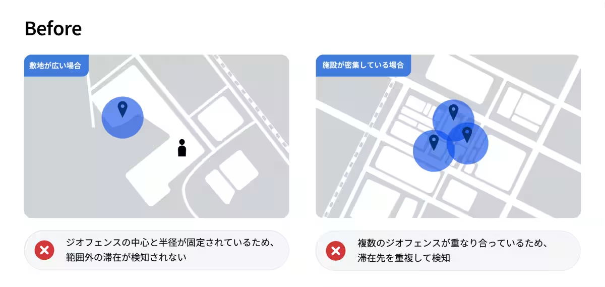
However, this system had limitations, especially with fixed geofence parameters. Sales representatives often encountered scenarios requiring manual adjustments due to varying property sizes, density, and visit patterns. Challenges included:
- - Detection Gaps: Instances where representatives remained at a location without detection, particularly in expansive facilities.
- - Overlapping Detection: In densely packed urban environments, where the geofence systems could trigger redundantly.
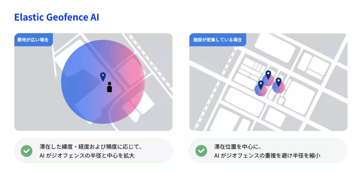
Features of Elastic Geofence AI
The new Elastic Geofence AI addresses these shortcomings by employing machine learning algorithms that analyze users’ activity and geographical data. The system intelligently optimizes the center and radius of geofences for each user, allowing the detection area to flexibly adjust in response to individual patterns of movement. This

Topics Other)
【About Using Articles】
You can freely use the title and article content by linking to the page where the article is posted.
※ Images cannot be used.
【About Links】
Links are free to use.