Mapping Seagrass Initiatives in the Western Indian Ocean for Climate Conservation


Groundbreaking Initiative for Seagrass Conservation in the Indian Ocean
The Western Indian Ocean Marine Science Association (WIOMSA), in collaboration with The Pew Charitable Trusts and the University of Southampton, has recently announced the launch of the large-scale initiative named LaSMMI (Large-Scale Seagrass Mapping and Management Initiative). This revolutionary project aims to create the first ground-validated map of seagrass beds across crucial marine areas in Kenya, Tanzania (including Zanzibar), Mozambique, and Madagascar.
The Importance of Seagrass Ecosystems
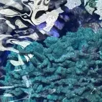
Seagrass meadows are vital coastal habitats that support biodiversity while playing a significant role in carbon sequestration. Despite their importance, these ecosystems rank among the least studied and most threatened of marine environments. The LaSMMI will utilize satellite imagery alongside ground verification techniques to produce highly accurate maps of these critical habitats. The mapping effort will cover shallow waters along a combined coastline exceeding 9,500 kilometers and over 2 million square kilometers of maritime area.
Dr. Arthur Tuda, Executive Director of WIOMSA, emphasized the crucial role that seagrasses play: "They are the unsung heroes of our oceans, essential for marine life, coastal communities, and climate change mitigation. Yet they remain among the least understood and protected ecosystems. With LaSMMI, we aim to leverage science and collaboration to ensure that seagrass meadows are recognized, valued, and safeguarded. By connecting global data to local action, we seek to create a future where seagrasses are actively protected as a cornerstone of ocean health and resilience."
Research and Policy Integration
LaSMMI transcends mere mapping; it represents a comprehensive effort to enhance seagrass research and policy integration with multiple key objectives:
- - Develop a standardized, ground-validated map of seagrass meadows by the end of 2026.
- - Evaluate carbon stock values in the region to support climate strategies.
- - Strengthen local research capacities through training and workshops on data collection, analysis, and verification.
- - Raise awareness among national and regional authorities about the conservation of seagrass meadows and their role in climate change mitigation.
- - Foster political linkages by integrating seagrass data into Nationally Determined Contributions (NDCs) under the Paris Agreement, marine spatial planning, and sustainability frameworks.
Professor Gwilym Rowlands from the University of Southampton, who leads the project, noted, "LaSMMI marks a pivotal step in recognizing, protecting, and integrating Western Indian Ocean coastal ecosystems into global climate strategies. By bridging the gap between science and policy, this initiative will lead to meaningful conservation actions benefiting both marine biodiversity and coastal communities."
Strong Partnerships for Sustainable Impact
The LaSMMI is built on a solid foundation of partnerships, bringing together leading research institutions in the region, including the Kenya Marine and Fisheries Research Institute (KMFRI), the University of Dar es Salaam, the State University of Zanzibar (Tanzania), Eduardo Mondlane University (Mozambique), and the University of Toliara - Institute of Fisheries and Marine Sciences (Madagascar).
Stacy Baez, Coastal Wetlands Conservation Campaign Manager at Pew, stated, "Neglected and underprotected seagrass meadows are vital for our planet. LaSMMI aims to map these underwater ecosystems in the Western Indian Ocean and estimate the carbon they store, fueling conservation efforts for the benefit of nature, communities, and the climate."
The LaSMMI follows the success of the Seychelles Seagrass Mapping and Carbon Assessment project, which mapped the first ground-validated seagrass and assessed carbon stocks for the country. This highly collaborative initiative informed Seychelles of its commitment to protect all marine meadows as part of its 2021 NDC. LaSMMI will utilize similar scientific methodologies by combining available satellite data with field information to create maps of seagrass habitats. These maps will provide essential data to governments, environmental advocates, and marine spatial planners to better protect and manage seagrass meadows in the Western Indian Ocean.
Through initiatives like LaSMMI, we can hope to foster a greater understanding of the immense value seagrass meadows bring to the marine environment, climate resilience, and local communities. By recognizing their significance, we can work towards safeguarding these ecosystems for future generations.
Topics Environment)

【About Using Articles】
You can freely use the title and article content by linking to the page where the article is posted.
※ Images cannot be used.
【About Links】
Links are free to use.