


Exploring the Integration of Photogrammetry and LiDAR in Drone Surveying Seminars
Seminar on Drone Surveying with Photogrammetry and LiDAR
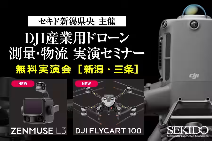
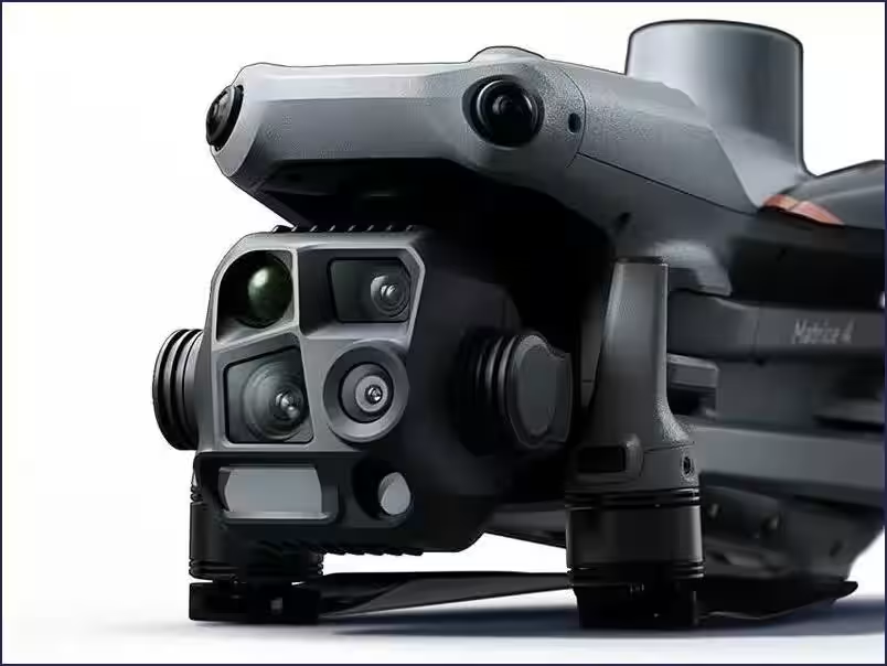
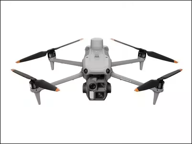
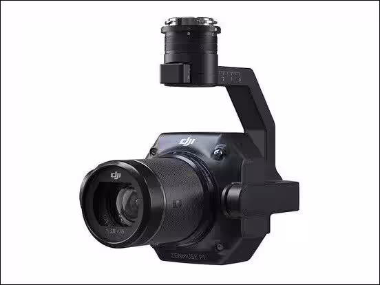
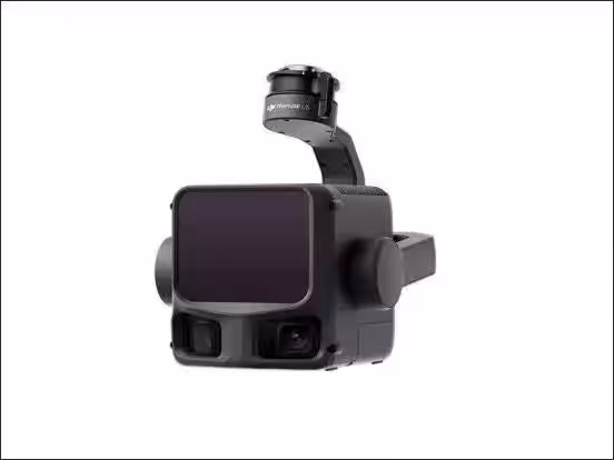
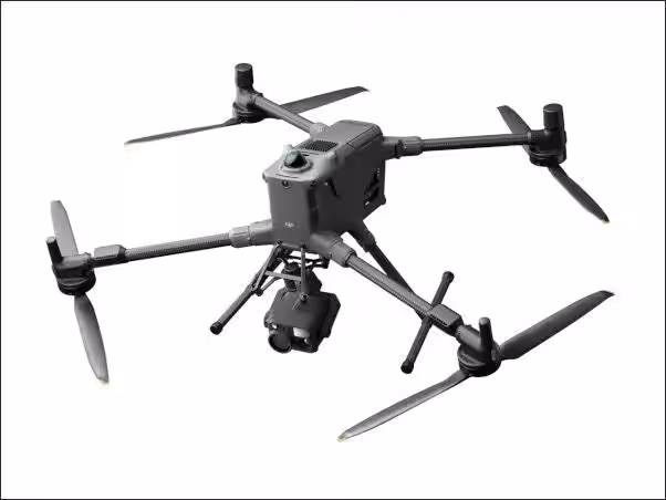
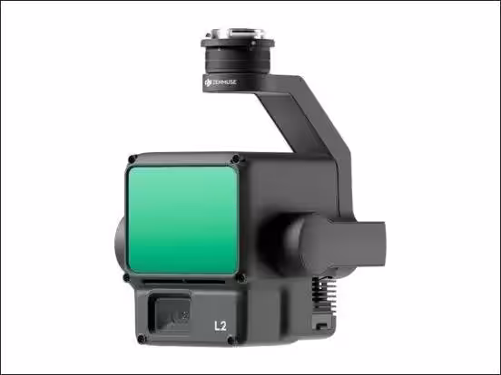
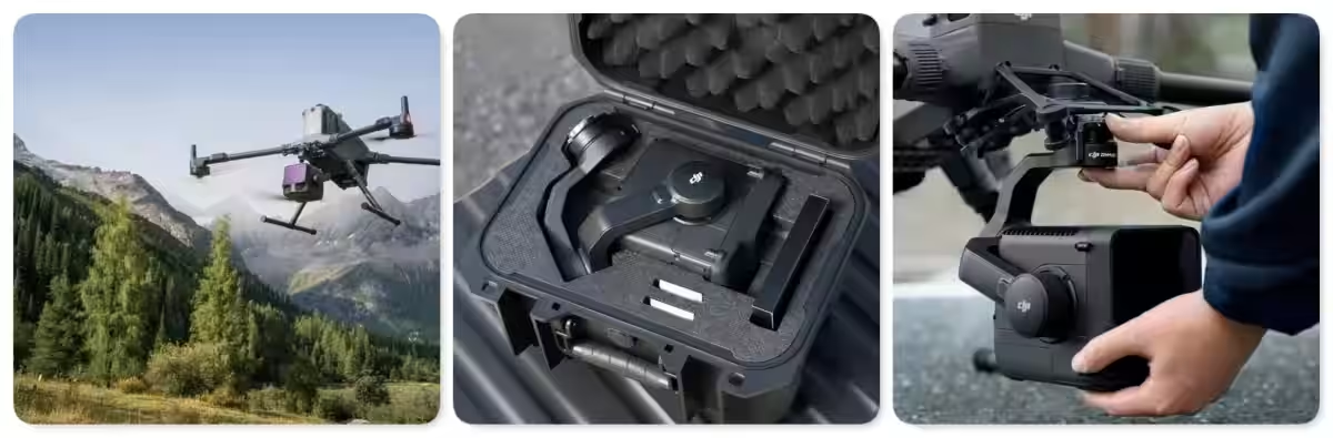
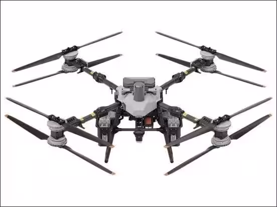
On January 23, 2026, Sekido Corporation, a leading company in drone sales and support, will host a seminar in Sanjo City, Niigata Prefecture. This event, co-operated with Sekido Niigata Ken'oh, will focus on practical demonstrations of the DJI industrial flagship drone "MATRICE 400," the latest LiDAR module "ZENMUSE L3," and the logistics drone "FLYCART 100."
In today’s rapidly evolving drone technology landscape, understanding how to effectively implement photogrammetry and LiDAR is crucial for surveying businesses. This seminar aims to assist participants in making informed decisions regarding the integration and application of these technologies in their operations. Attendees will have the opportunity to observe live demonstrations and review the data gathered, enabling them to gain hands-on experience while interacting with industry professionals.
Who Should Attend?
This practical seminar caters to various stakeholders, including:
- - Surveying professionals wishing to update their equipment from older models like the Phantom 4 RTK to more efficient systems.
- - Businesses interested in expanding their services by incorporating LiDAR into their operations.
- - Individuals contemplating the adoption of drone technology for surveying purposes.
Participants will gain insights from expert staff during dedicated consultation periods, helping them select the optimal drones and sensors suitable for their specific needs and budget.
Understanding Photogrammetry vs. LiDAR
The seminar will clarify the application ranges and limits of photogrammetry and LiDAR technologies, ensuring attendees can discern when each method is appropriate. By demonstrating concrete scenarios where traditional methods suffice versus when LiDAR is necessary, the seminar presents vital information for making equipment upgrade decisions.
Furthermore, businesses considering financial support through grants for upgrading their technology will also benefit from discussions on key points regarding equipment selection and the latest funding opportunities available.
Interactive Demonstrations and Consultations
Attendees will explore the full capabilities of the drones through demonstrations, addressing common queries, such as:
- - Which drone and sensor combination is best suited for specific tasks?
- - How should businesses strategize the use of photogrammetry vs. LiDAR to optimize their workflow?
The detailed demonstrations will highlight the capabilities of the industrial flagship "MATRICE 400" and the performance of the new product "ZENMUSE L3." Participants will witness firsthand the differences among the data collected through various methodologies, understanding how to select the necessary equipment based on operational conditions, required precision, and time constraints. The full workflow from data acquisition to processing will be showcased, allowing for clear communication of the differences in data quality, workload, and operational efficiency among the various methods employed in the field.
Additionally, a demonstration involving the logistics drone "FLYCART 100" will illustrate the effective transportation of materials, particularly in challenging environments where traditional methods fall short. Attendees will appreciate the logistical capabilities that drone technology brings to construction and surveying tasks.
Event Details
Date: January 23, 2026 (Friday)
Time:
- - Morning Session: 10:00 AM – 12:00 PM
- - Afternoon Session: 2:00 PM – 4:00 PM
Venue: Chuo University of Management Sanjo Campus
〒955-0025 Niigata Prefecture, Sanjo City, Uenohara 570
Participation Fee: Free
Capacity: Each session is limited to 20 participants on a first-come, first-served basis.
Target Audience:
- - Representatives from surveying/engineering companies considering drone integration.
- - Those currently using aerial photogrammetry exploring upgrades for enhanced efficiency.
- - Professionals looking to incorporate LiDAR into their existing workflows or considering new surveying technologies.
- - Government officials or organizations interested in drone applications.
This seminar allows participants to observe, hear, and experience real-world surveying challenges, providing them with actionable insights and direction for solutions they can implement immediately.
To secure your participation in this groundbreaking seminar, please register promptly at the following link: Sign Up Here. Don't miss the chance to understand the performance comparison of the latest surveying equipment and explore all possible avenues for effective drone integration into your business operations.
Topics Consumer Products & Retail)


【About Using Articles】
You can freely use the title and article content by linking to the page where the article is posted.
※ Images cannot be used.
【About Links】
Links are free to use.