The Grand Exhibition of Inō Tadataka’s Maps in Gateway Hall


Exhibition of Inō Tadataka's Maps at Gateway Hall
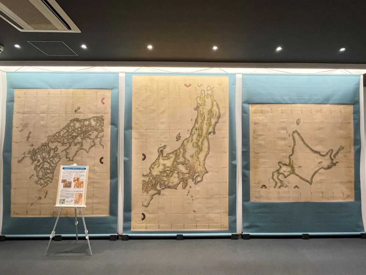
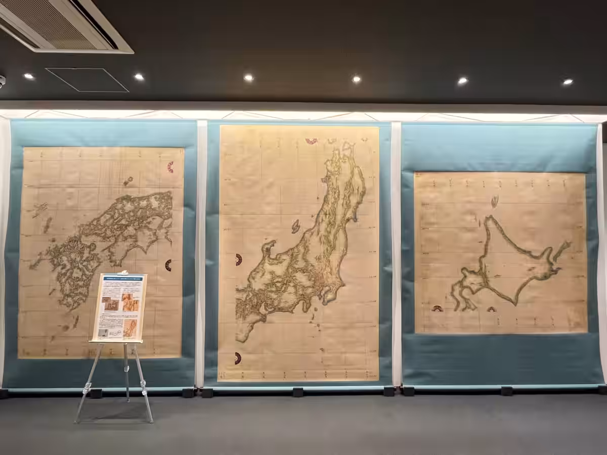
On March 17, the Territory and Sovereignty Exhibition Hall will launch an exhibit featuring a life-sized replica of the Inō Small Map, a historical masterpiece attributed to the renowned Japanese cartographer Inō Tadataka. Known for its significant influence on maritime navigation, this map is among only three complete sets in existence, with the one displayed being particularly well-preserved from the UK National Archives.
What is the “UK Inō Small Map”?
Inō Tadataka meticulously measured the Japanese coastline between 1800 and 1816. Following his untimely death in 1818, his work culminated in the submission of the “Great Map of Japan's Coastal Waters” (Inōzu) to the Tokugawa shogunate in 1821. This monumental cartographic achievement comprises 214 large-scale sheets and multiple smaller maps, making it a cornerstone of Japanese navigational history.
Regrettably, the original manuscripts suffered catastrophic losses over time, including a devastating fire at the Imperial Palace in 1873 and the Great Kanto Earthquake in 1923. Therefore, any surviving specimens of the Inō Map are immensely valuable cultural artifacts. The “UK Inō Small Map” in particular is a treasured relic, as it is one of just three complete sets remaining, which also includes versions housed in the Tokyo National Museum and the Zenrin Museum.
The UK Inō Small Map was delivered to the Royal Navy in 1861 via the British diplomat Sir Rutherford Alcock, earning high praise from British navigators who noted its remarkable accuracy in contemporary navigational charts, significantly impacting the evolution of maritime maps worldwide. Despite being termed a 'small' map, it features enormous dimensions: approximately 165×184 cm for Hokkaido, 260×165 cm for Eastern Japan, and 212×164 cm for Western Japan.
Details of the Upcoming Exhibition
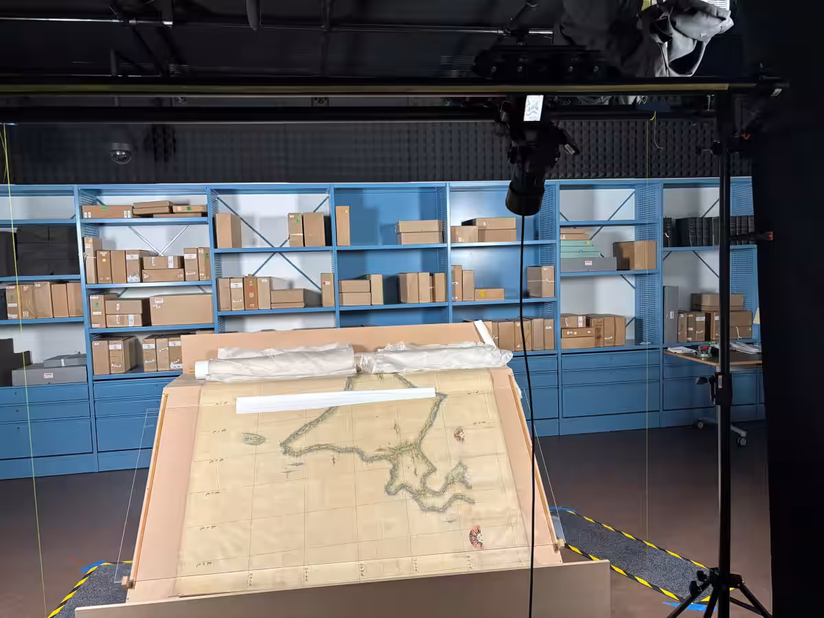
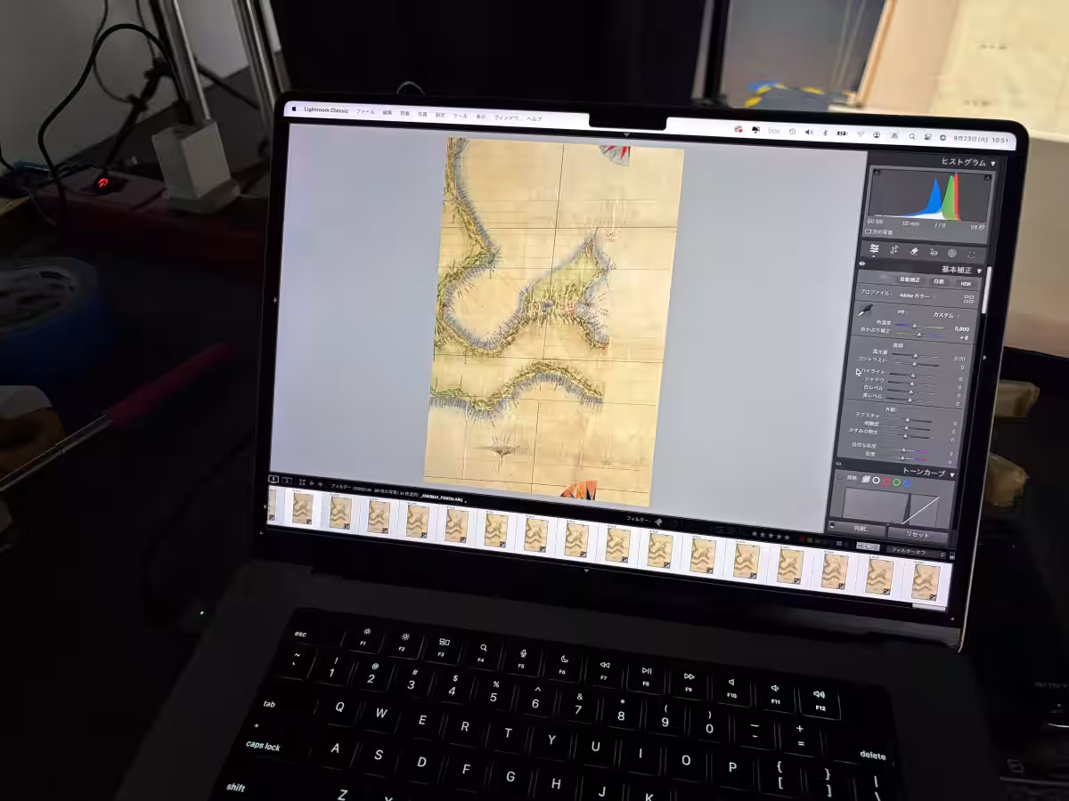
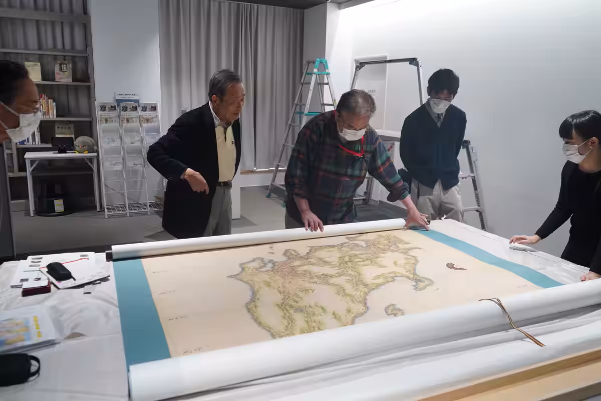
After residing at the British Admiralty, the UK Inō Small Map eventually found its way to the National Maritime Museum in Greenwich and is now preserved at the National Archives in the UK. The Cabinet Office's Territory and Sovereignty Planning and Coordination Office has aimed to create a permanent display for the Gateway Hall, collaborating closely with the British National Archives to produce this life-sized replica. In September 2025, detailed imagery of the UK Inō Small Map will be captured, leading to the assembly of digital data that allows for the creation of the full replica.
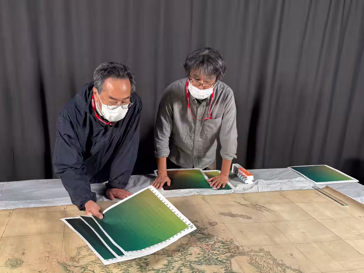
To ensure preservation, a custom-made photography platform was developed, prominently featuring the original map without causing any damage. Furthermore, the design of the Gateway Hall has been thoughtfully planned, facilitating vertical display of this large-scale map. A “Digital Japan Map Corner” will also be established adjacent to the large map, giving visitors the opportunity to explore detailed digital representations of the Inō Map.

Image of the specialized photography platform used for capturing the Inō Small Map.
Highlights of the UK Inō Small Map
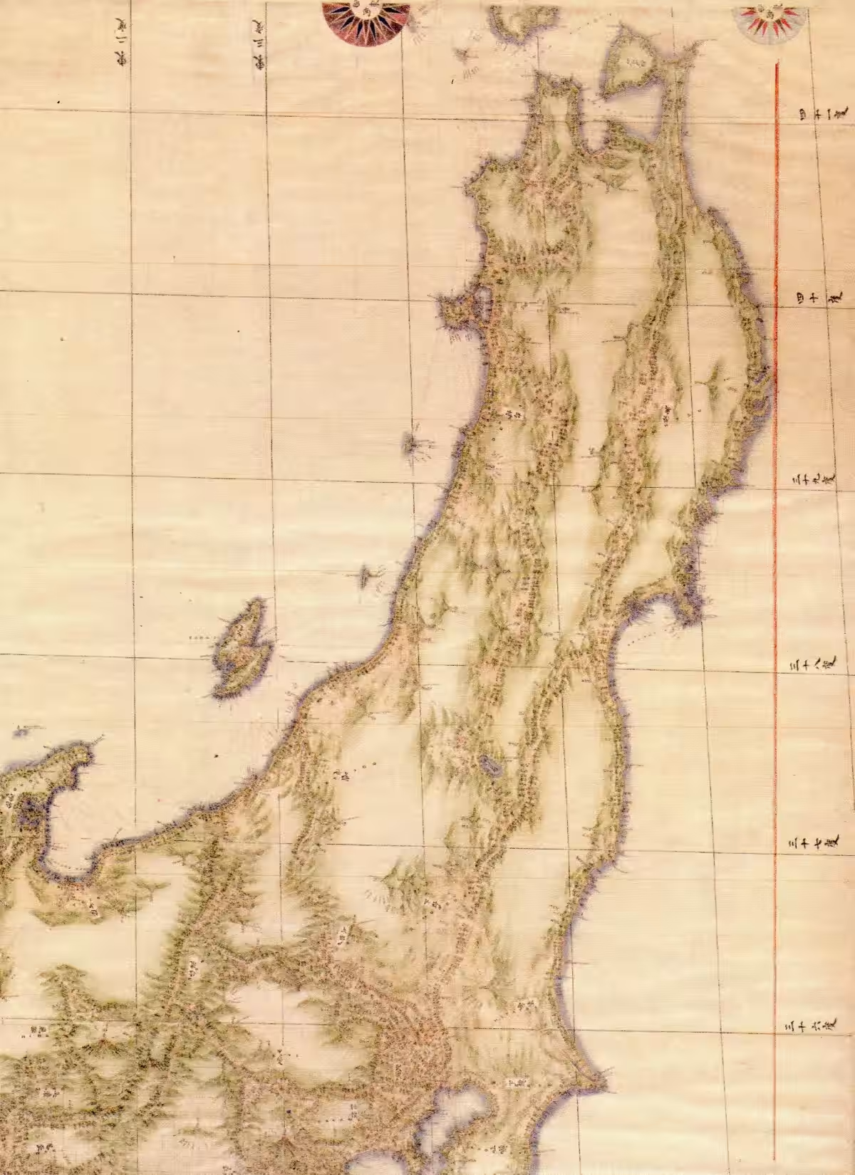
Visitors will be able to observe various annotations and characteristics on the UK Inō Small Map that reflect the Royal Navy's meticulous work in producing nautical charts.
1. Alphabetical Annotations: Both English words and alphabets have been inscribed beside Japanese place names, including mountains, islands, and national borders.
2. Thick Red Lines: The shoreline of Japan (excluding some parts of Hokkaido) is predominantly traced in red, likely to facilitate transferring details onto official charts.
3. Gridlines and Longitude Indicators: The shapes of the Japanese archipelago recorded on the Inō Map are remarkably similar to modern maps. However, discrepancies in longitude are noted in areas such as Hokkaido and Kyushu, arising from distinct calculations used by Inō based on meridians passing through Kyoto.
This exhibition offers a glimpse into the meticulous effort that led to the advancement of cartography in Japan, thus shaping a pivotal chapter in maritime history. Join us in celebrating this immense contribution to our understanding of geography and navigation.
Facility Information
- - Name: Territory and Sovereignty Exhibition Hall
- - Location: 1F Toranomon D Building East, 3-8-1 Kasumigaseki, Chiyoda, Tokyo 100-0013
- - Opening Hours: 10 AM - 6 PM (closed Mondays and Year-End holidays)
- - Admission Fee: Free
- - Website: Japan's Territory and Sovereignty Exhibition

Topics Other)


【About Using Articles】
You can freely use the title and article content by linking to the page where the article is posted.
※ Images cannot be used.
【About Links】
Links are free to use.