Divirod's Groundbreaking GNSS-R Technology Enhances Landslide Monitoring in Japan


A New Era in Terrain Monitoring: Divirod's Innovative GNSS-R Approach
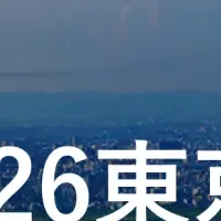
In a significant leap forward for environmental intelligence, Divirod Inc. has triumphantly concluded its ambitious GNSS-R terrain monitoring project in collaboration with leading tech company Oki Electric Industry Co., Ltd. This groundbreaking initiative took place in the Fukuoka Prefecture of Japan, an area notorious for its vulnerability to landslides and natural disasters.
Context of the Project
The impetus for this innovative project stems from Japan's pressing need to enhance early-warning systems and climate resilience in the wake of catastrophic rainfall events and treacherous topographies. Over recent years, Japan has faced intensified rainfall disasters, which have heightened the urgency for improved measures to monitor and predict landslide risks, thus safeguarding local communities.
Innovative Technology at Work
Divirod adopted cutting-edge GNSS-R (Global Navigation Satellite System Reflectometry) technology to deploy a sophisticated network of sensors across three specific areas within the Fukuoka region. This state-of-the-art system allows for continuous, real-time monitoring of ground stability under varying weather conditions. By continuously gathering GNSS-R data and applying proprietary algorithms, Divirod's technology accurately identifies minute shifts in the terrain, fostering a deeper understanding of slope dynamics.
Categorizing Terrain Changes
Among the many achievements of the project is Divirod's capability to classify changes in the terrain into three critical categories:
1. Slope Failure Events: Making it easier to detect potential landslides.
2. Creep/Slow-Moving Landslides: Monitoring gradual changes that might lead to more significant events.
3. Temporary Terrain Changes: Often related to fluctuations in rainfall and moisture levels in the soil.
The system demonstrated exceptional sensitivity, successfully identifying hundreds of significant terrain changes and correlating them with rainfall data and seismic activities, allowing for detailed risk mapping.
A Real-World Success Story
One pivotal moment in the project occurred in August, when the system detected a landslide at Hakikoga in the City of Asakura. Despite the lack of visual evidence through daylight observation, Divirod's sensors picked up on a notable change in the terrain overnight, showcasing their ability to establish situational awareness even in low-visibility conditions. This advanced detection could prove essential in mitigating future disasters, as it provides timely alerts that might otherwise be missed.
Preparing for the Future
Divirod's collaboration with OKI not only highlights advancements in real-time terrain intelligence but represents a vital contribution to Japan’s disaster preparedness framework. With Japan prone to frequent typhoons, heavy rainfall, and seismic shifts, the successful implementation of GNSS-R technology offers new possibilities for scalable early-warning systems and automated risk modeling.
Divirod's CEO, Javier Marti, emphasized the importance of such technologies in enhancing situational awareness in a country facing formidable geohazards. The partnership is expected to pave the way for broader implementation of this technology across Japan and globally.
Conclusion
Both Divirod and OKI articulate the pride they feel in contributing to these advancements in disaster response capabilities. The partnership stands as a testament to the potential of innovative technology in protecting communities from natural disasters, underscoring a collective commitment to building future resilience.
With continued efforts like these, the future of disaster management is looking more proactive and robust than ever, a necessary evolution in our response to the challenges posed by climate change and geological instabilities.
Topics Environment)

【About Using Articles】
You can freely use the title and article content by linking to the page where the article is posted.
※ Images cannot be used.
【About Links】
Links are free to use.