Introducing Metamap VISION: A Revolutionary Indoor Positioning System Using Camera AI


Introducing Metamap VISION
BoldRight Corporation, headquartered in Shinjuku, Tokyo, has unveiled a groundbreaking feature of its facility navigation platform, Metamap. This innovation, named Metamap VISION, marks Japan's first indoor positioning system that utilizes Artificial Intelligence (AI) to determine a user’s location through smartphone camera footage. The service is set to launch on September 26, 2025, making its debut at Kyoto Station, which boasts an impressive average user base of around 450,000 daily.
Traditionally, indoor positioning relied heavily on technologies such as beacons or Wi-Fi, which involves measuring signal strength to determine location. However, these methods often necessitated the development of native applications and posed challenges in terms of development costs and user convenience. Metamap VISION addresses these issues by providing a web application that requires no installation. Users can instantly access indoor positioning features directly via their smartphone browsers, improving accessibility and significantly reducing operating costs for facility management.
Development Background
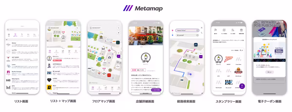
BoldRight introduced Metamap in 2022, transforming the way visitors interact with physical spaces through 2D and 3D interactive digital maps. The platform integrates functionalities such as route searches, congestion information, stamp rallies, and coupon distribution, thus enhancing navigation and visitor exploration simultaneously. A notable challenge within indoor environments is acquiring the user's current location accurately, primarily due to GPS limitations and difficulties in distinguishing between different building levels. To solve this issue, previous solutions like beacons and Wi-Fi positioning were utilized, yet they were costly and required users to download applications.
Responding to these obstacles, BoldRight developed a novel approach that analytically employs AI to interpret smartphone camera images, resulting in the creation of Metamap VISION.
Technology Overview
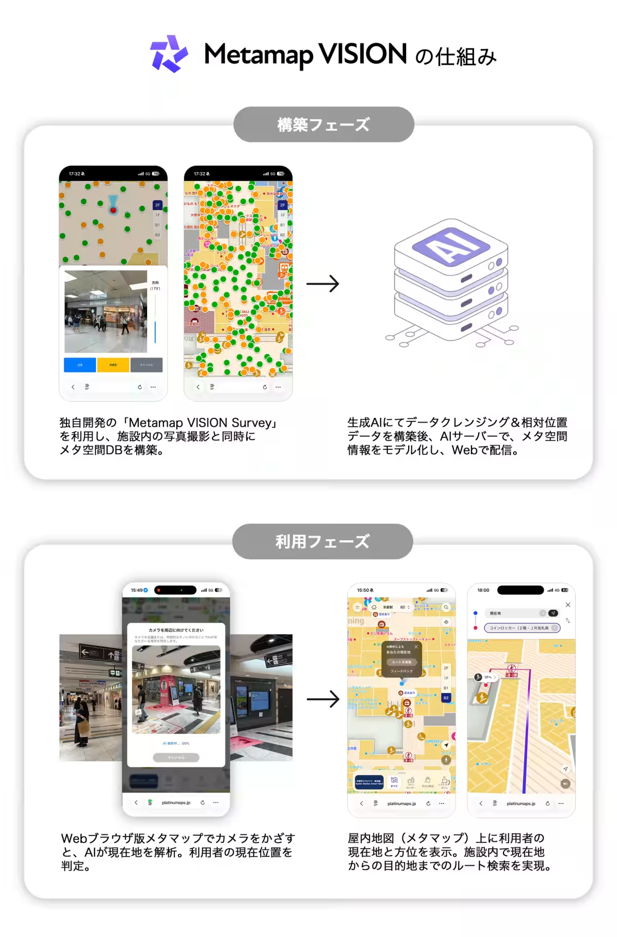
Construction Phase
Using the dedicated tool Metamap VISION Survey, both photographic and video captures of indoor spaces occur simultaneously with the construction of a spatial database. Through generative AI, the massive image data is organized and employed to build a spatial AI model via deep learning techniques. This AI model can also be delivered through the cloud, allowing for real-time user feedback to facilitate further training and enhancement.
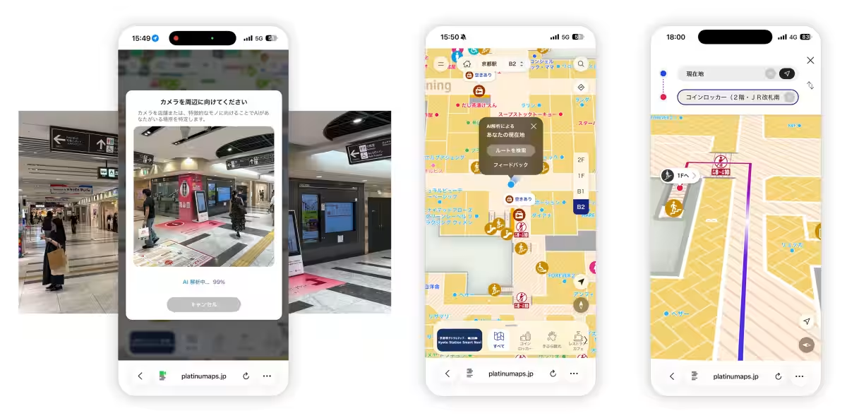
Utilization Phase
When a user points their camera at the environment, the AI analyzes the footage in real-time on the device itself. It extracts relevant information from the video to accurately identify the user’s current position and orientation, displaying this data on the digital map. This seamless integration paves the way for dynamic route searches from any location, enhancing user experience.
All processing is conducted on-device without sending visual data to the cloud, ensuring both speed and privacy protection. The system is compatible with the latest tech requirements: iOS (Safari) version 26 or higher, and Android (Chrome) version 12 or higher, while supporting WebGL on non-compatible environments.
Implementation at Kyoto Station
Kyoto Station has been chosen as the initial implementation site, welcoming tourists from around the world. The Kyoto City officials are deploying a multilingual tourist guide digital map, Kyoto Smart Navi, from 2024 onward. The integration of both Metamap and Metamap VISION into the Kyoto Station Smart Navi will greatly enhance navigation through its complex structures, including the station premises, underground shopping areas, and bus terminals, where confusion is common. It is anticipated that this integration will streamline movement for tourists, minimize transit times, alleviate congestion, and reduce inquiries made to information desks.
The Kyoto Station Digital Map, powered by Metamap VISION, highlights more efficient visitor guidance in a globally recognized tourist destination.
Image credit: Kyoto City Tourism Association
For a deeper insight, visit Kyoto Smart Navi and the Kyoto Station Digital Map.
About Metamap
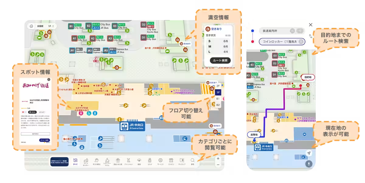
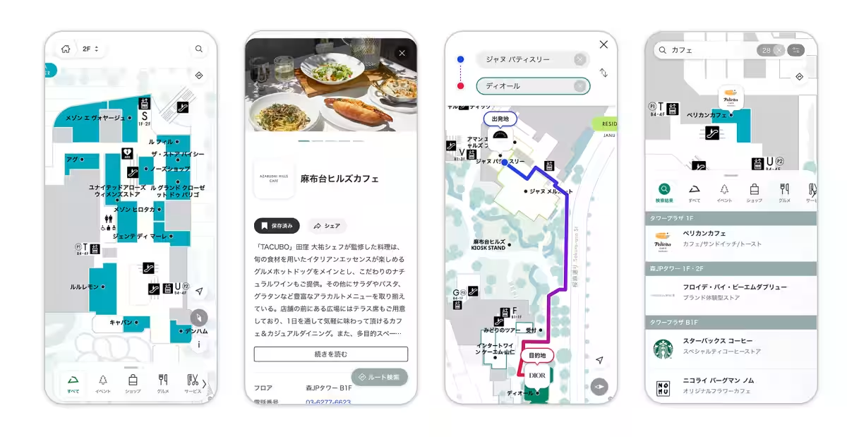
Metamap digitalizes facility maps, providing essential features within a single platform such as search options, current location displays, route guidance, stamp rallies, and coupon distribution. Its functionality not only prevents visitors from getting lost but also enhances operational efficiency and promotes visitor interactions within the facilities. Discover more at Metamap.
With the Platinum Map Platform, Metamap supports digital transformation (DX) for tourist spots and commercial facilities, facilitating data updates, enhancing consumer engagement, improving dwell time, and accommodating diverse analytical needs.
Contact Information
Company: BoldRight Corporation
Business Scope: Tourism DX, Commercial Facility DX
Establishment: April 3, 2019
Website: BoldRight
For inquiries regarding Metamap, please reach out here.
Topics Consumer Technology)
【About Using Articles】
You can freely use the title and article content by linking to the page where the article is posted.
※ Images cannot be used.
【About Links】
Links are free to use.