Innovative Use of Drones for CO2 Measurement at High Altitudes in Tokyo


Innovative Use of Drones for CO2 Measurement
Introduction
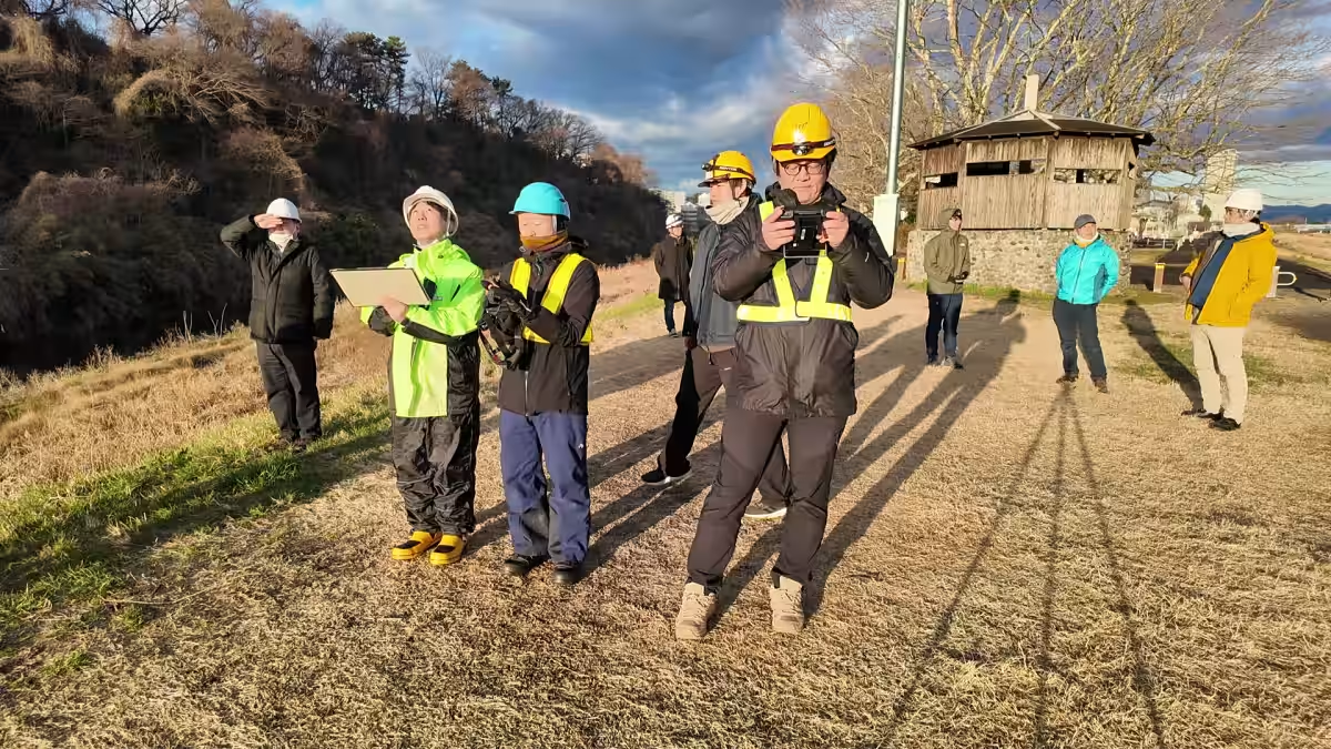
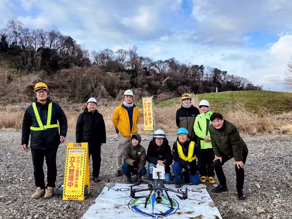
In a groundbreaking experiment, Tohoku Drone Co., Ltd. collaborated with Soravision, along with a team of experts from various universities, including the University of Tokyo and Akita Prefectural University. They conducted high-altitude CO2 measurements in Tokyo by deploying a comprehensive drone system capable of operating at over 700 meters above ground.
Experimental Overview
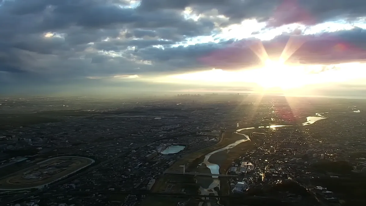
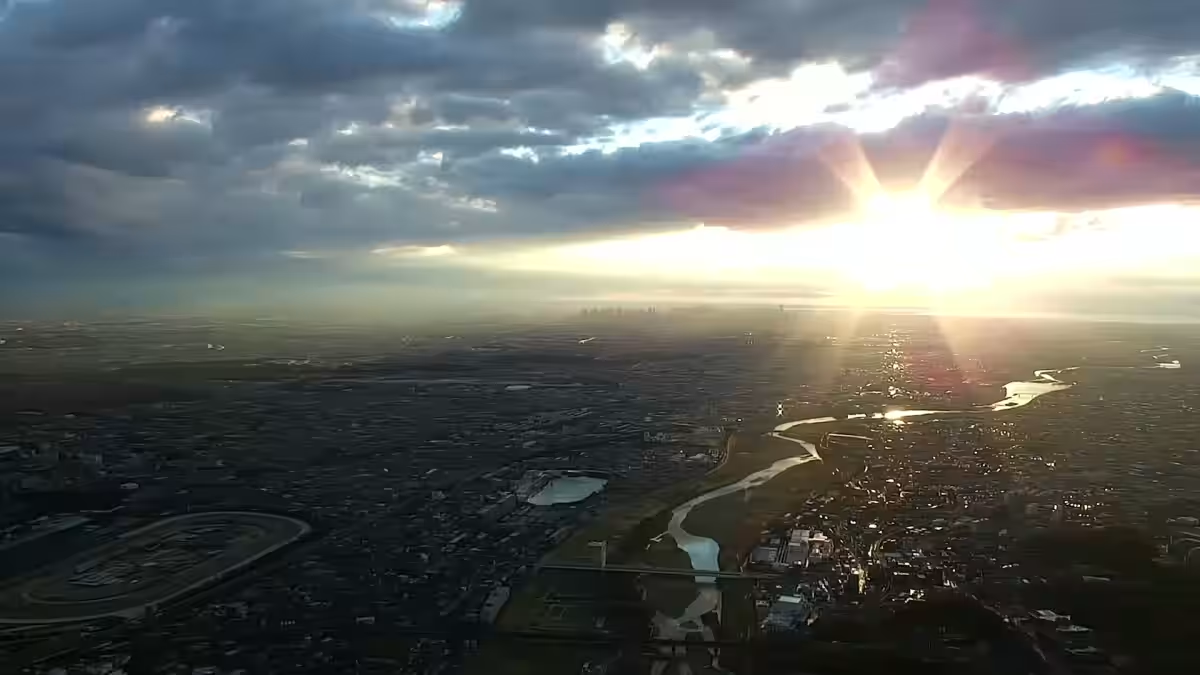
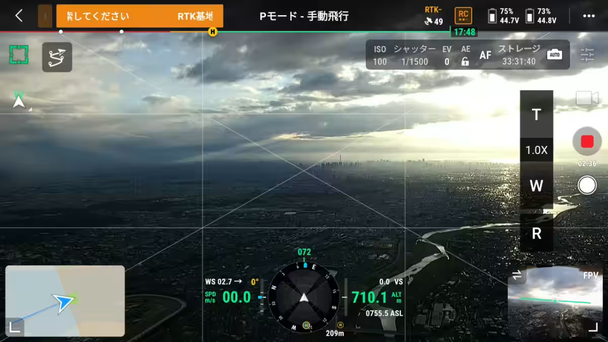
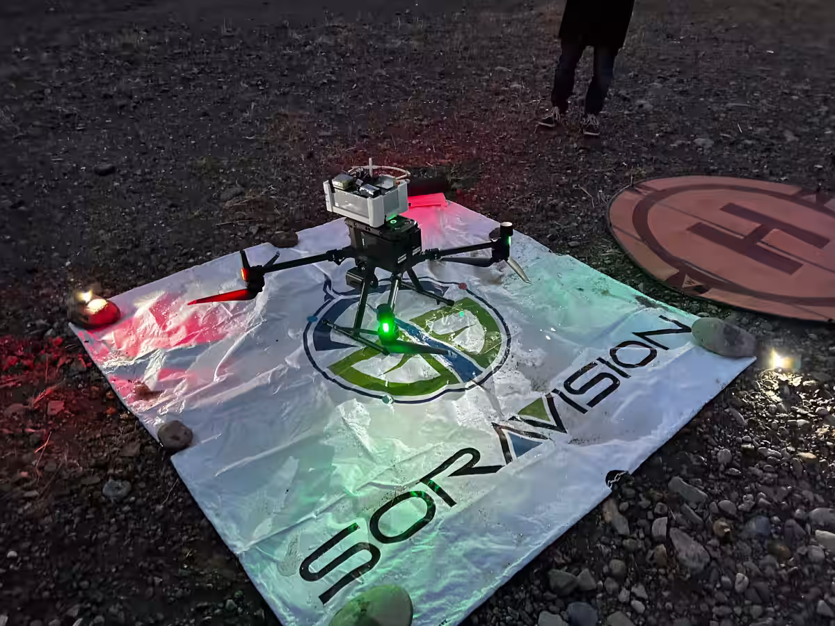
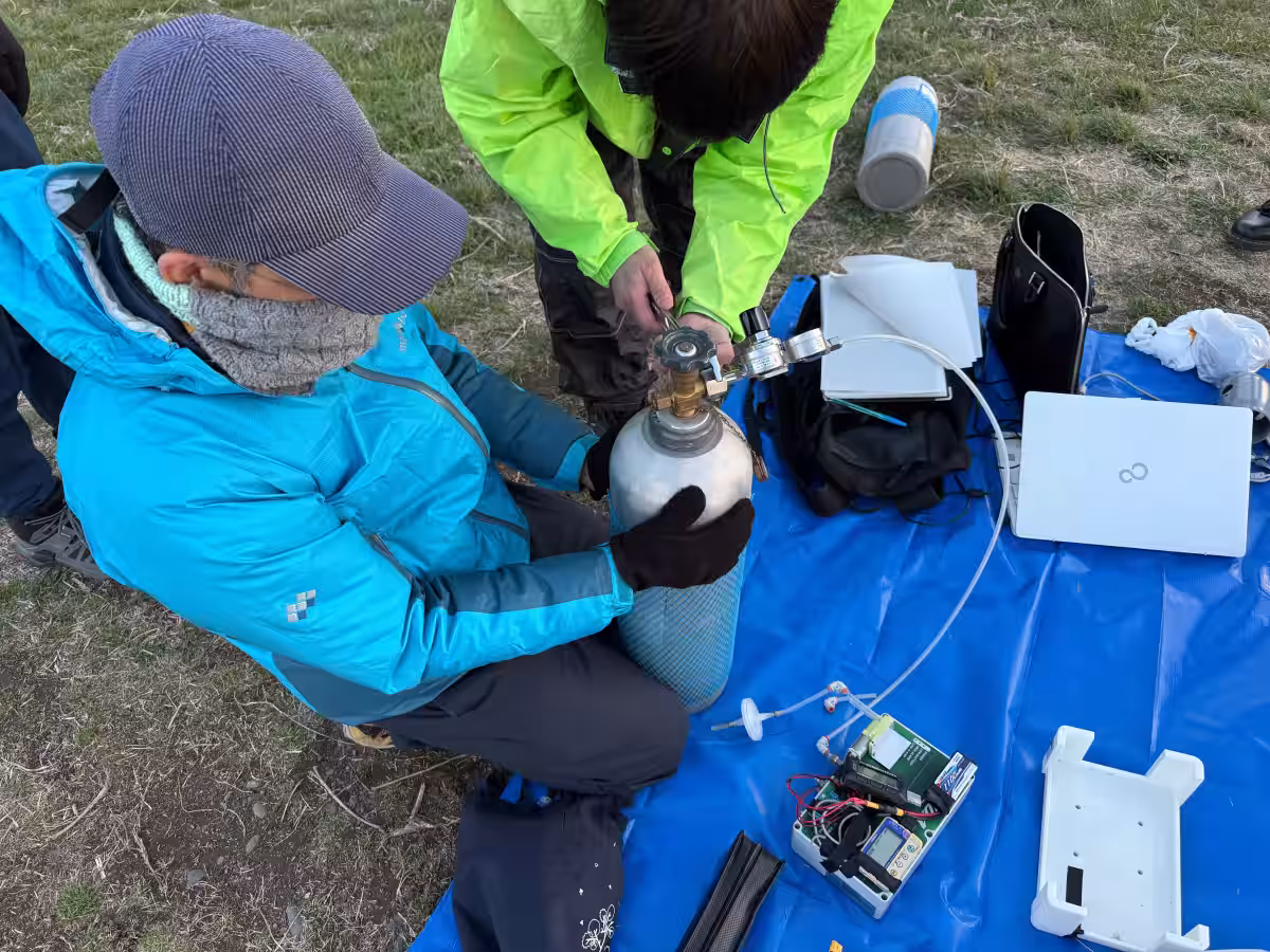
On March 17 and 18, 2023, drones equipped with specialized greenhouse gas measuring systems took to the skies above Tokyo. The DJI Matrice 300 RTK drone was utilized, capable of precise measurements and advanced flight maneuvers. The system, developed by Associate Professor Makoto Inoue from Akita Prefectural University, allowed the drone to hover at specified altitudes while capturing crucial CO2 data.
With a maximum elevation of 710 meters, the drone hovered for 30 seconds at every 100-meter increment up to 500 meters, and at further increments of 50 meters, 25 meters, and 2 meters, measuring the CO2 concentration at each level. This was especially notable as it marked the first time a drone had observed CO2 concentrations at elevations exceeding 500 meters.
The Challenges of High-Altitude Flights
Securing permissions for night-time flights at high altitudes posed numerous challenges. Kouta Yano, representing Yano Law Office and overseeing the permission applications, explained that coordinating with local air bases for controlled flight times was a complex process. The proximity to aviation hubs necessitated careful timing and communication to ensure a safe operation.
Technological Innovations and Developments
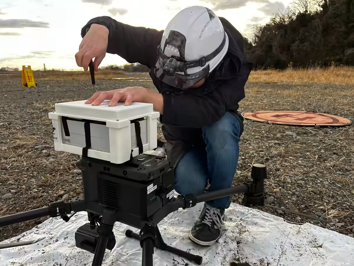
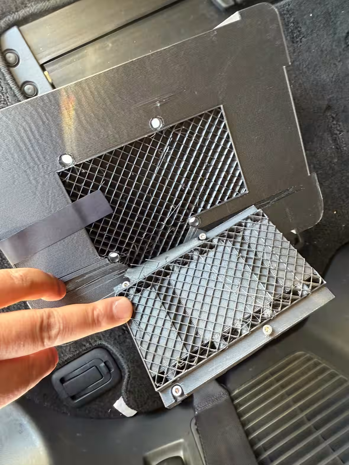
To mount the measuring equipment onto the drone, a custom 3D printed apparatus was designed. This ensured that the payload was within limits while maintaining structural integrity. The device was optimized for weight, preventing interference with the sensors and ensuring durability.
According to Professor Ryoichi Imasu from the University of Tokyo's Atmosphere and Ocean Research Institute, this experiment has paved the way for more precise measurements of atmospheric CO2 concentrations, especially in preparation for Japan's GOSAT-GW satellite scheduled for launch in 2025.
Insights from the Observations
Reflecting on the observations, Inoue noted that CO2 concentration fluctuations in urban areas appeared to be significantly influenced by human activities. The data gathered suggests that as dawn approaches, high CO2 located near the surface ascends, necessitating further study.
Inoue emphasized the critical need for lighter, cost-effective sensors to facilitate widespread simultaneous drone measurements.
Future Perspectives
The initiative aims to refine the drones for even higher altitudes, targeting up to 1,000 meters while shortening hover durations. Future experiments will involve comparative analyses of CO2 concentrations between urban and forested areas, contributing significantly to climate change mitigation strategies.
Conclusion
Since forming a partnership in 2016, Tohoku Drone has remained at the forefront of drone technology, continuously adapting to meet modern challenges. The recent success in conducting high-altitude CO2 observations has reinforced their commitment to leveraging drone technology for scientific and societal advancements.
As Tohoku Drone continues to explore wider collaborations with academic institutions, they are set to tackle pressing environmental issues through innovative drone-based measurements.
Topics Consumer Technology)
【About Using Articles】
You can freely use the title and article content by linking to the page where the article is posted.
※ Images cannot be used.
【About Links】
Links are free to use.