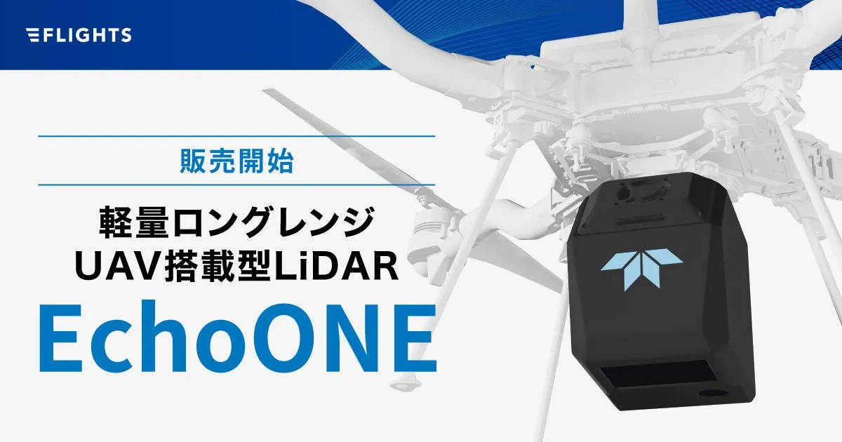
Introducing the EchoONE: High-Precision, Lightweight UAV LiDAR for Efficient Surveying


The Launch of EchoONE
FLIGHTS Corporation, headquartered in Shibuya, Tokyo, is excited to announce the launch of EchoONE, a state-of-the-art UAV-mounted LiDAR system. In the face of labor shortages and increasing demands within the construction industry, EchoONE provides a novel solution, offering remarkable speed and precision in capturing point cloud data while ensuring top-notch security features that significantly expand the potential for data utilization.
Collaboration of Industry Leaders
EchoONE is a result of the collaboration between Teledyne Geospatial, a leader in LiDAR technology, and Inertial Labs, renowned for its advanced inertial navigation systems (INS). This innovative product integrates a high-performance laser sensor with a compact INS, achieving unprecedented accuracy and speed in extensive survey operations using drones.
With compliance to the National Defense Authorization Act (NDAA) security regulations, EchoONE is designed to be robust enough for sensitive operations, making it a dependable asset in surveying, forest resource management, and infrastructure inspection.
Key Features of EchoONE
- - Sharp and Accurate 3D Measurements: EchoONE harnesses the power of Teledyne Geospatial’s high-performance laser sensors and Inertial Labs’ tactical-grade IMU, the KERNEL-210. This combination ensures absolute accuracy with an RMSE of 1.5 cm even from heights of 120 meters. The low-noise output provides clear data suitable for a wide range of applications.
- - Impressive Measurement Range: The powerful laser sensor boasts a maximum measurement range of 270 meters against targets with a reflectivity of 20%, suggesting a recommended maximum altitude of 205 meters. Additionally, it supports up to eight returns, enhancing the ability to accurately survey vegetated areas as well as improving the reproduction of tree shapes, significantly boosting spatial data acquisition accuracy.
- - Lightweight Design: Weighing just 1.4 kg, EchoONE combines functionality with a compact design, making it compatible with small UAVs and extending flight time and area data acquisition per flight. This reduces operational burden in the field and supports smarter drone operations.
- - High Security Compliance: Fully compliant with the latest NDAA standards, EchoONE meets stringent security requirements established by U.S. regulations, providing peace of mind for users working with sensitive data. The product prioritizes security throughout its design, development, and manufacturing processes.
Request More Information
For those interested in detailed information or product coverage, we encourage you to reach out to us.
About FLIGHTS Corporation
FLIGHTS is a tech startup focusing on improving the efficiency of specialized surveying tasks within the construction sector by leveraging drone technology. Our team is comprised of experienced professionals who have honed their skills in business development and research within major construction consulting and aerial surveying firms. We are well-versed in the demands related to the nature of existing work, measurement techniques, expected outcomes, and relevant regulations. Our key offerings include the FLIGHTS SCAN for LiDAR surveying and the FLIGHTS CONTROL software for bridge inspections.
For inquiries related to our products and services, please contact the FLIGHTS LiDAR Division at [email protected].

Topics Consumer Technology)
【About Using Articles】
You can freely use the title and article content by linking to the page where the article is posted.
※ Images cannot be used.
【About Links】
Links are free to use.