


Innovative Monitoring System for Invisible Boundaries in Flood Disaster Management
Introduction
In a bid to combat the increasing severity of flood disasters, the Tokyo Metropolitan Industrial Technology Research Institute, in collaboration with Daiki Rika Co., has introduced an innovative monitoring system designed to automatically measure underwater and underground boundaries. This system addresses significant challenges in continuously monitoring the positions of water and sediment interfaces, particularly around bridge piers, where erosion can lead to instability and failure.
The Importance of Monitoring Boundaries
Bridges situated over rivers are particularly vulnerable to erosion—this phenomenon, known as scouring, can result in the washing away of soil around their foundations, ultimately leading to structural issues such as sinking, tilting, or even collapse. The frequency and intensity of heavy rain events in recent years have exacerbated the risks of significant changes to the riverbed surrounding these critical structures. Traditional methods for assessing scouring, including diving surveys and sonar depth measurement, have proven burdensome due to the labor demands and the complexities associated with deploying and operating persistent monitoring equipment.
System Features and Functionality
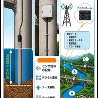
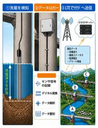
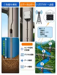
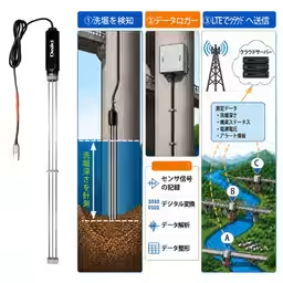
To overcome these challenges, the new monitoring system is designed for ease of installation. Sensors can be simply embedded in the ground to facilitate continuous monitoring of boundary positions both underwater and underground. The system includes the following key features:
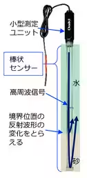
- - Sensor Design: The monitoring device comprises a slender sensing section and a measurement unit, which transmits high-frequency signals.
- - Automatic Depth Calculation: The reflection waveforms captured by the sensing section are analyzed by the measurement unit, automatically calculating the depths of boundaries between water and sediment.
- - Continuous Data Logging: By connecting to a data logger, changes in boundary positions can be monitored in real time, providing crucial data for assessing ongoing environmental risks.
This innovative approach not only alleviates the human resource burden associated with traditional monitoring methods but also enhances safety through more effective flood risk assessment.
Application of Technology
The monitoring system also extends its capabilities to evaluate the boundary positions between freshwater and saltwater, along with changes in electrical conductivity. This is invaluable for understanding complex underwater environments and potential contamination.
The technology employed leverages the patented boundary measurement method held by Kyushu University, which enhances the reliability of freshwater and saltwater boundary assessments in various aquatic environments.
Future Prospects
Looking ahead, Daiki Rika Co. is set to launch this state-of-the-art monitoring system in October. It will also be showcased at the Crisis Management Industry Exhibition 2026, scheduled for September 30 to October 2 at Tokyo Big Sight, where industry experts and stakeholders will have the opportunity to witness firsthand how this technology can transform flood management practices and improve infrastructure resilience.
Conclusion
As the frequency and severity of heavy rain events continue to rise, the need for effective monitoring and disaster management solutions becomes increasingly critical. This groundbreaking monitoring system represents a significant advancement in our ability to visualize and respond to the unseen changes in our environment, paving the way for safer and more resilient infrastructure management practices in the face of potential disasters.
Topics Other)


【About Using Articles】
You can freely use the title and article content by linking to the page where the article is posted.
※ Images cannot be used.
【About Links】
Links are free to use.