Innovative Construction DX Experiment at Kansai University with STUDIO55 and Takenaka Corporation


Transforming Construction with Digital Innovation
STUDIO55, part of the Metareal Group, has collaborated with Takenaka Corporation to conduct a groundbreaking Proof of Concept (PoC) for the renovation of Kansai University's campus, using cutting-edge 3D measurement technologies. This initiative addresses the challenges faced during reconstruction in an area bustling with students and rich in history.
The Challenge: Limitations of Traditional Site Surveys
In the complex environment of Kansai University, the renovation of existing buildings introduces a level of uncertainty not present in new constructions. The campus features a mixture of structures built in different eras, and infrastructure blueprints are scattered across various ages. The primary issues arise from gaps in information, leading to uncertainty in designs versus reality. Teams struggled with correlating 2D blueprints with the actual locations on-site, including understanding terrain gradients and the profiles of tree branches, which significantly extended the duration required for site surveys.
Innovative Solutions Implemented
To address these challenges, STUDIO55 introduced a dynamic and integrated workflow centered around:
Handheld SLAM Scanners
These devices allow the quick acquisition of point cloud data with centimeter-level accuracy simply by walking through the vast area. This rapid data collection enables the creation of a 3D model that reflects the current state of the site.
BIM Integration Tool - Revizto
The collected 3D data was integrated with historical blueprints and new architectural models on an intuitive platform accessible via devices like iPads. This integration streamlined the verification process, making it easier to visualize the current site condition alongside existing documentation.
Key Outcomes of the Experiment
The results yielded several significant benefits for the team at Takenaka Corporation:
- - Enhanced Visibility of Subsurface Infrastructure: The newly acquired data allowed for instant identification of the locations of buried infrastructure, revealing how old pipe layouts correspond with current trees and curbs. This significantly reduces the need for trial excavations and minimizes the risks of accidents on-site.
- - Real-time Tree Assessments: Previously, surveyors had to measure trees one by one for their diameter and height. The point cloud data enabled assessments to be conducted from the office, increasing productivity by eliminating excessive on-site work.
- - Advance Detection of Aerial Obstacles: The visualization of airborne elements such as power lines and trees in 3D allows for preemptive checks on potential equipment interference, ensuring smooth operations.
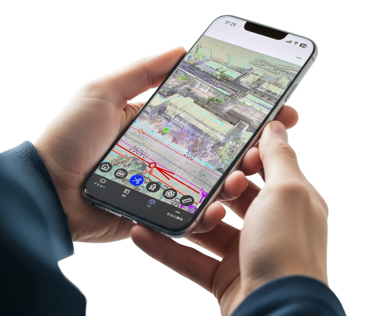
Integration Visualization
The integration screen showcasing how Revizto compiles scanning data demonstrates the potential of merging traditional construction knowledge with technological innovation.
Full Case Study Available Online
This press release only scratches the surface of the findings. A comprehensive article detailing the challenges, the three walls encountered in traditional surveys, and specific use cases within this project are now accessible on STUDIO55's official website. For those interested in exploring how digital transformation can enhance construction efficiency and productivity, we encourage you to check out the full case study at STUDIO55 Case Study.
About STUDIO55
STUDIO55 is committed to supporting design visibility globally under the purpose of

Topics General Business)
【About Using Articles】
You can freely use the title and article content by linking to the page where the article is posted.
※ Images cannot be used.
【About Links】
Links are free to use.