


N-Sonar Registered in Japan's Ministry of Land Infrastructure Technology Catalog
N-Sonar Technology Registered in Inspection Support Catalog
On April 10, 2025, Central Development Co., Ltd. announced that its innovative underwater 3D mapping technology, known as N-Sonar, has been officially registered in the Ministry of Land, Infrastructure, Transport, and Tourism's Inspection Support Technology Performance Catalog. This catalog, established in 2019, aims to enhance the efficiency and sophistication of inspections for road structures by compiling technologies applicable for this purpose.
What is N-Sonar?
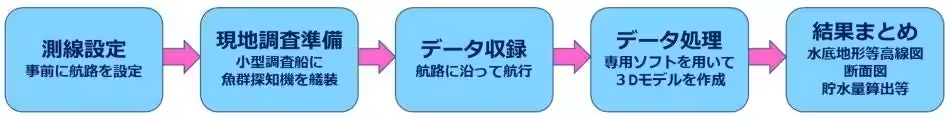
N-Sonar is a groundbreaking method developed in 2018 that visualizes underwater conditions, using sonar technology traditionally employed in fish finding devices. Since its inception, N-Sonar has gained acclaim, particularly in dam and reservoir sectors, and has received several prestigious awards, recognizing its effectiveness. The recent registration in the Performance Catalog signifies its adaptability and potential application in river infrastructure inspections. This technology allows for the visualization of riverbed structures and the erosion conditions of bridge piers and embankments cost-effectively and in a much shorter time frame.
Key Features and Advantages of N-Sonar
N-Sonar's advantages over traditional depth measurement methods are manifold:
1. Cost-Effective and Quick Results: The technology produces accurate and comprehensive results at a fraction of the cost and time of conventional surveying methods.
2. Diverse Outputs: It generates a variety of data formats, including 3D terrain models (digital elevation models), substrate classification maps, and ultrasonic echoes, making it highly versatile.
3. Wide Application Range: N-Sonar can be effectively applied in various water bodies such as rivers, dams, and reservoirs.
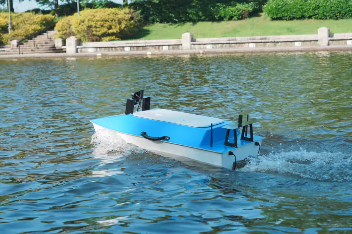
Automatic Navigation Development
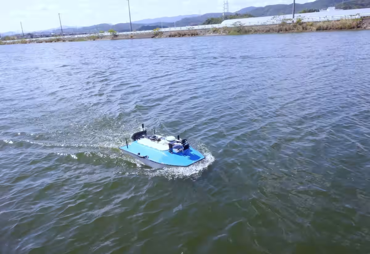
Originally, N-Sonar was designed for manned operation, but significant advancements were integrated to allow unmanned vessels equipped with automatic navigation and remote control capabilities to collect data. The automatic navigation function enables the unmanned vessels to follow pre-set routes and gather point clouds along the way. Furthermore, operators can remotely control the vessels using widely available technology, such as smartphones, enhancing accessibility and ease of use.
Demonstration Models
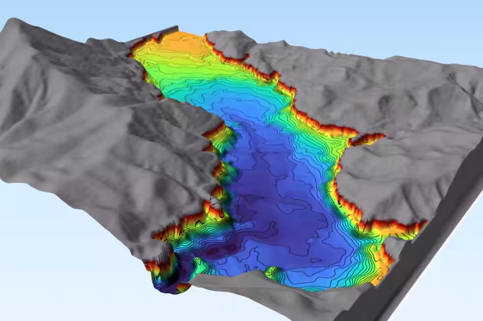
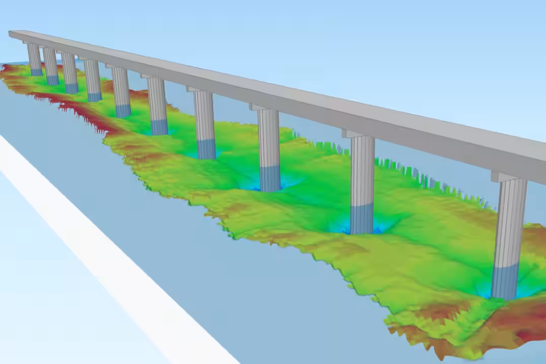
To visualize N-Sonar's outputs, various models have been developed. For instance, using QGIS, the technology showcases 3D representations of scouring at bridges and the morphology of dam lakes, demonstrating its practical utility in real scenarios. Visitors can explore these demonstrations via the following links:
Future Prospects and Company Background
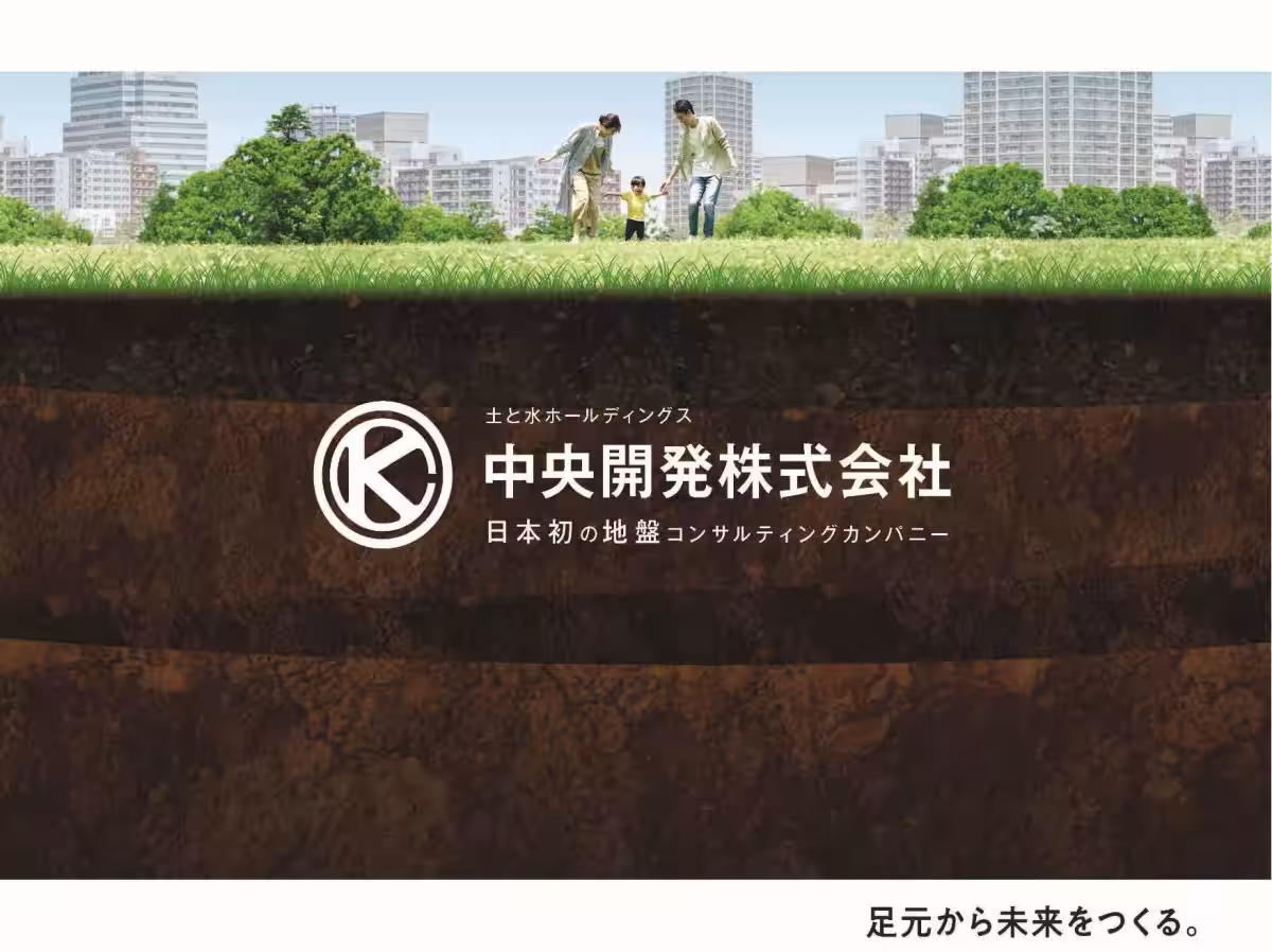
Central Development Co., Ltd., established in 1946 as Japan's first ground consulting company, has consistently advanced its technological capabilities, transforming from a soil survey firm to a multifaceted construction consulting entity engaged in large-scale infrastructural projects. The company is also pioneering digital transformation in the geological survey sector.
As Central Development continues to innovate, it aims to promote the dissemination of advanced bridge inspection technologies like N-Sonar, enhancing the maintenance of social infrastructure. The integration of advanced surveying techniques will undoubtedly help maintain and manage essential infrastructure more efficiently.
For detailed information, visit Central Development's official website or contact their public relations office directly.
Contact Information
Central Development Co., Ltd.
Public Relations Centre
Phone: 03-6228-0861
Email: [email protected]
Topics Other)


【About Using Articles】
You can freely use the title and article content by linking to the page where the article is posted.
※ Images cannot be used.
【About Links】
Links are free to use.