
Explore the Latest Innovations in Surveying Drones at Free Seminar in Nagoya


Experience the Cutting-Edge of Drone Technology in Nagoya
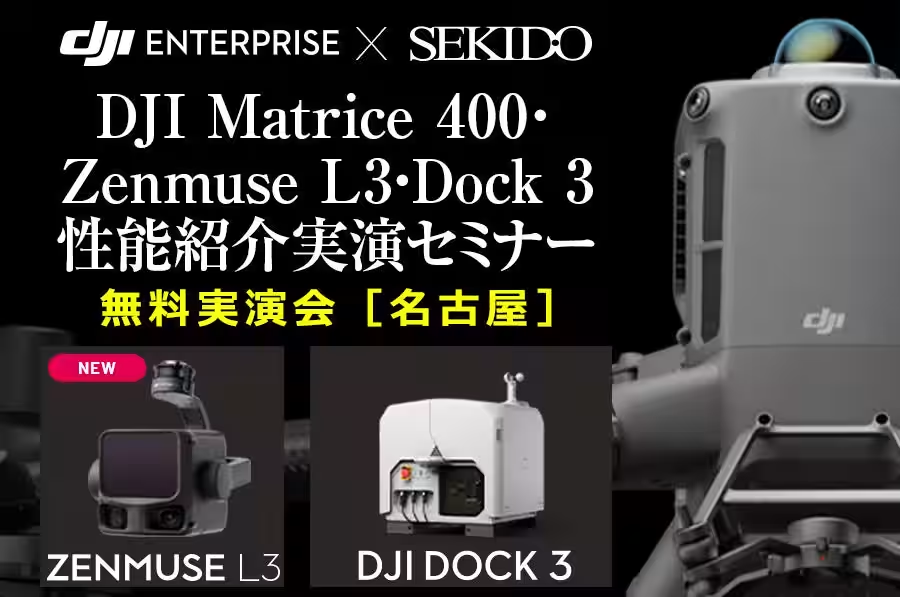
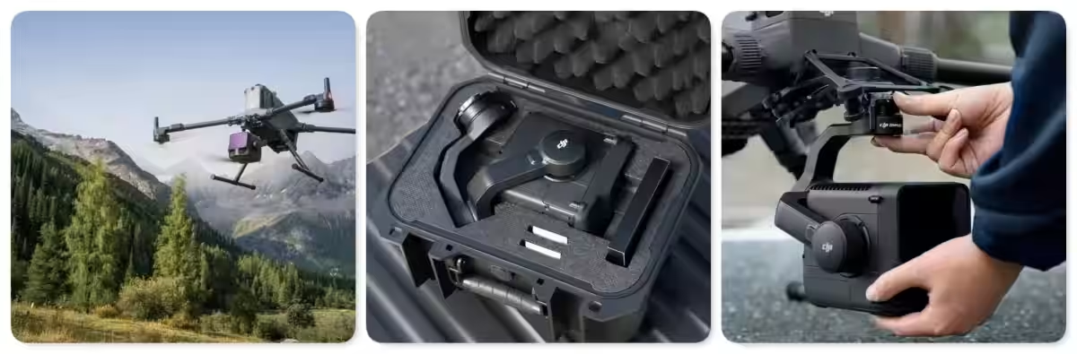
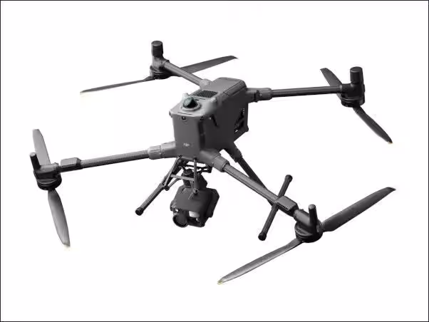
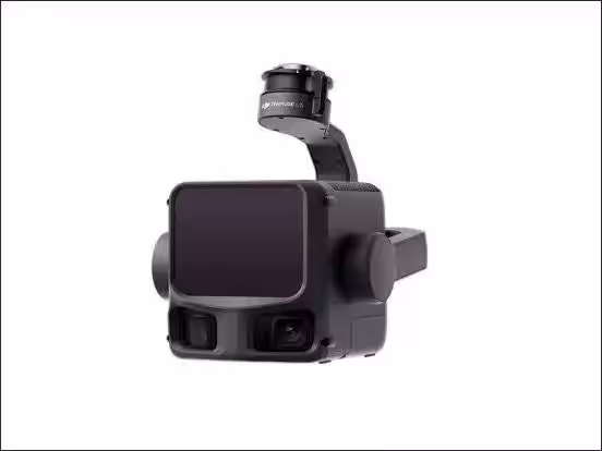
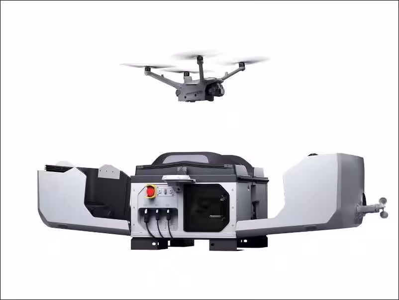
On December 11, 2025, a free seminar showcasing the latest in drone technology for surveying will take place at the Prime Central Tower in Nagoya. Organized by Sekido Co., Ltd, a leading DJI authorized dealer, in collaboration with Armada Co., Ltd, this event will provide insights into the capabilities of the DJI Matrice 400 flagship drone and the state-of-the-art Zenmuse L3 LiDAR module.
Understanding the Seminar Offerings
The seminar will kick off at 1 PM, with doors opening at 12:45 PM. Covering an essential range of topics, attendees will learn about the significant enhancements made in the Zenmuse L3, which was released on November 4, 2025, focusing on its applications in precise surveying operations. The event aims to demonstrate how aerial photography and laser surveying can be executed safely and efficiently through practical showcases and data assessments.
With only 20 spots available, interested participants are encouraged to register quickly as attendance is on a first-come, first-served basis.
A Hands-On Learning Experience for Surveying Professionals
This practical seminar targets various stakeholders in the surveying industry. Whether you are currently using Phantom 4 RTK for aerial imaging and looking to upgrade your fleet, or considering the introduction of laser surveying techniques in your operations, you will find valuable insights here. The staff from the industrial division will be present to provide tailored advice based on your business needs and budget, helping you choose the optimal drone and sensor configurations.
Additionally, for those evaluating the utilization of subsidies and grants for equipment procurement, this seminar provides an excellent opportunity to gain both crucial information on equipment selection and updates on financial aid options.
Addressing Your Questions on Effective Surveying Workflows
A prominent focus of the seminar will be to address common queries related to drone deployment for surveying, such as choosing the right equipment and differentiating between photosurveys and laser surveys. Attendees will be able to clarify their uncertainties through hands-on demonstrations and comparative data analysis, facilitating informed decision-making for their operations.
The session will delve into the features of the flagship Matrice 400 and the newly launched Zenmuse L3, alongside the high-performance DJI Dock 3. During the practical flow of the event, we will explain how to establish an effective system configuration that integrates new technologies, detailing the nuances between photo and laser surveys, and guiding you through aspects such as workload, accuracy, and equipment selection based on field conditions.
Simplifying the Acquisition Process in Just Two Hours
This seminar is structured to prioritize not just specifications but the practical realities of utilizing these systems on site. Participants will gain insights into:
- - The differences and applications of photogrammetry vs. laser surveying in real-world scenarios
- - An all-in-one comparison of the Matrice 400 combined with the Zenmuse L3 and Dock 3
- - Personalized consultation options for subsidy and grant application strategies, detailing the steps for implementations and investment recovery.
By engaging with the physical aspects of drone surveying, attendees will leave the session equipped with actionable directions for overcoming their current challenges in the field.
Seminar Details
- - Date: December 11, 2025
- - Time: 1:00 PM to 3:00 PM (Registration from 12:45 PM)
- - Venue: Prime Central Tower Nagoya, 17 Meeting Room (13th Floor)
- - Cost: Free
- - Capacity: Limited to 20 participants (limited availability upon reaching capacity)
- - Target Audience:
- Companies currently utilizing drones but considering upgrading to the latest models
- Construction, civil engineering, surveying, and consulting firms
- Entities investigating equipment procurement with grants or subsidies
- Public sector employees exploring drone deployment options
- Anyone proactively examining the adoption of drone technology
Topics Consumer Technology)
【About Using Articles】
You can freely use the title and article content by linking to the page where the article is posted.
※ Images cannot be used.
【About Links】
Links are free to use.