



Innovative Technique Combines Satellite Images and Social Media Data for Flood Area Estimation
Revolutionary Approach to Flood Area Estimation
In a groundbreaking collaboration, Japanese firms Spectee and Synspective have joined forces to develop an innovative methodology that combines satellite imagery and social media data to provide more precise estimates of flood areas. This could significantly enhance disaster response and crisis management, particularly in areas affected by heavy rainfall.
Background
As natural disasters become more severe and frequent due to climate change, the urgency for accurate and rapid assessment of damages has never been more critical. Flooding, in particular, poses a significant risk to life and property. In emergency situations, obtaining a real-time, accurate understanding of the damage is essential to facilitate effective rescue missions and recovery efforts.
Synspective has been utilizing its small radar satellites to observe vast land surfaces, analyzing flood damage irrespective of weather conditions or time of day. However, while satellite data is effective, it often struggles to provide detailed insights into localized flooding in urban areas where buildings and homes are closely packed.
On the other hand, Spectee leverages AI technology to automatically identify flood locations and depths from social media posts, integrating this information with geographical data like terrain and rainfall. However, their technology is limited in areas where social media posts are sparse.
By combining the strengths of both companies since their collaboration began in July 2025, this new approach effectively merges the broad perspective offered by SAR (Synthetic Aperture Radar) satellites with the pinpoint accuracy from ground-level social media information, filling in each other's gaps to enhance flood analysis capabilities.
New Flood Area Estimation Method
Method Overview
The developed method integrates two distinct data types—SAR satellite data and social media information—through geographical spatial data such as elevation and land usage.
1. Extraction of Broad Flood Areas Using SAR Data
Synspective’s frequent satellite observations enable the automated analysis of satellite data, allowing for extensive flood area mapping.
2. Identification of Local Flood Depths from Social Media
Utilizing Spectee’s AI technology, images, videos, and text posted on social media are automatically analyzed to ascertain the exact locations and depths of flooding.
3. Comprehensive Analysis to Refine Flood Area Estimates
By comparing the results from steps one and two, along with additional geographical data, the method formulates refined flood area estimates. The boundaries of the flood areas extracted from SAR data serve as a baseline for assessing water depth, while factors like river basin shapes and gradients are taken into account to achieve accurate estimations.
Verification Process
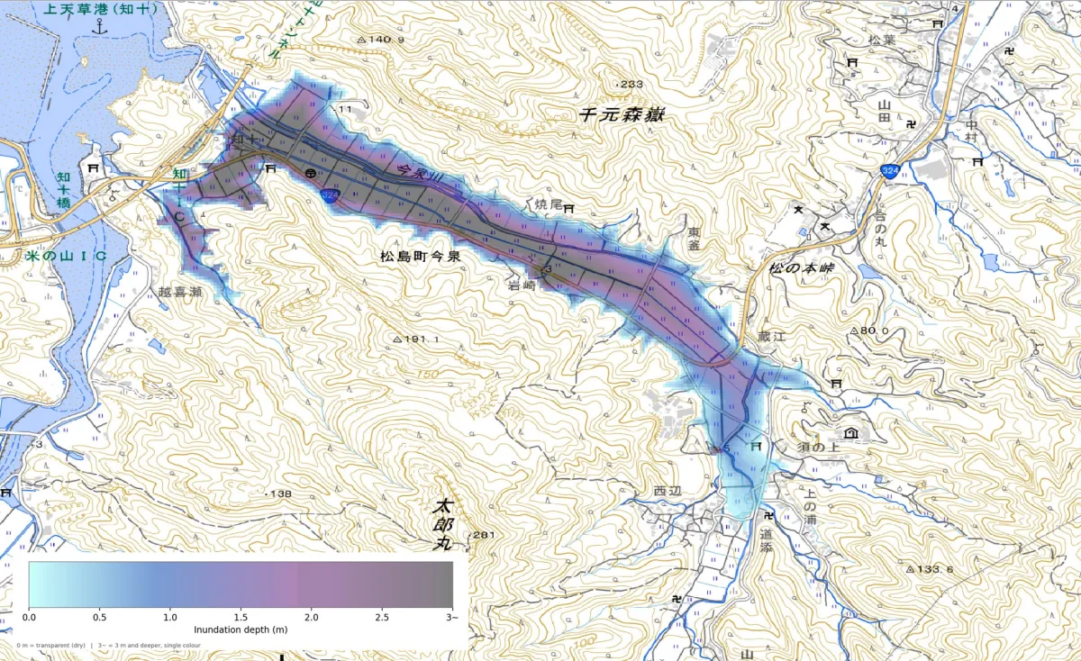
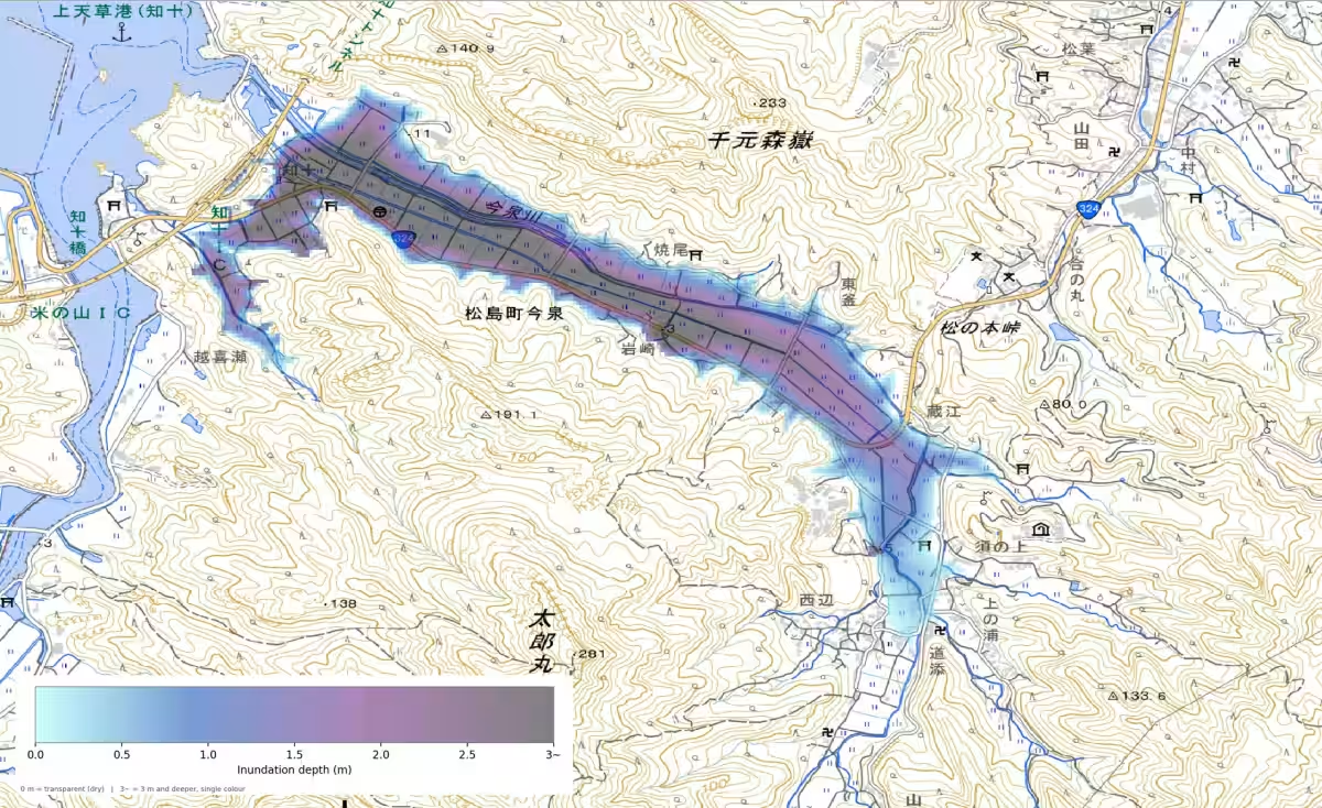
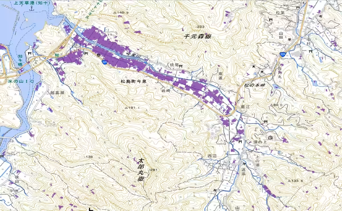
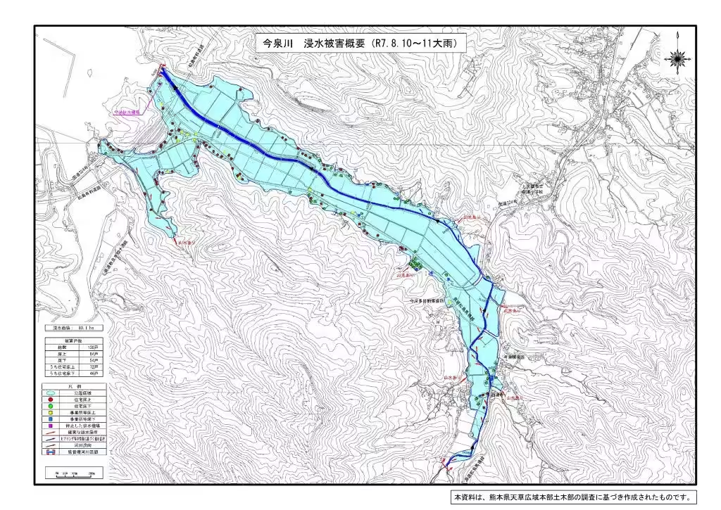
In August 2025, a collaboration was conducted in Kumamoto Prefecture during severe rainfall, examining both SAR and social media data obtained during the event. Key findings confirmed that:
- - The analysis results from both methodologies aligned in identified areas, reinforcing the accuracy of flood predictions.
- - Utilizing social media data improved flood area analysis in urban settings, where SAR data alone was inadequate.
- - By factoring in geographical conditions derived from SAR data, broader flooding resulting from river overflow, often not captured by social media, could be accurately estimated.
- - The predicted flood areas by this new method closely matched assessments conducted by the Kumamoto Prefectural government, validating its effectiveness.
Future Prospects
This innovative method aims to provide localized flood situation estimates early after a disaster strikes. Such enhancements could expedite initial disaster responses, facilitate effective evacuation decisions, and streamline the issuance of disaster certificates. It holds potential applications across various fields, including corporate damage assessments and supply chain risk evaluations.
Moving forward, the companies plan to validate their method against multiple rainfall events of varying terrain conditions and disaster scales to ensure stable and uniform information delivery. They aim to further develop the method into a practical service.
About Spectee
Founded in Tokyo, Spectee is recognized as a leader in providing real-time crisis management solutions. Their mission is to visualize crises through AI-powered data analysis, contributing significantly to risk visualization and damage predictions necessary for building resilient communities.
For more information about Spectee, visit their official website: spectee.co.jp.
About Synspective
Also based in Tokyo, Synspective specializes in developing and operating small SAR satellites, offering an innovative approach to global monitoring of environmental changes caused by various factors, including natural disasters. The company's goal is to establish a constellation of over thirty small SAR satellites by 2028, combining earth observation with advanced analytical capabilities.
Discover more about Synspective here: synspective.com.
Topics Other)
【About Using Articles】
You can freely use the title and article content by linking to the page where the article is posted.
※ Images cannot be used.
【About Links】
Links are free to use.