Space Shift Expands Its SateAIs Brand with New Soil Detection AI Feature


Space Shift Introduces `Soil Detection AI` in SateAIs Lineup
In a significant development for satellite data analysis, Space Shift Inc., based in Chiyoda, Tokyo, has officially launched a new feature named `Soil Detection AI` under its SateAIs brand. This innovative service leverages Synthetic Aperture Radar (SAR) from multiple satellites to identify areas that may require soil fill, thus improving the efficiency of monitoring and management tasks for local governments and enterprises.
Enhanced Monitoring with Advanced Technology
The `Soil Detection AI` uses satellite data collected at different times to recognize surface changes that indicate potential earthworks. By narrowing down the areas that require on-site investigation, organizations can allocate resources and focus their efforts more effectively. Aside from providing raw detection results, the service offers various delivery formats, including grid processing and API integration, facilitating seamless access to insights for stakeholders.
Additionally, clients can opt for supplementary services, such as creating site maps and documentation that utilize the expertise of construction consulting companies affiliated with SateBiz—a program aimed at promoting collaborative business innovation. Note that these options require prior consultation to tailor solutions to specific needs.
Collaboration with JAXA for Enhanced Accuracy
Moreover, Space Shift is a participating organization in the JAXA Space Strategy Fund's second phase, which focuses on detecting illegal and improper soil filling and assessing landslide risks through multimodal AI technology. The project aims to refine the accuracy of soil detection and quantitatively evaluate landslide risks by integrating various satellite data types, including SAR and optical data. The results from this collaboration will enable the development of higher-precision analytical options for the `Soil Detection AI` service in the future.
Exploring SateAIs:
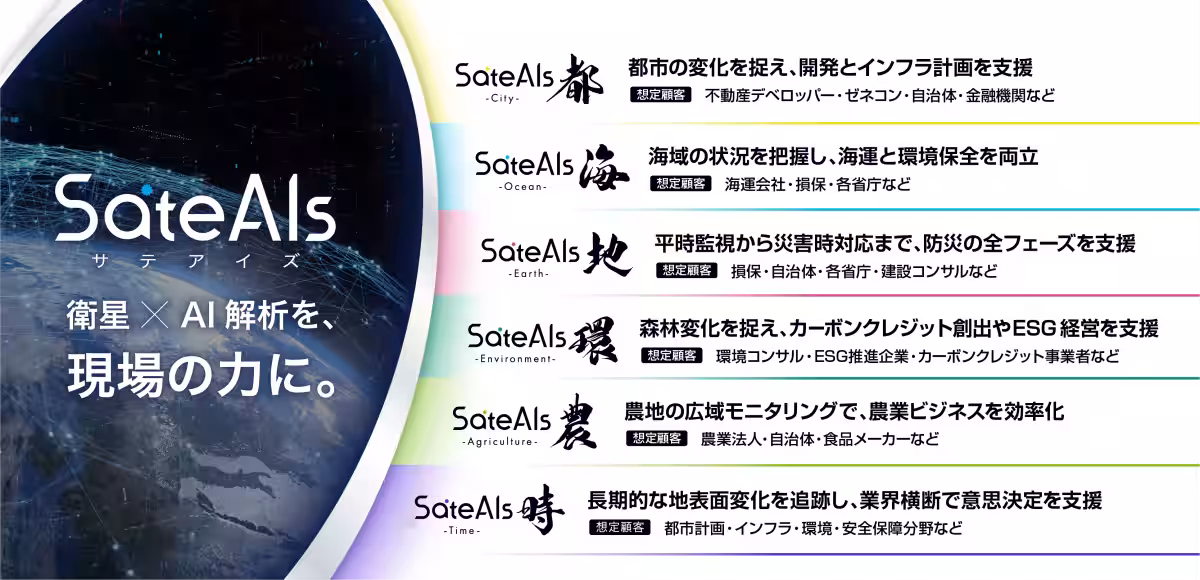
The SateAIs brand operates under the philosophy of transforming satellite data and AI analysis into practical tools for field applications. It organizes Space Shift's satellite data analytical algorithms into easily accessible AI packages tailored to specific applications, making it suitable for a diverse range of users, including municipalities, corporations, and research institutions. This initiative aims to lower the barriers to entry for using advanced satellite technology and provide solutions geared towards addressing operational challenges.
In addition to the `Soil Detection AI`, the lineup will soon include features such as `Environmental Monitoring AI`, which will further extend the brand’s capabilities. Space Shift is committed to continuously developing new analytical packages centered around SateAIs, enhancing the social implementation of satellite data analysis. Future plans include expanding delivery methods through APIs, dashboards, and cloud integrations.
Diverse Application Areas
Currently, Space Shift has rolled out additional AI features like `Building Change Detection AI`, `Ineffective Agricultural Land Detection AI`, `Time Series Change Detection AI`, and more. These technologies can transform various sectors, including infrastructure management, disaster risk reduction, agriculture, and environmental protection, showcasing the versatility and robustness of SateAIs.
About Space Shift
Founded in December 2009, Space Shift operates under the motto `Sense the Unseen from Orbit`, focusing on developing AI technologies to analyze data obtained from Earth observation satellites. By offering satellite data analytical packages like SateAIs, the company aims to contribute to building a sustainable society through collaborative programs like SateBiz.
Being at the forefront of satellite data analysis, Space Shift is poised to redefine how organizations and governments monitor land use and environmental changes, paving the way for innovative management strategies and solutions.
For further inquiries, visit Space Shift's official website.


Topics Consumer Technology)

【About Using Articles】
You can freely use the title and article content by linking to the page where the article is posted.
※ Images cannot be used.
【About Links】
Links are free to use.