


HoloLab Supports 3D Urban Model Utilization in Fujisawa City with XR Digital Twin
HoloLab's Innovative Partnership with Fujisawa City
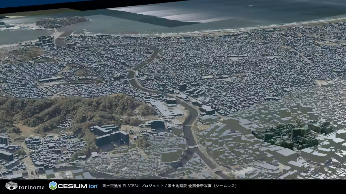
In a significant step towards modern urban planning, HoloLab, based in Shinagawa, Tokyo, has taken part in an initiative by Fujisawa City, Kanagawa Prefecture, to enhance its urban digital infrastructure with their XR digital twin platform, torinome. This collaboration was made possible through its partnership with Aero Toyota, which developed the 3D urban model crucial for this project.
Background: Accelerating Utilization of 3D Urban Models
Fujisawa City aims to utilize its 3D urban model not just for urban planning and disaster management but across various departments within the local government. This comes as part of Project PLATEAU, a national initiative facilitated by the Ministry of Land, Infrastructure, Transport and Tourism.
However, there are challenges associated with this innovative approach; the concept of a 3D urban model is complex, and there is often difficulty communicating its potential uses to different sectors, which can result in a lack of understanding and hinder wider adoption.
torinome: Enabling Meaningful Dialogue and Engagement
To tackle these challenges, HoloLab employed its torinome platform, which allows users to interact with 3D data intuitively via web browsers or AR, eliminating the need for specialized knowledge in GIS. By visualizing the results and data from Plateau use cases, HoloLab created opportunities for engaging dialogues about the 3D urban model's relevance to the stakeholders' daily experiences.
The platform supports local government employees, residents, and officials from nearby municipalities to explore diverse applications of the urban model tailored to their needs. By fostering a space where users can experience the model's capabilities firsthand, HoloLab is encouraging interdisciplinary collaboration among different organizational branches.
Supporting Internal Administration and Learning
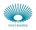
During a series of workshops organized for Fujisawa City officials, HoloLab demonstrated how to utilize the torinome Base, a 3D map operable via web browsers, featuring data from nine Plateau use cases. Participants actively interacted with the models, discussing how these tools could aid engineers and city planners in solving real-world challenges.
By contextualizing the operational challenges within the existing 3D urban model, awareness and understanding across departments were heightened.
Engagement Beyond Local Administration
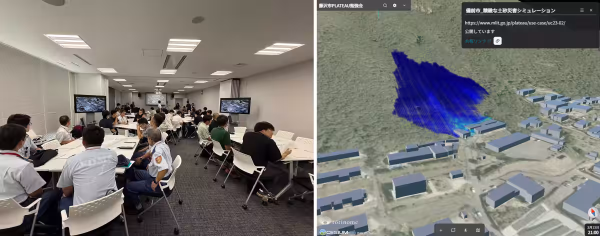
In a conference featuring officials from neighboring municipalities, HoloLab discussed various 3D urban model construction methods and case studies, including a citizen-participation workshop. HoloLab showcased how the 3D urban model engages citizens by rendering disaster simulations, overlaying data such as tsunami inundation predictions and fire spread simulations onto the urban model; this helped stakeholders visualize the city's emergency preparedness more effectively.
Future Urban Development Experiences
On March 23, 2026, Fujisawa City hosted a symposium centered on urban master plan revisions, followed by a digital twin experience event. Employing torinome, HoloLab brought to life a 3D urban model of the area surrounding Fujisawa Station and another for Enoshima in a Minecraft format. By integrating the beloved local character, Fujikyun, into the AR environment, participants could grasp the data in a relatable manner, thus bridging generational gaps in understanding urban development.
Looking Ahead
Fujisawa City is set to continue developing its 3D urban model while expanding its use in various administrative and community engagement contexts. HoloLab intends to broaden the reach of torinome, creating more opportunities for interaction across fields like municipal planning and citizen education. By fostering an environment where everyone can engage with data regardless of expertise, HoloLab aims to contribute to the national dialogue on the effective use of 3D urban models throughout local governments.
About torinome
torinome is HoloLab's state-of-the-art XR digital twin platform designed to visualize 3D urban models and geospatial data seamlessly, facilitating a multidimensional experience for urban planning and spatial design applications.
Company Overview
HoloLab, inc. is a tech company focused on the cutting-edge realms of AR/VR and 3D spatial data technologies, continually innovating and sharing its breakthroughs with the public. With a commitment to expanding urban DX through digital twins, HoloLab is poised to influence how cities are conceived and interacted with in the 21st century.
For more information about HoloLab and torinome, please visit HoloLab's official website.

Topics Other)


【About Using Articles】
You can freely use the title and article content by linking to the page where the article is posted.
※ Images cannot be used.
【About Links】
Links are free to use.