


New Quest Feature on MapFan Integrates GeoQuest to Enhance User Engagement
Introduction to the GeoQuest Feature on MapFan
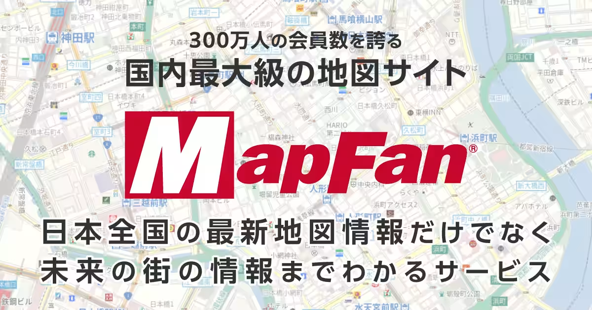
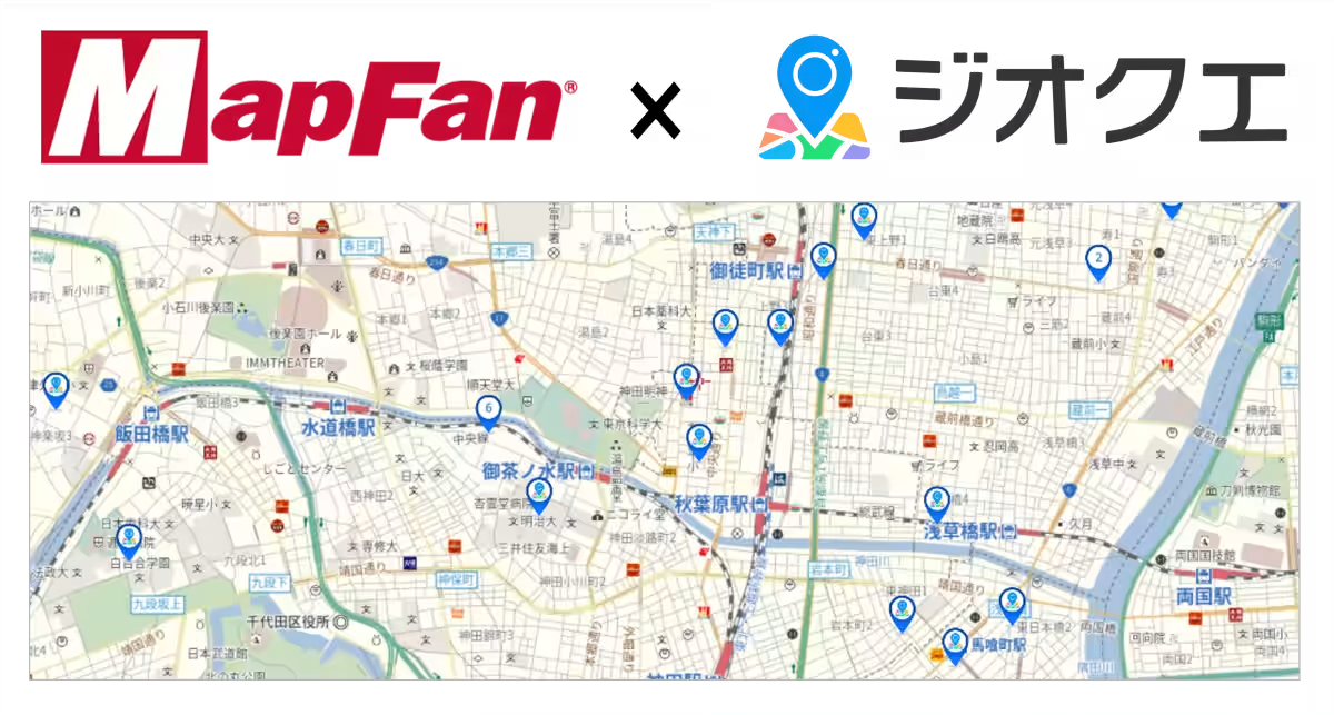
GeoTechnologies Inc., based in Bunkyo, Tokyo, is making waves with a groundbreaking addition to its popular mapping service, MapFan. With an impressive user base of approximately 3 million members, MapFan has been an essential tool for navigating Japan's intricate landscapes and urban environments. The company has recently announced a limited-time feature called "GeoQuest View Beta" that integrates the location-based quest application, GeoQuest (often called “ジオクエ”). This initiative opens up new avenues for users to engage with their surroundings through interactive quests displayed directly on the MapFan interface.
Overview of the GeoQuest View Beta Feature
Service Details
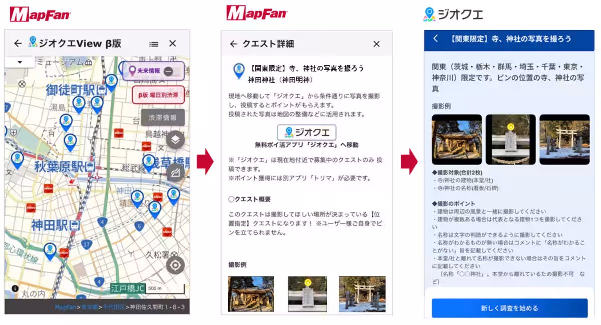
The "GeoQuest View Beta" feature will allow users to view the location of ongoing quests in real-time on the MapFan maps. This means anyone can effortlessly discover quests around their current location or a destination they're planning to visit.
How to Use the Feature
Users can select quest pins on the MapFan map to receive detailed information about each quest. If a user finds a quest that piques their interest, they simply click the “GeoQuest” button. For those who have the GeoQuest app installed on their smartphone, this action will open the app directly to the quest's submission page. Alternatively, users can find quests through the GeoQuest app by selecting the “Search on Map” button, which will open a MapFan browser map to explore ongoing quests.
Availability
This innovative feature will be available from September 16, 2025, to March 16, 2026, providing a temporary yet exciting opportunity for users to enhance their map exploration.
The Rationale Behind the Feature
For nearly 30 years, GeoTechnologies has been dedicated to developing high-quality digital maps, which have become integral to everyday life as part of societal infrastructure. Maintaining the integrity and quality of these maps relies heavily on gathering accurate, up-to-date information from ever-changing local environments. Traditionally, surveyors have manually verified facility information such as building names and parking spaces onsite. However, to collect more timely and comprehensive data, GeoTechnologies developed the GeoQuest app, empowering users to contribute to map data collection. The new feature allows everyone to locate and engage in quests via their smartphones or PCs, making the mapping experience more enjoyable while enhancing the quality of the maps through fresh, user-generated data.
What is GeoQuest?
GeoQuest is a fully free app that gamifies the process of documenting urban spaces by posting various local facilities as "quests." Users receive rewards called "miles" for visiting these quests and submitting photos taken at the site. Accumulated miles can be exchanged for more than 30 types of points, including Amazon gift cards and PayPay money, or even cash. Additionally, GeoTechnologies offers a participatory research service called "GeoQuest Connect," targeting corporate and municipal studies, thereby broadening the app's functionality and reach.
More information can be found at the GeoQuest Website and the GeoQuest Connect page.
About MapFan
Establishing itself as Japan's largest mapping service since its launch in 1997, MapFan boasts a robust registration count of 3 million users. Leveraging proprietary digital map data, MapFan supports 14 different map representations in 13 languages. The service also publicizes future developments, such as upcoming facility openings and events, garnered through comprehensive map development processes. Users can access all features, including route search based on VICS information, gas price information, and parking statuses, through the MapFan Premium paid membership service. More details are available at the MapFan Website.
About GeoTechnologies Inc.
Founded in 1994, GeoTechnologies has steadily focused on providing digital mapping solutions. The company was a trailblazer in deploying Japan's first i-mode maps and continues to innovate with automotive map solutions and advanced AD/ADAS maps essential for autonomous driving.
In 2020, GeoTechnologies released the mileage-earning app, "Torema," which has further strengthened the company's connection to users and provided valuable insights into human mobility and awareness in the real world. By combining extensive big data with geospatial data cultivated over three decades, GeoTechnologies aims to offer up-to-the-minute insights and contribute to creating a more sustainable and comfortable world.
Corporate Information
Headquarters: Bunkyo Green Court Center Office, 2-28-8 Hongo, Bunkyo-ku, Tokyo 113-8686, Japan
CEO: Yoichiro Yatsutake
Founded: May 1, 1994
Business Areas: Automotive, Enterprise, Marketing, Consumer
Corporate Site: GeoTechnologies
Topics Consumer Technology)


【About Using Articles】
You can freely use the title and article content by linking to the page where the article is posted.
※ Images cannot be used.
【About Links】
Links are free to use.