



The Launch of Tokyo Map: A Comprehensive Resource for City Residents
Tokyo Map: A New Era for Tokyo Residents
Tokyo has just welcomed a significant enhancement in public resources with the official launch of the Tokyo Map, developed in collaboration between the Tokyo Metropolitan Government and GovTech Tokyo. This new platform provides residents access to a multitude of map information, previously scattered across various governmental websites, all within a single interface.
What is Tokyo Map?
Tokyo Map is an innovative digital resource aimed at making life easier for the citizens of Tokyo. It aggregates diverse map data that serves many purposes, from disaster preparedness and environmental information to welfare services and water resources. Users can now conveniently view and interact with these maps without needing to navigate through different websites, which had previously added to the complexity of finding relevant information.
Enhanced Accessibility and Functionality
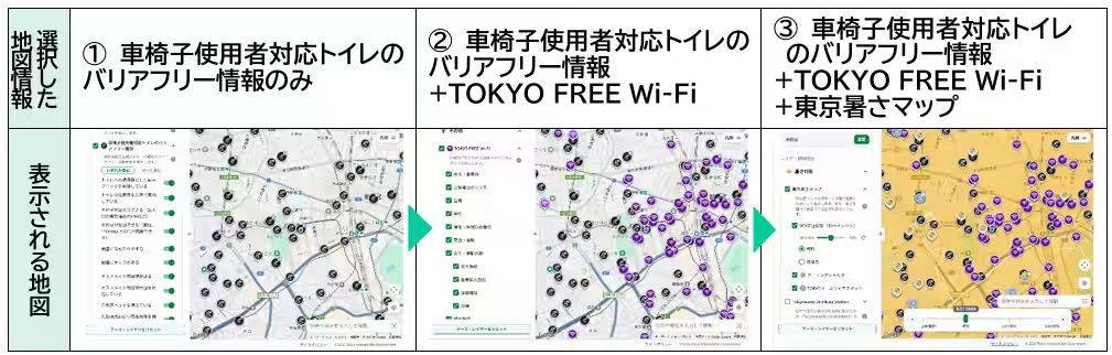
One of the standout features of Tokyo Map is its ability to display multiple map layers simultaneously, empowering users to customize their viewing experience based on specific needs or interests. For instance, users can combine maps related to disaster preparedness with environmental data, facilitating a comprehensive view of the city's resources and risks.
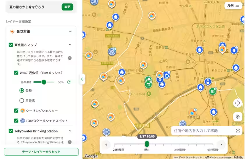
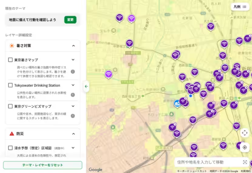
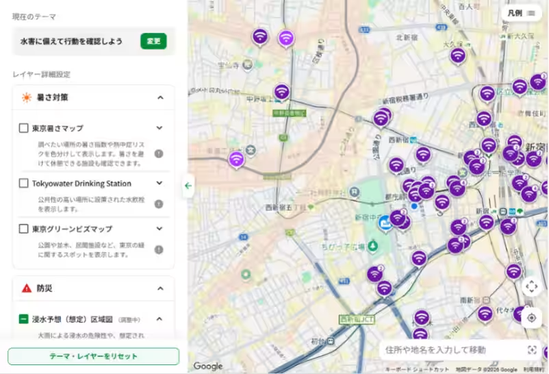
Moreover, Tokyo Map includes themed displays that aggregate relevant information, allowing residents to quickly access maps associated with high-interest topics. For example:
- - Heat Protection in Summer
- - Earthquake Preparedness
- - Flood Preparedness
These thematic combinations ensure that residents can easily find necessary information tailored to seasonal challenges or emergency situations, streamlining the way in which essential data is accessed during critical times.
Governance and Development
The development and operation of Tokyo Map is a joint effort, with the Tokyo Metropolitan Government responsible for overall strategies and policies, while GovTech Tokyo handles the technological aspects, including product design and user interface (UI) development. This collaboration reflects a commitment to using modern technology to improve the lives of Tokyo's residents.
Launch Details and Access
Tokyo Map will officially be available starting August 20, 2023. It is designed for free access, meaning any resident can utilize this resource via a web browser on a computer or smartphone. Users can navigate to Tokyo Map to experience this new service firsthand.
Important Notes for Users
While the Tokyo Map serves as a centralized hub for diverse map information, users should be mindful of copyright considerations associated with the specific maps. Different maps may have varying terms of use and restrictions, especially regarding reproduction or modification. It’s crucial to refer back to each map's original source site for detailed guidelines concerning use beyond simple web viewing.
Additionally, detailed explanations and usage instructions for terms and symbols presented within the maps are not included on the Tokyo Map itself. For complete context and information, users are encouraged to visit the respective project sites associated with each map.
The launch of Tokyo Map is a promising step towards enhancing urban living in Tokyo, allowing residents to not only access vital information more quickly but also to engage with the city’s rich resources more effectively. As Tokyo continues to evolve, tools like Tokyo Map will play an essential role in supporting its inhabitants’ needs in an increasingly complex urban environment.
Topics General Business)
【About Using Articles】
You can freely use the title and article content by linking to the page where the article is posted.
※ Images cannot be used.
【About Links】
Links are free to use.