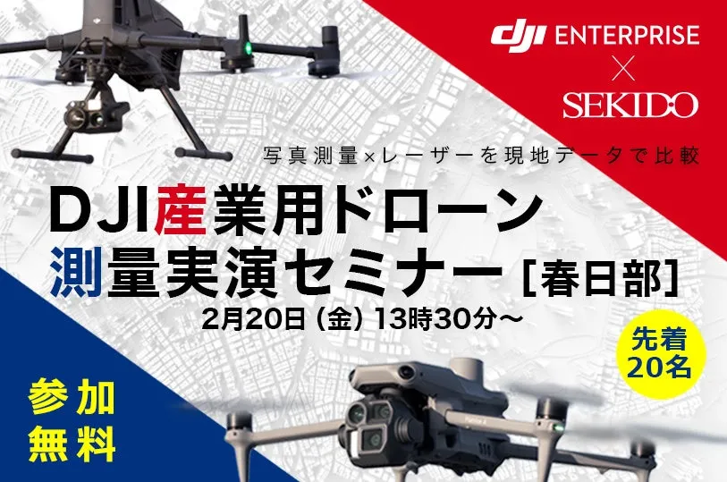
Experience Cutting-Edge Drone Surveying with DJI's Matrice 400 and LiDAR Technology


Free DJI Drone Surveying Demonstration Seminar
The leading drone business support company, Sekido Co., Ltd., will host a free demonstration seminar titled "DJI Industrial Drone Surveying Seminar in Kawaguchi" on February 20, 2026. This event will vividly showcase the practical application of surveying using drones, particularly focusing on the DJI Matrice 400 and the latest LiDAR systems.
Event Details
The seminar is scheduled to start at 1:30 PM at Midori Park in Kawaguchi. Aimed at professionals in the surveying field, this free event will feature demo flights simulating surveying tasks and allow participants to evaluate the captured data. Attendees will gain critical insights necessary for making informed decisions about drone adoption and upgrades in their operations. Pre-registration is required, and only the first 20 registrants will secure a spot.
Why Attend?
Whether you are currently using drones for surveying or considering an upgrade from models like the Phantom 4 RTK or Matrice 300 RTK, this seminar is tailored for you. Participants can explore various options, such as different sensors, camera configurations, and how to integrate photo and laser surveying in a cohesive workflow. Following the demonstrations, there will be opportunities for individual consultations regarding equipment selection and operational strategies.
Key Highlights
During the seminar, experts will guide you through the following critical aspects:
- - Understanding Data Outputs: Learn how and when to leverage different surveying techniques and what to expect regarding labor and effort for various tasks.
- - Assessing Site Conditions: Discuss how site-specific factors such as vegetation and project requirements can influence your drone operations.
- - Comparative Analysis of Tools: Understand how to effectively combine existing methods with new drone technology for enhanced results.
The event promises valuable insights, especially for those contemplating the inclusion of laser surveying in their repertoire. Attendees will also receive information on possible funding options for implementing drone technology.
Participant Feedback
We have received positive feedback from past attendees:
- - "The case studies provided a clear picture of what to expect from the implementation."
- - "It was great to hear the latest industry updates and innovations."
- - "I appreciated the opportunity to compare different products directly."
- - “Consulting on configurations before making a purchase was invaluable.”
- - "Learning that subsidies could fund drone acquisitions was a significant takeaway."
Event Logistics
- - Date: February 20, 2026
- - Time: 1:30 PM – 3:30 PM (Registration starts at 1:20 PM)
- - Location: Midori Park, 872 Kamiama, Kawaguchi, Saitama 344-0132, Japan
- - Capacity: 20 spots available (registration closes once full)
- - Registration: Free and requires advance sign-up
- - Register Here
Featured Equipment
The seminar will prominently feature:
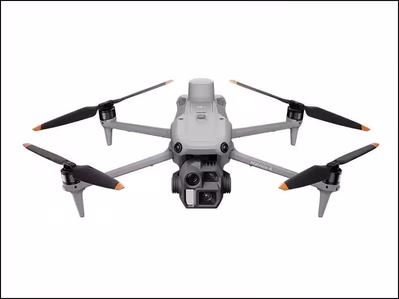
- - DJI MATRICE 400: This flagship industrial drone offers unparalleled efficiency and operational reliability for surveying, with a payload capacity of 6 kg and a maximum flight time of 59 minutes.
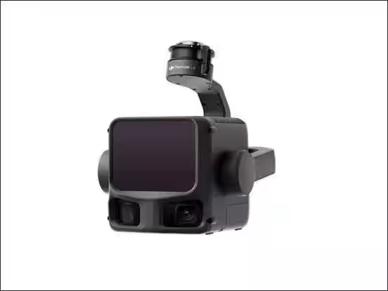
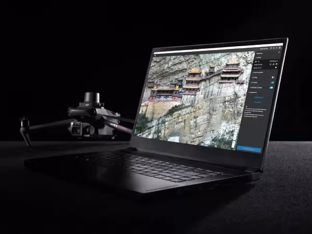
- - DJI ZENMUSE L3: A next-generation LiDAR system capable of measuring distances up to 950 meters, it encompasses dual 100MP cameras for streamlined data capture.
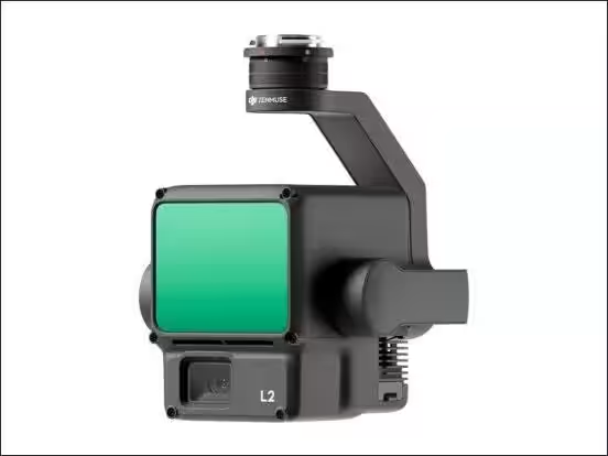
- - DJI ZENMUSE L2: A high-precision LiDAR system optimized for reliable terrain data acquisition.
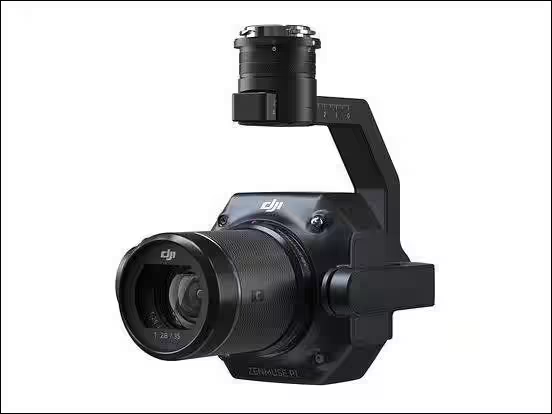
- - DJI ZENMUSE P1: A 45MP full-frame sensor camera designed to elevate aerial photography measurement standards.
- - DJI MATRICE 4E: A smaller drone ideal for mapping and construction medium-specific applications.
For more insights and upcoming seminars hosted by Sekido, visit Sekido's official site. Join this valuable opportunity to enhance your understanding of drone technology and its application within the surveying industry.


Topics Consumer Products & Retail)
【About Using Articles】
You can freely use the title and article content by linking to the page where the article is posted.
※ Images cannot be used.
【About Links】
Links are free to use.